U.S. Space-Based Positioning, Navigation and Timing: A Policy


54 Slides6.32 MB
U.S. Space-Based Positioning, Navigation and Timing: A Policy and Program Review Polytechnic University of Turin 25 February 2008 Michael Shaw, Director U.S. National Coordination Office for Space-Based Positioning, Navigation, and Timing (PNT)
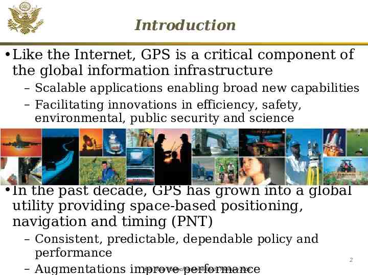
Introduction Like the Internet, GPS is a critical component of the global information infrastructure – Scalable applications enabling broad new capabilities – Facilitating innovations in efficiency, safety, environmental, public security and science In the past decade, GPS has grown into a global utility providing space-based positioning, navigation and timing (PNT) – Consistent, predictable, dependable policy and performance – Augmentations improve performance Italy, Turin Polytechnic University 25 February 2008 2
GPS as a Global “Public Service” Owned and operated by the U.S. Government – Paid for by U.S. taxpayers – Managed at a national level as multi-use asset – Acquired and operated by the U.S. Air Force on behalf of the U.S. Government GPS service is a one-way broadcast, like FM radio – Unlimited number of users – Access to civilian GPS signals is free of direct user charges Public domain documentation – Available on an equal basis to users and industry – Anyone in the world can develop GPS user equipment3 Italy, Turin Polytechnic University 25 February 2008
Overview Systems Applications Policy International Cooperation 4 Italy, Turin Polytechnic University 25 February 2008
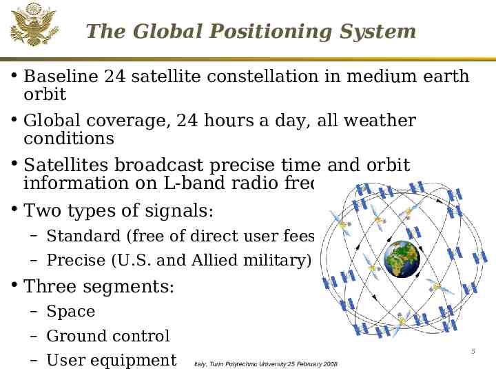
The Global Positioning System Baseline 24 satellite constellation in medium earth orbit Global coverage, 24 hours a day, all weather conditions Satellites broadcast precise time and orbit information on L-band radio frequencies Two types of signals: – Standard (free of direct user fees) – Precise (U.S. and Allied military) Three segments: – Space – Ground control – User equipment 5 Italy, Turin Polytechnic University 25 February 2008
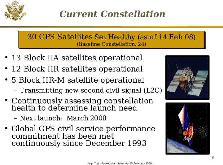
Current Constellation 30 30 GPS GPS Satellites Satellites Set Set Healthy Healthy (as (as of of 14 14 Feb Feb 08) 08) (Baseline (Baseline Constellation: Constellation: 24) 24) 13 Block IIA satellites operational 12 Block IIR satellites operational 5 Block IIR-M satellite operational – Transmitting new second civil signal (L2C) Continuously assessing constellation health to determine launch need – Next launch: March 2008 Global GPS civil service performance commitment has been met continuously since December 1993 6 Italy, Turin Polytechnic University 25 February 2008
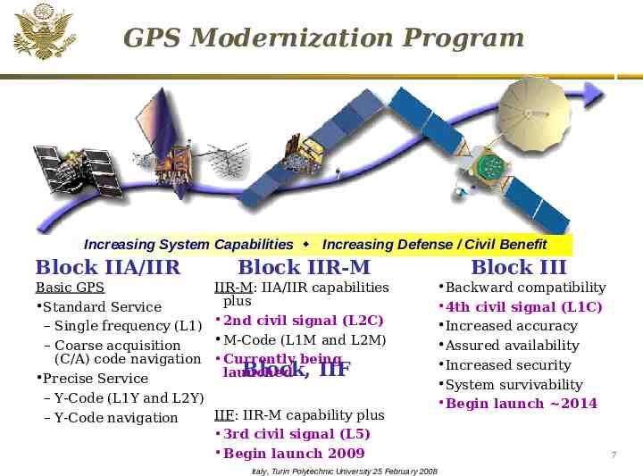
GPS Modernization Program Increasing System Capabilities Increasing Defense / Civil Benefit Block IIA/IIR Basic GPS Standard Service – Single frequency (L1) – Coarse acquisition (C/A) code navigation Precise Service – Y-Code (L1Y and L2Y) – Y-Code navigation Block IIR-M Block III IIR-M: IIA/IIR capabilities plus 2nd civil signal (L2C) M-Code (L1M and L2M) Currently being Block, IIF launched Backward compatibility 4th civil signal (L1C) Increased accuracy Assured availability Increased security System survivability Begin launch 2014 IIF: IIR-M capability plus 3rd civil signal (L5) Begin launch 2009 Italy, Turin Polytechnic University 25 February 2008 7
Modernized GPS – Civil Signals Second civil signal (“L2C”) –Designed to meet commercial needs Higher accuracy through ionospheric correction Higher effective power and improved data structure reduce interference, speed up signal acquisition, enable miniaturization of receivers, may enable indoor use –Began with GPS Block IIR-M in Sep 2005; 24 satellites: 2014 Third civil signal (“L5”) –Designed to meet demanding requirements for transportation safety (safety-oflife) Uses highly protected Aeronautical Radio Navigation Service (ARNS) band –Begins with GPS Block IIF –First launch: 2008 (GPS IIR-M Demo); 2009 (GPS IIF); 24 satellites: 2016 Fourth civil signal (“L1C”) –Designed with international partners to enable GNSS interoperability 8 –Begins with GPS Block III Italy, Turin Polytechnic University 25 February 2008
Benefits of GPS Modernization System-wide improvements in accuracy, availability, integrity, and reliability for all users – Higher standalone accuracy Augmentations likely will still remain – More robust against interference – Operational capability for second (L2C) and third (L5) civil signals In combination with GPS IIR-M and IIF satellites – Delivers L1C for interoperability with Galileo and other GNSS – Improved indoor, mobile, and urban use Italy, Turin Polytechnic University 25 February 2008 9
GPS Program Update New GPS Operational Control Segment -- September 2007 Upgrading GPS ground segment – OCX – 2012 - 2016 – Will implement full functionality for L2C and L5 – Contract awarded – January 2008 Acquiring next generation of GPS satellites – GPS IIIA – In source selection - anticipate contract award – early 2008 GPS SPS Performance Standard update in progress – Apr 08 10 Italy, Turin Polytechnic University 25 February 2008
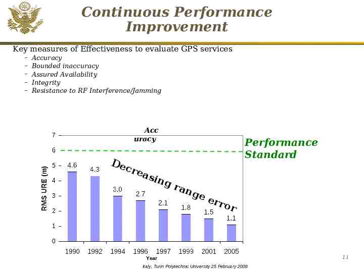
Continuous Performance Improvement Key measures of Effectiveness to evaluate GPS services – – – – – Accuracy Bounded inaccuracy Assured Availability Integrity Resistance to RF Interference/Jamming Acc uracy De cr Performance Standard eas ing r an ge err or Year Italy, Turin Polytechnic University 25 February 2008 11
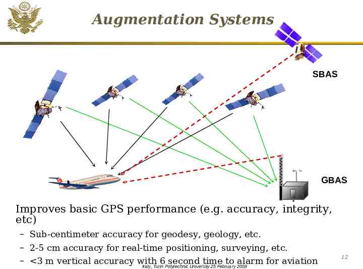
Augmentation Systems SBAS GBAS . Improves basic GPS performance (e.g. accuracy, integrity, etc) – Sub-centimeter accuracy for geodesy, geology, etc. – 2-5 cm accuracy for real-time positioning, surveying, etc. – 3 m vertical accuracy with 6 second time to alarm for aviation Italy, Turin Polytechnic University 25 February 2008 12
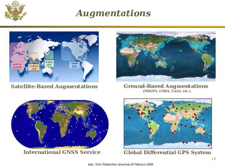
Augmentations Satellite-Based Augmentations Ground-Based Augmentations (NDGPS, CORS, LAAS, etc.) International GNSS Service Global Differential GPS System 13 Italy, Turin Polytechnic University 25 February 2008
Satellite-Based Augmentations Geostationary satellites provide regional coverage GPS-like signals enable simplified receivers International Partner Service Providers – US (WAAS), Europe (EGNOS), Japan (MTSAT), and India (GAGAN) – WAAS operational – Jul 03; Expanding capability with L5 – GPS-based EGNOS leading way for Galileo Independent signal monitoring supports the interests of each individual State – International assured aviation integrity standard Italy, Turin Polytechnic University 25 February 2008 14
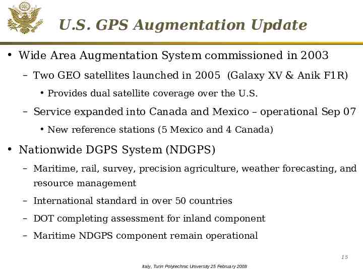
U.S. GPS Augmentation Update Wide Area Augmentation System commissioned in 2003 – Two GEO satellites launched in 2005 (Galaxy XV & Anik F1R) Provides dual satellite coverage over the U.S. – Service expanded into Canada and Mexico – operational Sep 07 New reference stations (5 Mexico and 4 Canada) Nationwide DGPS System (NDGPS) – Maritime, rail, survey, precision agriculture, weather forecasting, and resource management – International standard in over 50 countries – DOT completing assessment for inland component – Maritime NDGPS component remain operational 15 Italy, Turin Polytechnic University 25 February 2008
Overview Systems Applications Policy International Cooperation 16 Italy, Turin Polytechnic University 25 February 2008
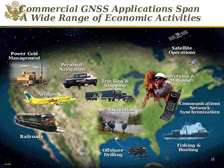
Commercial GNSS Applications Span A Wide Range of Economic Activities Satellite Operations Power Grid Management Personal Navigation Trucking & Shipping Surveying & Mapping Aviation Recreation Communications Network Synchronization Railroads Offshore Drilling Italy, Turin Polytechnic University 25 February 2008 Fishing & Boating 17 16
Civil GNSS Applications Enabling technology – New applications emerging every day – 68 Billion industry worldwide by year 2010 Wide use in transportation safety – Aviation, maritime, railroad, highway, etc. – Potential to reduce land-based navigation systems – Centerpiece of future transportation infrastructure Wide range of civil uses – Telecommunications, surveying, law enforcement, emergency response, agriculture, mining, etc. – Used in conjunction with remote sensing Italy, Turin Polytechnic University 25 February 2008 18
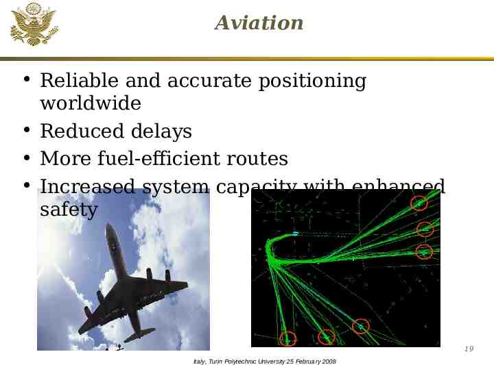
Aviation Reliable and accurate positioning worldwide Reduced delays More fuel-efficient routes Increased system capacity with enhanced safety Maritime Italy, Turin Polytechnic University 25 February 2008 19
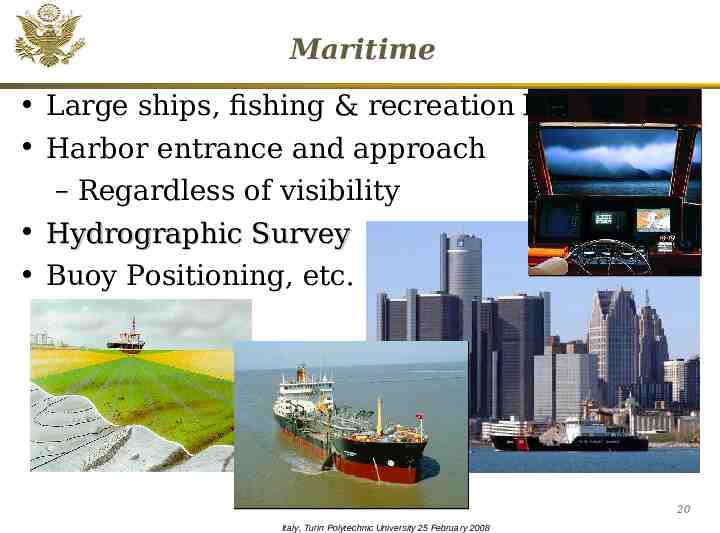
Maritime Large ships, fishing & recreation boats Harbor entrance and approach – Regardless of visibility Hydrographic Survey Buoy Positioning, etc. 20 Italy, Turin Polytechnic University 25 February 2008
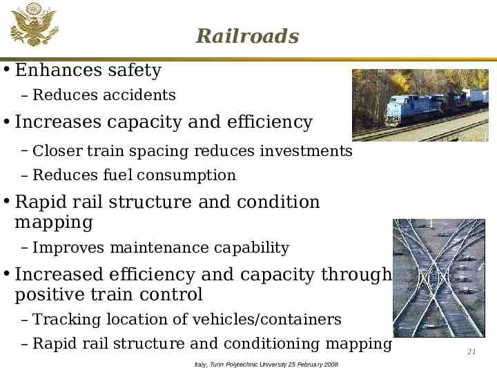
Railroads Enhances safety – Reduces accidents Increases capacity and efficiency – Closer train spacing reduces investments – Reduces fuel consumption Rapid rail structure and condition mapping – Improves maintenance capability Increased efficiency and capacity through positive train control – Tracking location of vehicles/containers – Rapid rail structure and conditioning mapping Italy, Turin Polytechnic University 25 February 2008 21
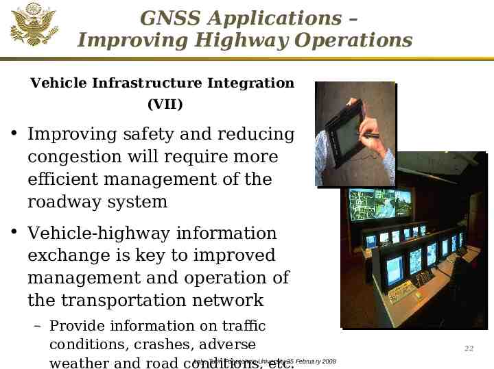
GNSS Applications – Improving Highway Operations Vehicle Infrastructure Integration (VII) Improving safety and reducing congestion will require more efficient management of the roadway system Vehicle-highway information exchange is key to improved management and operation of the transportation network – Provide information on traffic conditions, crashes, adverse Italy, Turin Polytechnic University 25 February 2008 weather and road conditions, etc. 22
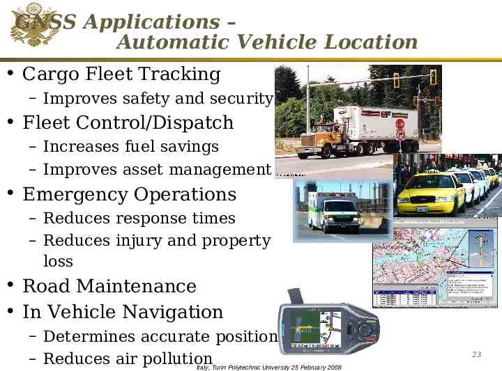
GNSS Applications – Automatic Vehicle Location Cargo Fleet Tracking – Improves safety and security Fleet Control/Dispatch – Increases fuel savings – Improves asset management Emergency Operations – Reduces response times – Reduces injury and property loss Road Maintenance In Vehicle Navigation – Determines accurate position – Reduces air pollution Italy, Turin Polytechnic University 25 February 2008 23
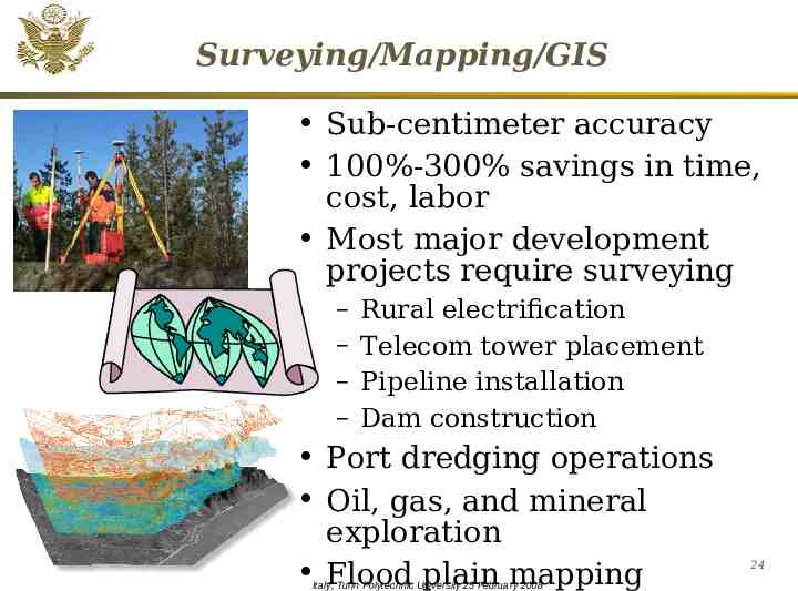
Surveying/Mapping/GIS Sub-centimeter accuracy 100%-300% savings in time, cost, labor Most major development projects require surveying – – – – Rural electrification Telecom tower placement Pipeline installation Dam construction Port dredging operations Oil, gas, and mineral exploration Flood plain mapping Italy, Turin Polytechnic University 25 February 2008 24
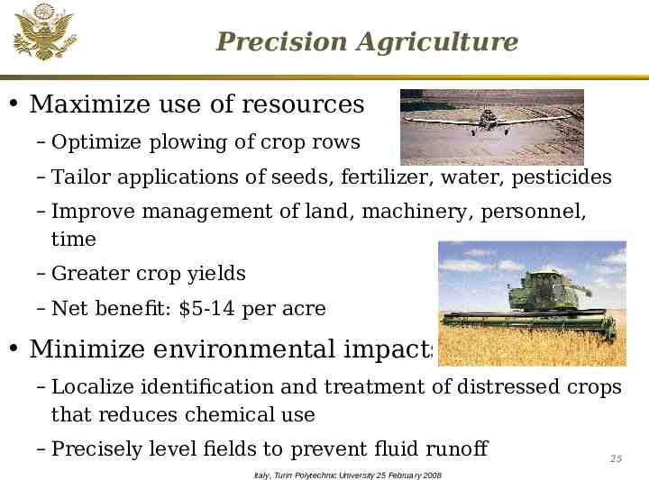
Precision Agriculture Maximize use of resources – Optimize plowing of crop rows – Tailor applications of seeds, fertilizer, water, pesticides – Improve management of land, machinery, personnel, time – Greater crop yields – Net benefit: 5-14 per acre Minimize environmental impacts – Localize identification and treatment of distressed crops that reduces chemical use – Precisely level fields to prevent fluid runoff Italy, Turin Polytechnic University 25 February 2008 25
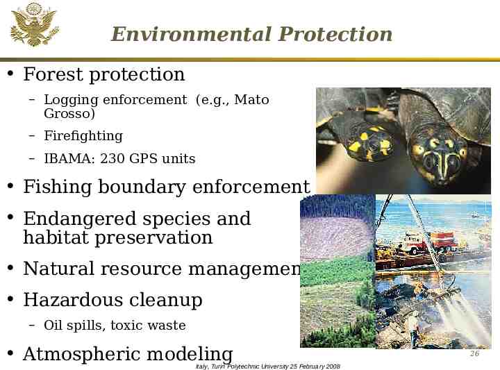
Environmental Protection Forest protection – Logging enforcement (e.g., Mato Grosso) – Firefighting – IBAMA: 230 GPS units Fishing boundary enforcement Endangered species and habitat preservation Natural resource management Hazardous cleanup – Oil spills, toxic waste Atmospheric modeling Italy, Turin Polytechnic University 25 February 2008 26
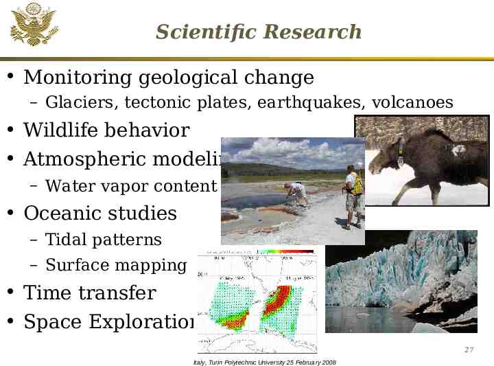
Scientific Research Monitoring geological change – Glaciers, tectonic plates, earthquakes, volcanoes Wildlife behavior Atmospheric modeling – Water vapor content Oceanic studies – Tidal patterns – Surface mapping Time transfer Space Exploration 27 Italy, Turin Polytechnic University 25 February 2008
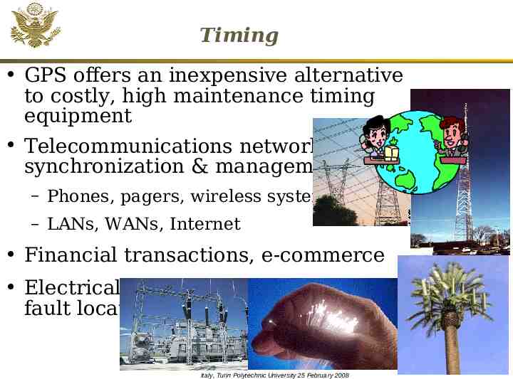
Timing GPS offers an inexpensive alternative to costly, high maintenance timing equipment Telecommunications network synchronization & management – Phones, pagers, wireless systems – LANs, WANs, Internet Financial transactions, e-commerce Electrical power grid management & fault location 28 Italy, Turin Polytechnic University 25 February 2008
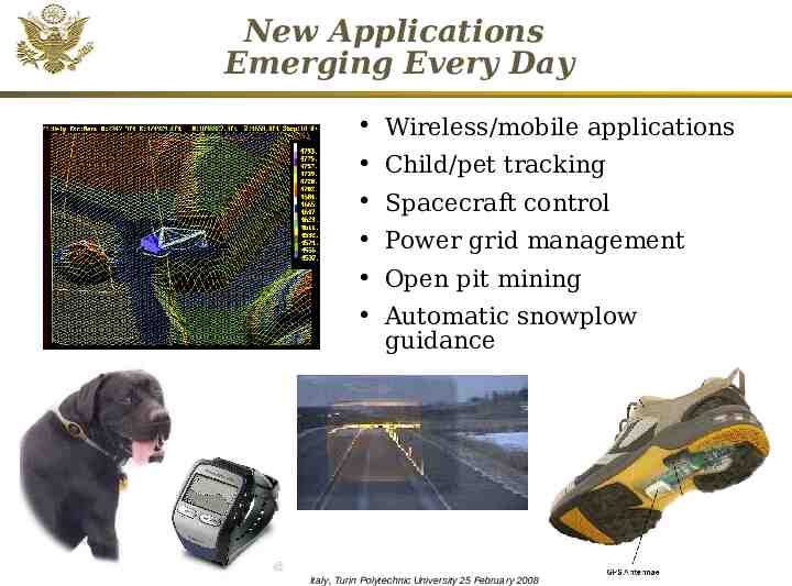
New Applications Emerging Every Day Wireless/mobile applications Child/pet tracking Spacecraft control Power grid management Open pit mining Automatic snowplow guidance 29 Italy, Turin Polytechnic University 25 February 2008
Snow Plow Video 30 Italy, Turin Polytechnic University 25 February 2008
Overview Systems Applications Policy International Cooperation 31 Italy, Turin Polytechnic University 25 February 2008
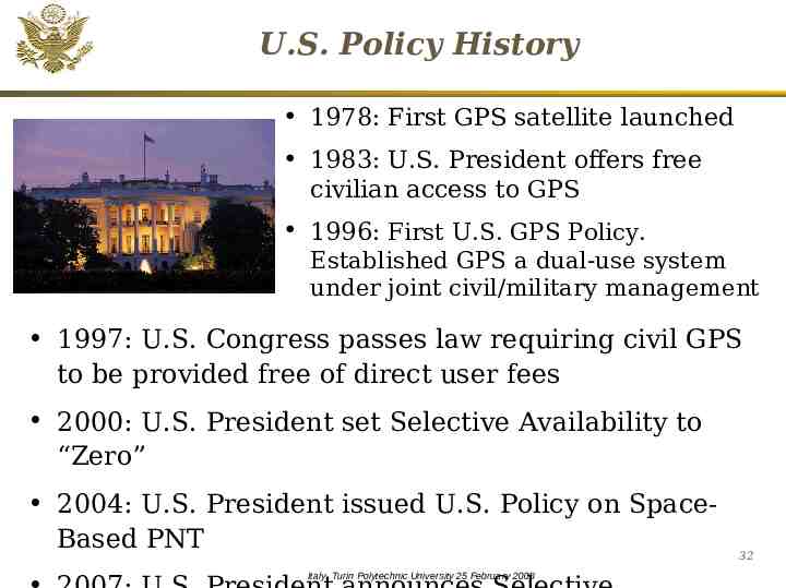
U.S. Policy History 1978: First GPS satellite launched 1983: U.S. President offers free civilian access to GPS 1996: First U.S. GPS Policy. Established GPS a dual-use system under joint civil/military management 1997: U.S. Congress passes law requiring civil GPS to be provided free of direct user fees 2000: U.S. President set Selective Availability to “Zero” 2004: U.S. President issued U.S. Policy on SpaceBased PNT Italy, Turin Polytechnic University 25 February 2008 32
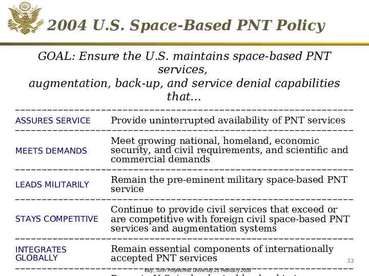
2004 U.S. Space-Based PNT Policy GOAL: Ensure the U.S. maintains space-based PNT services, augmentation, back-up, and service denial capabilities that ASSURES SERVICE Provide uninterrupted availability of PNT services MEETS DEMANDS Meet growing national, homeland, economic security, and civil requirements, and scientific and commercial demands LEADS MILITARILY Remain the pre-eminent military space-based PNT service STAYS COMPETITIVE Continue to provide civil services that exceed or are competitive with foreign civil space-based PNT services and augmentation systems INTEGRATES GLOBALLY Remain essential components of internationally accepted PNT services Italy, Turin Polytechnic University 25 February 2008 33
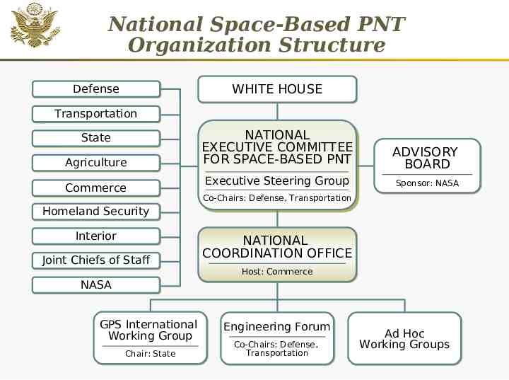
National Space-Based PNT Organization Structure WHITE HOUSE Defense Transportation Agriculture NATIONAL NATIONAL EXECUTIVE EXECUTIVE COMMITTEE COMMITTEE FOR FOR SPACE-BASED SPACE-BASED PNT PNT ADVISORY BOARD Commerce Executive Executive Steering Steering Group Group Sponsor: NASA State Homeland Security Interior Joint Chiefs of Staff Co-Chairs: Co-Chairs: Defense, Defense, Transportation Transportation NATIONAL COORDINATION OFFICE Host: Commerce NASA GPS International Working Group Chair: State Engineering Forum Co-Chairs: Defense, Transportation Italy, Turin Polytechnic University 25 February 2008 Ad Hoc Working Groups 34
National Space-Based PNT Executive Committee National Space-Based PNT Executive Committee established in 2004 U.S. Policy – Chaired by Deputy Secretaries of Defense and Transportation – Membership includes: State, Agriculture, Interior, Commerce, Homeland Security, JCS and NASA – Supported by a new National Coordination Office National Coordination Office (NCO) was established with staff from each member agency – Director, Deputy Director, and 6 staff Italy, Turin Polytechnic University 25 February 2008 35
National Coordination Office Facilitates information sharing, coordination, and issue resolution regarding space-based PNT programs, requirements, budgets, and policies across all U.S. Agencies Facilitates coordination among Agencies regarding plans to modernize U.S. space-based PNT infrastructure Conducts or oversees space-based PNT studies, analyses and projects with a U.S. National benefit Informs state, local and international GNSS users and 36 participants of National Executive Committee activities Italy, Turin Polytechnic University 25 February 2008
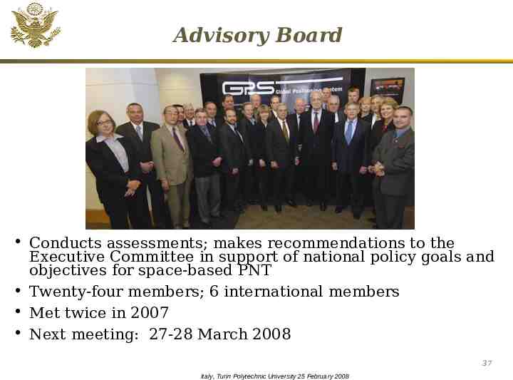
Advisory Board Conducts assessments; makes recommendations to the Executive Committee in support of national policy goals and objectives for space-based PNT Twenty-four members; 6 international members Met twice in 2007 Next meeting: 27-28 March 2008 37 Italy, Turin Polytechnic University 25 February 2008
EXCOM Activities Program Oversight – Five-Year National Plan – National PNT Architecture – GPS Modernization – Civil GPS Funding – GPS Augmentations Nationwide Differential GPS – Distress Alerting Satellite System (DASS) International Engagement – Bilateral – Multilateral Spectrum Management – Interference Detection and Mitigation Plan – Spectrum Protection Plan Outreach – Publications, websites, exhibits – Conferences and other venues – Coordination of U.S. message 38 Italy, Turin Polytechnic University 25 February 2008
Selective Availability Selective Availability (SA) feature was used in the past to intentionally degrade civilian GPS service – First fully implemented in 1995 – Discontinued (set zero) by the President in May 2000 – Has not been used since then USG made decision that the next generation of GPS satellites (GPS III) will be built without the Selective Availability feature – Secretary of Transportation Peters announced decision at ICAO General Assembly on 18 September 39 2007 Italy, Turin Polytechnic University 25 February 2008
2004 U.S. Policy Demonstrates U.S. Government commitment to spacebased PNT for all stakeholders Provides framework for public/private decision makers Improves ability to coordinate efforts across the various agencies of the U.S. Government Creates basis for meaningful dialogue between service providers and end users Promotes common standards for worldwide interoperability 40 Italy, Turin Polytechnic University 25 February 2008
Overview Systems Applications Policy International Cooperation 41 Italy, Turin Polytechnic University 25 February 2008
Active Diplomacy Results of over a decade of bilateral/multilateral diplomatic efforts are beginning to be seen: – New satellite constellations and regional augmentation systems, while independently owned and operated, are being designed to be compatible and interoperable – Coordination mechanisms are being created to promote interoperability, promote GNSS use, and ensure a level playing field in the global marketplace Italy, Turin Polytechnic University 25 February 2008 42
Compatibility - Interoperability “Compatible” –ability of U.S. and non-U.S. space based PNT services to be used separately or together without interfering with each individual service or signal – Compatibility should also involve spectral separation between each system’s authorized service signals and other systems’ signals “Interoperable” – ability of civil U.S. and nonU.S. space-based PNT services to be used together to provide the user better capabilities than would be achieved by relying solely on one service or signal Interoperable Better Together than Separate 43 Italy, Turin Polytechnic University 25 February 2008
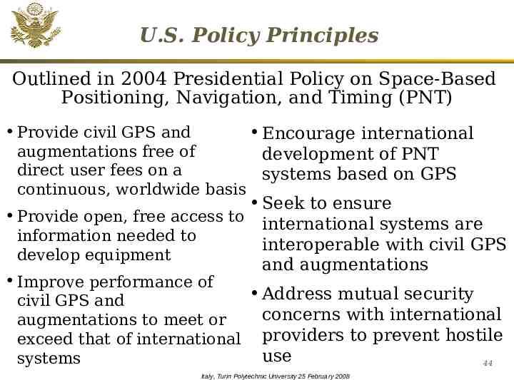
U.S. Policy Principles Outlined in 2004 Presidential Policy on Space-Based Positioning, Navigation, and Timing (PNT) Provide civil GPS and Encourage international augmentations free of development of PNT direct user fees on a systems based on GPS continuous, worldwide basis Seek to ensure Provide open, free access to international systems are information needed to interoperable with civil GPS develop equipment and augmentations Improve performance of Address mutual security civil GPS and concerns with international augmentations to meet or exceed that of international providers to prevent hostile use systems 44 Italy, Turin Polytechnic University 25 February 2008
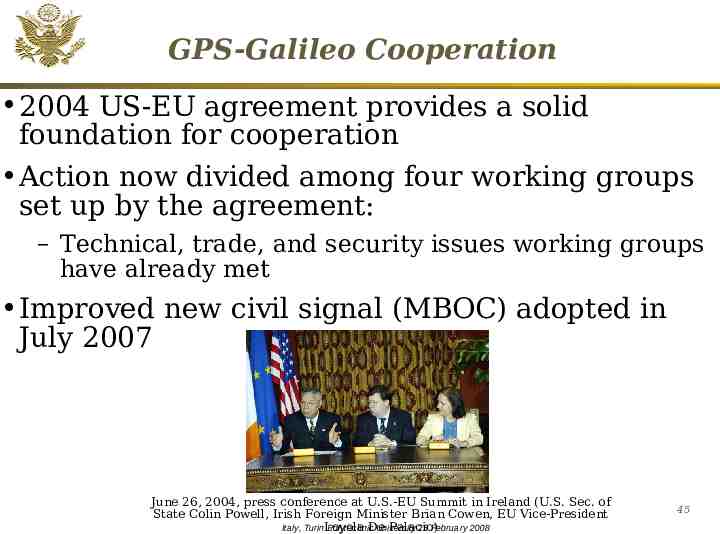
GPS-Galileo Cooperation 2004 US-EU agreement provides a solid foundation for cooperation Action now divided among four working groups set up by the agreement: – Technical, trade, and security issues working groups have already met Improved new civil signal (MBOC) adopted in July 2007 June 26, 2004, press conference at U.S.-EU Summit in Ireland (U.S. Sec. of State Colin Powell, Irish Foreign Minister Brian Cowen, EU Vice-President De Palacio) Italy, TurinLoyola Polytechnic University 25 February 2008 45
GPS-GLONASS Cooperation U.S.- Russia Joint Statement issued in Dec 2004 Several productive technical working group meetings have been held: – Russia WG-1 chair proposed adopting two new civil CDMA signals at L1, L5 which will be interoperable with GPS Negotiations for a U.S.-Russia agreement on satellite navigation cooperation have been underway since late 2005: – Next meeting will be held in early 2008 Italy, Turin Polytechnic University 25 February 2008 46
U.S. – Japan Cooperation Japan’s status as a world leader in GPS applications and user equipment makes it an important partner Regular policy consultations and technical meetings on GPS cooperation have been held since 1996 and led to the 1998 Clinton-Obuchi Joint Statement Both countries have benefited from the close relationship: – QZSS is designed to be compatible and interoperable with GPS – U.S. working with Japan to set up QZSS monitoring stations in Hawaii and Guam 47 Italy, Turin Polytechnic University 25 February 2008
U.S.-India Cooperation Policy and technical consultations on GPS cooperation underway since 2005 One aim is to ensure interoperability between GPS augmentation system WAAS and India’s planned GAGAN augmentation system based on GPS Another important topic is ionospheric distortion and solutions U.S.-India Joint Statement on GNSS Cooperation – Issued in Feb 2007 in Washington Bi-lateral meeting held in Bangalore in Sep 2007 48 Italy, Turin Polytechnic University 25 February 2008
U.S.-Australia Cooperation Long history of GPS cooperation between U.S. and Australia U.S.-Australia Joint Delegation Statement on Cooperation in the Civil Use of GPS signed Apr 19 Cooperation expands upon existing efforts to ensure interoperability between GPS and Australia's Ground-based Regional Augmentation System (GRAS) and Ground Based Augmentation System (GBAS) U.S. Coast Guard NAVCEN posts a daily Position Dilution of Precision (PDOP) report in response to Australia’s concerns over planned GPS outages 49 Italy, Turin Polytechnic University 25 February 2008
International Committee on Global Navigation Satellite Systems (ICG) Emerged from 3rd UN Conference on the Exploration and Peaceful Uses of Outer Space Jul 1999 Promote the use of GNSS and its integration into infrastructures, particularly in developing countries Encourage compatibility and interoperability among global and regional systems Members include: GNSS providers (U.S., EU, Russia, China, India, Japan), international organizations, and international associations Italy, Turin Polytechnic University 25 February 2008 50
2nd International Committee on Global Navigation Satellite Systems (ICG) ICG-2 held in September in Bangalore, India Established Providers Forum to address common issues Exchanged views on the ICG Work Plan by work groups: – A. Interoperability and compatibility – B. Enhancement of performance of GNSS services – C. Information dissemination, education, outreach & coordination – D. Interactions with National and Regional Authorities as well as International Organizations U.S. will host the 3rd ICG in Dec 2008 Italy, Turin Polytechnic University 25 February 2008 51
Summary U.S. Space-based PNT effort progressing significantly in areas of policy, programs and international Continuing to improve USG space-based PNT system performance New GNSS applications emerging Implementation of 2004 Policy proceeding well – Very active senior USG leadership International cooperation is a top priority for USG – Actively engaged in multi-lateral/bi-lateral consultations As As new new space-based space-based GNSS GNSS emerge emerge globally, globally, compatibility compatibility and and interoperability interoperability is is the the key key to to 52 Italy, Turin Polytechnic University 25 February 2008
Contact Information Michael E. Shaw Director U.S. National Coordination Office for SpaceBased PNT 14th and Constitution Ave, N.W. Washington, D.C. 20230 Ph: (202) 482-5809 Fax: (202) 482-4429 [email protected] Presentation and other GPS information available: www.PNT.gov Italy, Turin Polytechnic University 25 February 2008 53
Web-based Information PNT.gov established to distribute information on the U.S. National Executive Committee – Information on U.S. Policy, Executive Committee membership, Advisory Board and frequently asked questions – Recent announcement on Selective Availability and offer letter to International Civil Aviation Organization – All recent public presentation GPS.gov established for public information about GPS applications – Available in English, French, Spanish, Arabic and Chinese – Brochure also available in hardcopy upon request – Contains additional Italy, links to various other web sites Turin Polytechnic University 25 February 2008 54