Pennsylvania DEP’s Underground Injection Control Data Flow May

23 Slides1.35 MB
Pennsylvania DEP’s Underground Injection Control Data Flow May 31, 2012 Jen Gumert, PA DEP
Underground Injection Control Data Flow What is Underground Injection Control? Why PADEP selected the UIC Data Flow Designing and Developing the Process Challenges
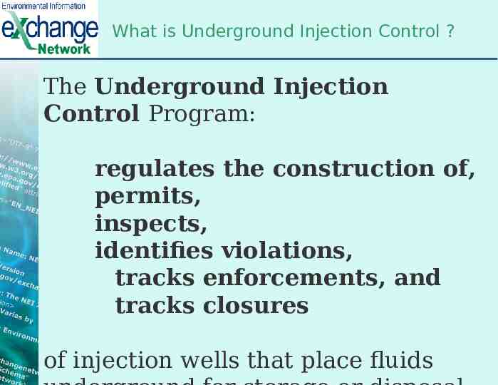
What is Underground Injection Control ? The Underground Injection Control Program: regulates the construction of, permits, inspects, identifies violations, tracks enforcements, and tracks closures of injection wells that place fluids
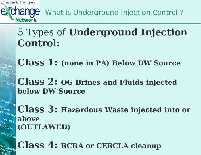
What is Underground Injection Control ? 5 Types of Underground Injection Control: Class 1: (none in PA) Below DW Source Class 2: OG Brines and Fluids injected below DW Source Class 3: Hazardous Waste injected into or above (OUTLAWED) Class 4: RCRA or CERCLA cleanup
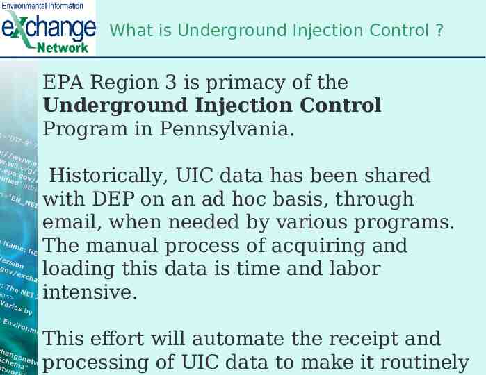
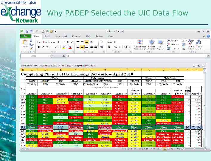
What is Underground Injection Control ? EPA Region 3 is primacy of the Underground Injection Control Program in Pennsylvania. Historically, UIC data has been shared with DEP on an ad hoc basis, through email, when needed by various programs. The manual process of acquiring and loading this data is time and labor intensive. This effort will automate the receipt and processing of UIC data to make it routinely
Why PADEP Selected the UIC Data Flow
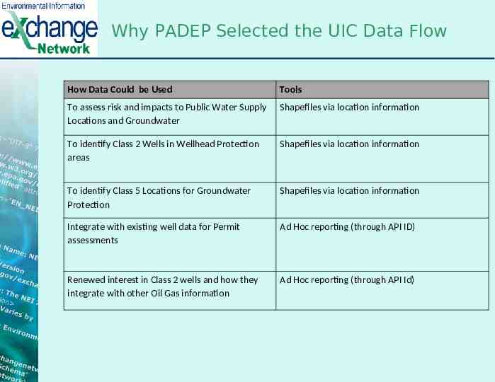
Why PADEP Selected the UIC Data Flow How Data Could be Used Tools To assess risk and impacts to Public Water Supply Locations and Groundwater Shapefiles via location information To identify Class 2 Wells in Wellhead Protection areas Shapefiles via location information To identify Class 5 Locations for Groundwater Protection Shapefiles via location information Integrate with existing well data for Permit assessments Ad Hoc reporting (through API ID) Renewed interest in Class 2 wells and how they integrate with other Oil Gas information Ad Hoc reporting (through API Id)
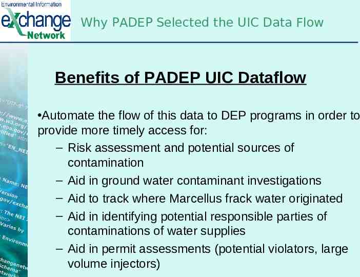
Why PADEP Selected the UIC Data Flow Benefits of PADEP UIC Dataflow Automate the flow of this data to DEP programs in order to provide more timely access for: – Risk assessment and potential sources of contamination – Aid in ground water contaminant investigations – Aid to track where Marcellus frack water originated – Aid in identifying potential responsible parties of contaminations of water supplies – Aid in permit assessments (potential violators, large volume injectors)
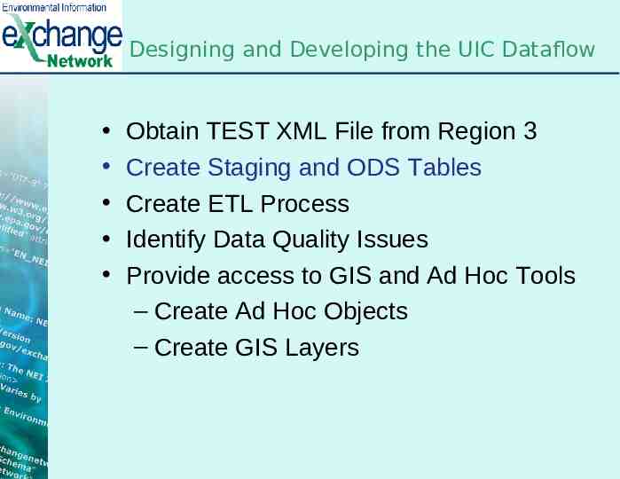
Designing and Developing the UIC Dataflow Obtain TEST XML File from EPA Region 3 Create Staging and ODS Tables Create ETL Process Identify Data Quality Issues Provide access to GIS and Ad Hoc Tools – Create GIS Layers – Create Ad Hoc Objects
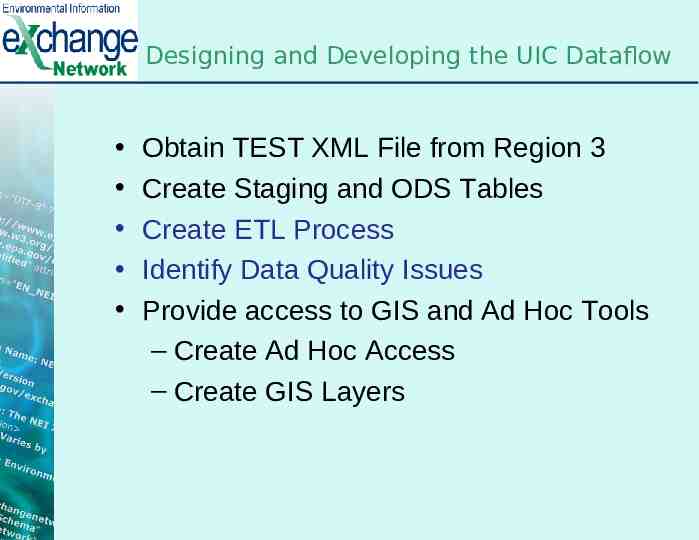
Designing and Developing the UIC Dataflow Obtain TEST XML File from Region 3 Create Staging and ODS Tables Create ETL Process Identify Data Quality Issues Provide access to GIS and Ad Hoc Tools – Create Ad Hoc Objects – Create GIS Layers
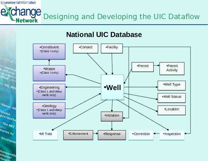
Designing and Developing the UIC Dataflow National UIC Database Constituent (Class I only) Contact Facility Permit Waste (Class I only) Well Type Well Engineering (Class I, and deep wells only) Well Status Geology Location (Class I, and deep wells only) MI Test Permit Activity Violation Enforcement Response Correction Inspection
Designing and Developing the UIC Dataflow Obtain TEST XML File from Region 3 Create Staging and ODS Tables Create ETL Process Identify Data Quality Issues Provide access to GIS and Ad Hoc Tools – Create Ad Hoc Access – Create GIS Layers
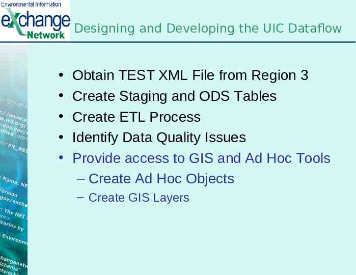
Designing and Developing the UIC Dataflow Obtain TEST XML File from Region 3 Create Staging and ODS Tables Create ETL Process Identify Data Quality Issues Provide access to GIS and Ad Hoc Tools – Create Ad Hoc Objects – Create GIS Layers
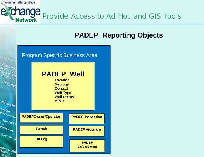
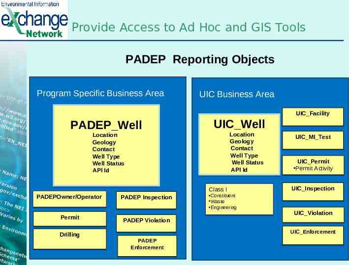
Provide Access to Ad Hoc and GIS Tools PADEP Reporting Objects Program Specific Business Area PADEP Well Location Geology Contact Well Type Well Status API Id PADEPOwner/Operator PADEP Inspection Permit PADEP Violation Drilling PADEP Enforcement
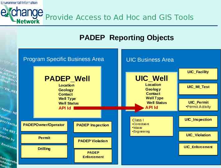
Provide Access to Ad Hoc and GIS Tools PADEP Reporting Objects Program Specific Business Area PADEP Well UIC Business Area UIC Well Location Geology Contact Well Type Well Status API Id Location Geology Contact Well Type Well Status API Id PADEPOwner/Operator Permit Drilling Class I PADEP Inspection Constituent Waste Engineering UIC Facility UIC MI Test UIC Permit Permit Activity UIC Inspection UIC Violation PADEP Violation UIC Enforcement PADEP Enforcement
Provide Access to Ad Hoc and GIS Tools PADEP Reporting Objects Program Specific Business Area PADEP Well UIC Business Area UIC Well Location Geology Contact Well Type Well Status Location Geology Contact Well Type Well Status API Id API Id PADEPOwner/Operator Permit Drilling Class I PADEP Inspection Constituent Waste Engineering UIC Facility UIC MI Test UIC Permit Permit Activity UIC Inspection UIC Violation PADEP Violation UIC Enforcement PADEP Enforcement
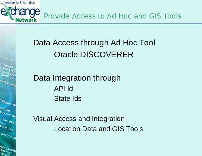
Provide Access to Ad Hoc and GIS Tools Data Access through Ad Hoc Tool Oracle DISCOVERER Data Integration through API Id State Ids Visual Access and Integration Location Data and GIS Tools
Provide Access to Ad Hoc and GIS Tools WellsJan Drilled Wells Permitted – Feb 2012
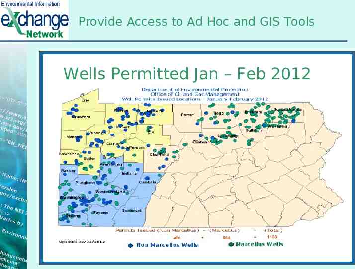
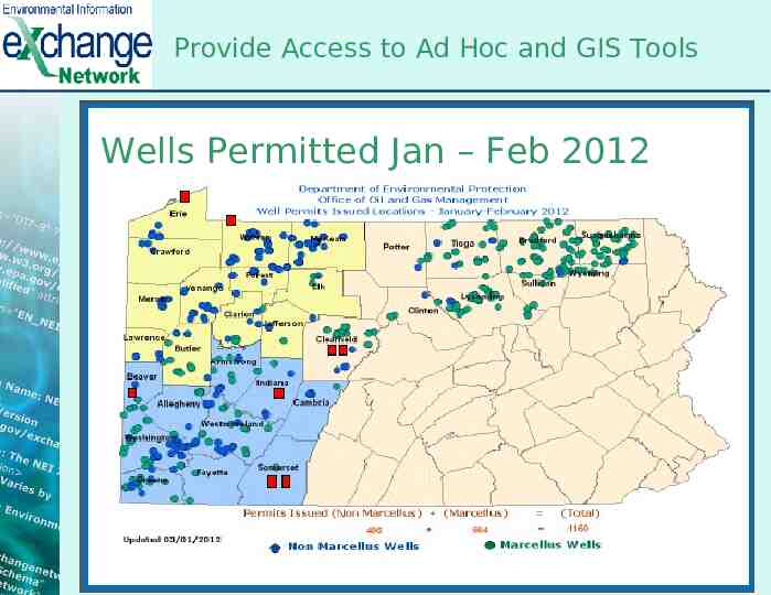
Provide Access to Ad Hoc and GIS Tools Wells Permitted Jan – Feb 2012
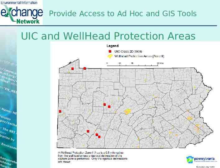
Provide Access to Ad Hoc and GIS Tools UIC and WellHead Protection Areas
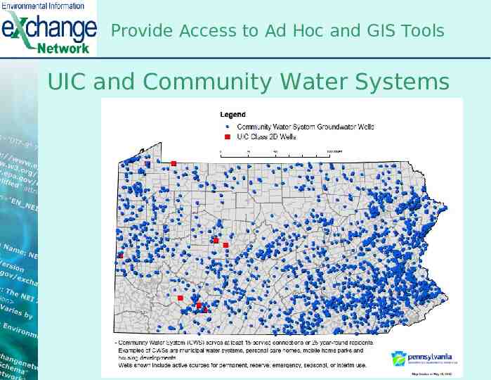
Provide Access to Ad Hoc and GIS Tools UIC and Community Water Systems
Challenges and Recommendations Refresh Process – Incremental or Full Source of Data Data Quality Data Integration
Questions PADEP Exchange Node Team Jen Gumert [email protected] Narendra Mehta [email protected] Darryl Ragantesi [email protected] Sanjay Shah c [email protected]