Introduction to VFR Charts


24 Slides3.14 MB
Introduction to VFR Charts
What is a VFR Chart It is an aerial map of the ground that shows important information to pilots flying overhead This information includes the airspace of the location and its boundaries Airport type and contact frequency information Topographical landmarks and elevation
Key features
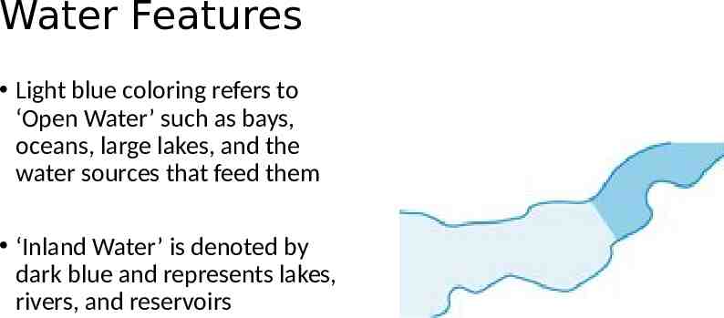
Water Features Light blue coloring refers to ‘Open Water’ such as bays, oceans, large lakes, and the water sources that feed them ‘Inland Water’ is denoted by dark blue and represents lakes, rivers, and reservoirs
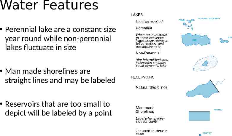
Water Features Perennial lake are a constant size year round while non-perennial lakes fluctuate in size Man made shorelines are straight lines and may be labeled Reservoirs that are too small to depict will be labeled by a point
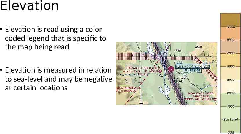
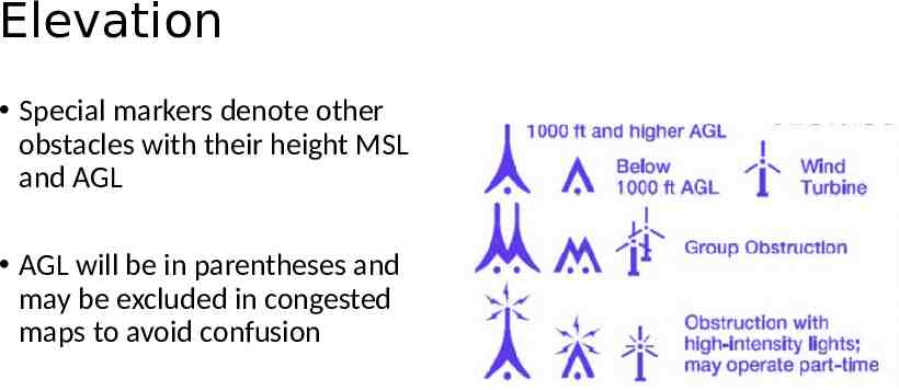
Elevation Elevation is read using a color coded legend that is specific to the map being read Elevation is measured in relation to sea-level and may be negative at certain locations
Elevation Special markers denote other obstacles with their height MSL and AGL AGL will be in parentheses and may be excluded in congested maps to avoid confusion
NAVAID
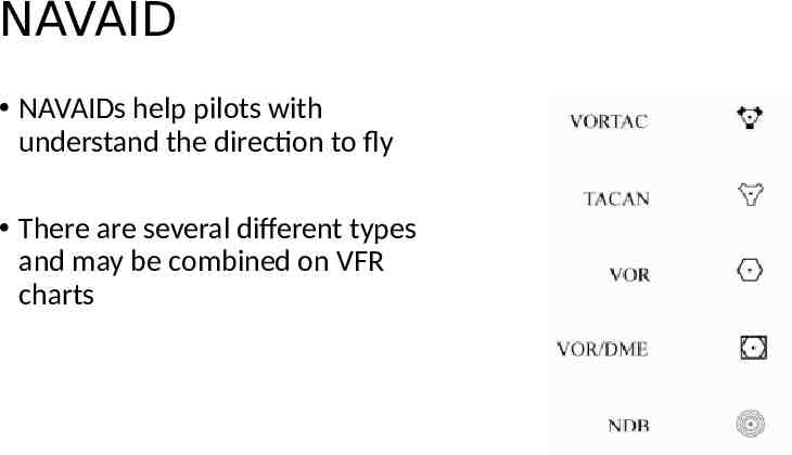
NAVAID NAVAIDs help pilots with understand the direction to fly There are several different types and may be combined on VFR charts
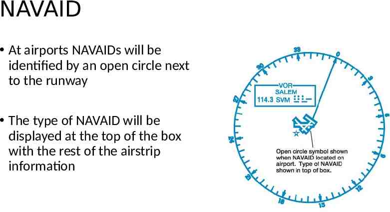
NAVAID At airports NAVAIDs will be identified by an open circle next to the runway The type of NAVAID will be displayed at the top of the box with the rest of the airstrip information
Airports
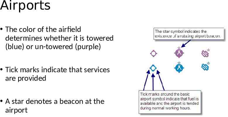
Airports The color of the airfield determines whether it is towered (blue) or un-towered (purple) Tick marks indicate that services are provided A star denotes a beacon at the airport
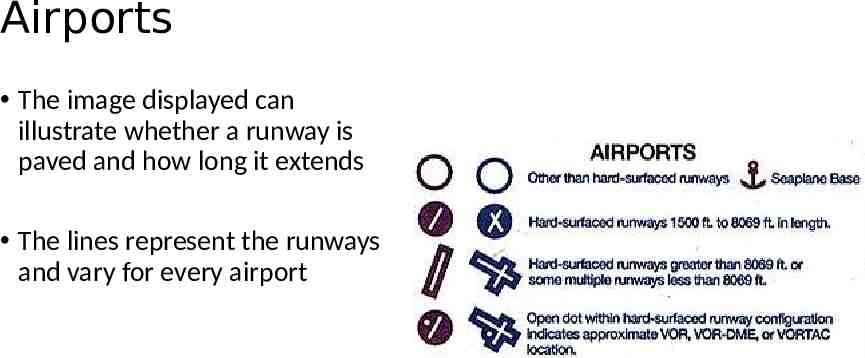
Airports The image displayed can illustrate whether a runway is paved and how long it extends The lines represent the runways and vary for every airport
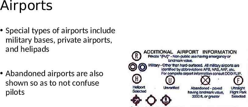
Airports Special types of airports include military bases, private airports, and helipads Abandoned airports are also shown so as to not confuse pilots
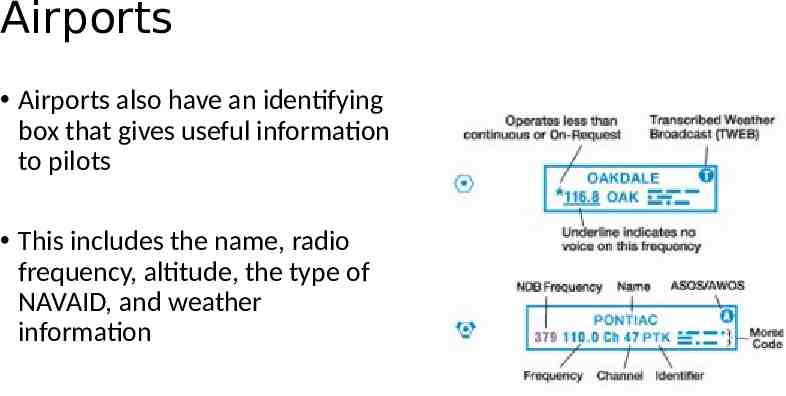
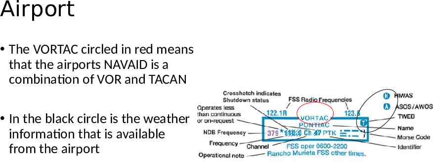
Airports Airports also have an identifying box that gives useful information to pilots This includes the name, radio frequency, altitude, the type of NAVAID, and weather information
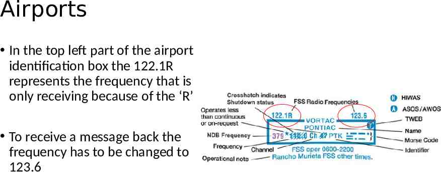
Airports In the top left part of the airport identification box the 122.1R represents the frequency that is only receiving because of the ‘R’ To receive a message back the frequency has to be changed to 123.6
Airport The VORTAC circled in red means that the airports NAVAID is a combination of VOR and TACAN In the black circle is the weather information that is available from the airport
Airspace
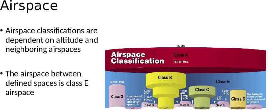
Airspace Airspace classifications are dependent on altitude and neighboring airspaces The airspace between defined spaces is class E airspace
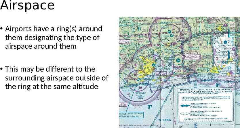
Airspace Airports have a ring(s) around them designating the type of airspace around them This may be different to the surrounding airspace outside of the ring at the same altitude
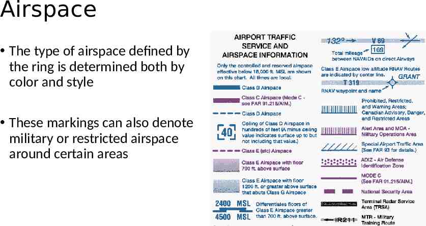
Airspace The type of airspace defined by the ring is determined both by color and style These markings can also denote military or restricted airspace around certain areas
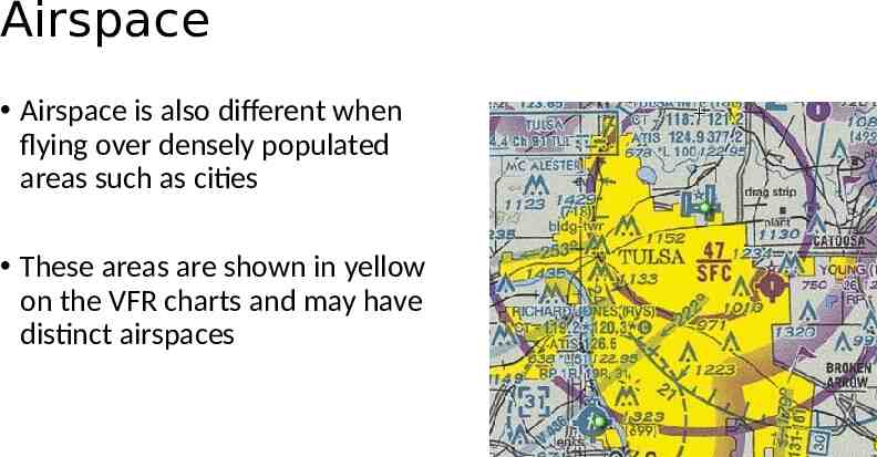
Airspace Airspace is also different when flying over densely populated areas such as cities These areas are shown in yellow on the VFR charts and may have distinct airspaces
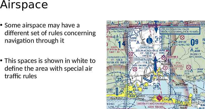
Airspace Some airspace may have a different set of rules concerning navigation through it This spaces is shown in white to define the area with special air traffic rules
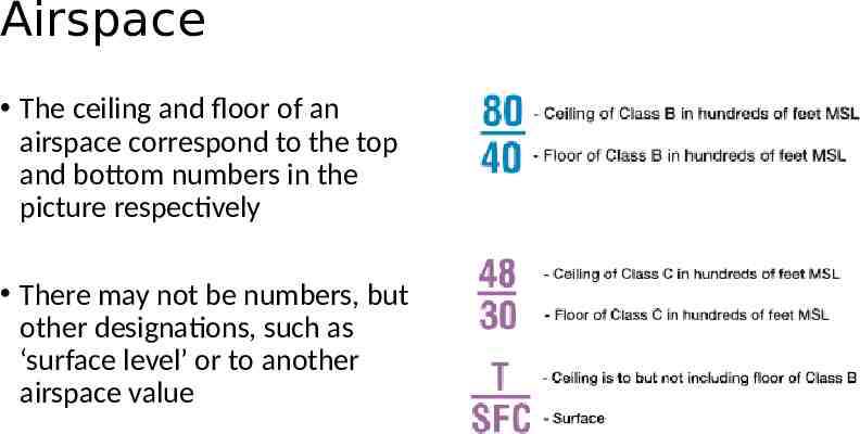
Airspace The ceiling and floor of an airspace correspond to the top and bottom numbers in the picture respectively There may not be numbers, but other designations, such as ‘surface level’ or to another airspace value