Land and Water Features Of the United States
34 Slides8.39 MB
Land and Water Features Of the United States
United States Landforms
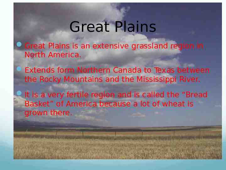
Great Plains Great Plains is an extensive grassland region in North America. Extends form Northern Canada to Texas between the Rocky Mountains and the Mississippi River. It is a very fertile region and is called the “Bread Basket” of America because a lot of wheat is grown there.
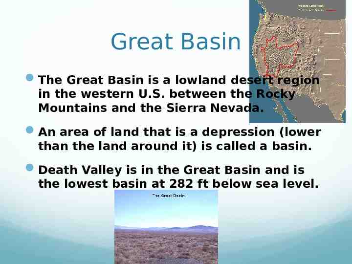
Great Basin The Great Basin is a lowland desert region in the western U.S. between the Rocky Mountains and the Sierra Nevada. An area of land that is a depression (lower than the land around it) is called a basin. Death Valley is in the Great Basin and is the lowest basin at 282 ft below sea level.
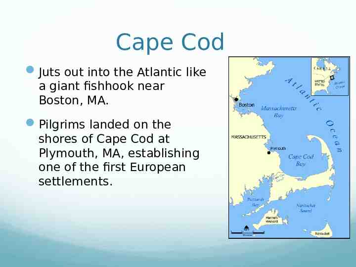
Cape Cod Juts out into the Atlantic like a giant fishhook near Boston, MA. Pilgrims landed on the shores of Cape Cod at Plymouth, MA, establishing one of the first European settlements.
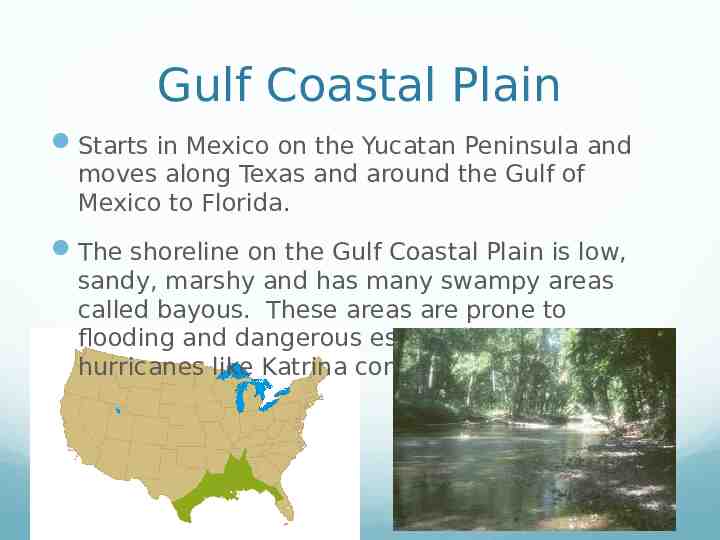
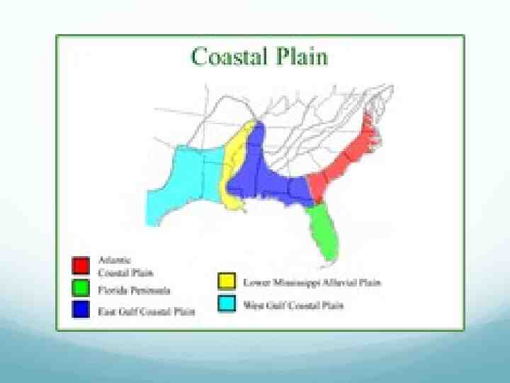
Gulf Coastal Plain Starts in Mexico on the Yucatan Peninsula and moves along Texas and around the Gulf of Mexico to Florida. The shoreline on the Gulf Coastal Plain is low, sandy, marshy and has many swampy areas called bayous. These areas are prone to flooding and dangerous especially when hurricanes like Katrina come through.
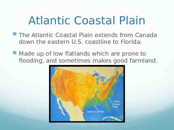
Atlantic Coastal Plain The Atlantic Coastal Plain extends from Canada down the eastern U.S. coastline to Florida. Made up of low flatlands which are prone to flooding, and sometimes makes good farmland.
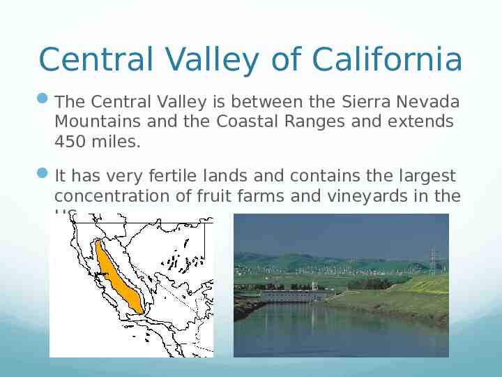
Central Valley of California The Central Valley is between the Sierra Nevada Mountains and the Coastal Ranges and extends 450 miles. It has very fertile lands and contains the largest concentration of fruit farms and vineyards in the US.
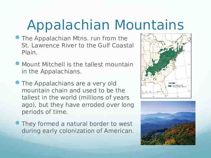
Appalachian Mountains The Appalachian Mtns. run from the St. Lawrence River to the Gulf Coastal Plain. Mount Mitchell is the tallest mountain in the Appalachians. The Appalachians are a very old mountain chain and used to be the tallest in the world (millions of years ago), but they have erroded over long periods of time. They formed a natural border to west during early colonization of American.
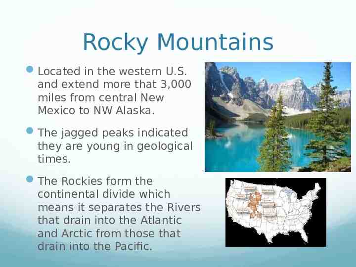
Rocky Mountains Located in the western U.S. and extend more that 3,000 miles from central New Mexico to NW Alaska. The jagged peaks indicated they are young in geological times. The Rockies form the continental divide which means it separates the Rivers that drain into the Atlantic and Arctic from those that drain into the Pacific.
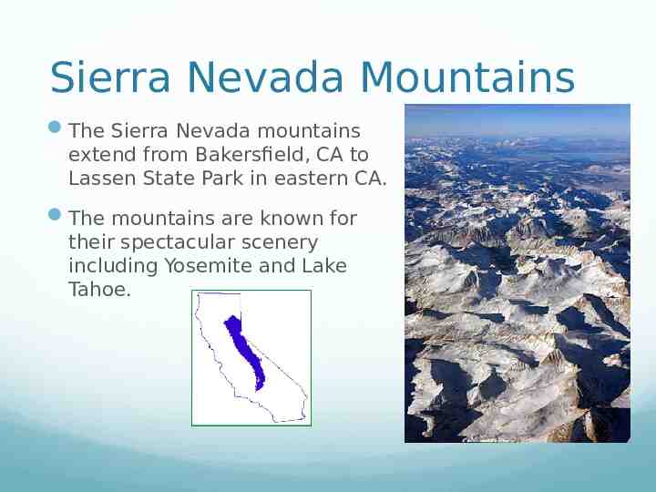
Sierra Nevada Mountains The Sierra Nevada mountains extend from Bakersfield, CA to Lassen State Park in eastern CA. The mountains are known for their spectacular scenery including Yosemite and Lake Tahoe.
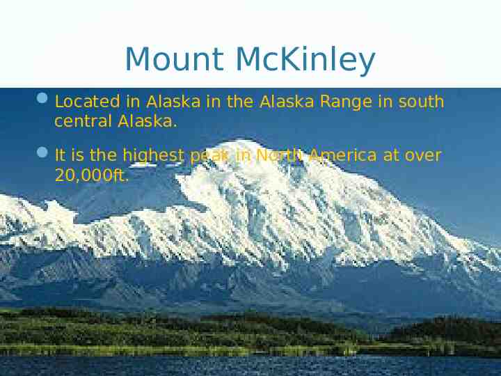
Mount McKinley Located in Alaska in the Alaska Range in south central Alaska. It is the highest peak in North America at over 20,000ft.
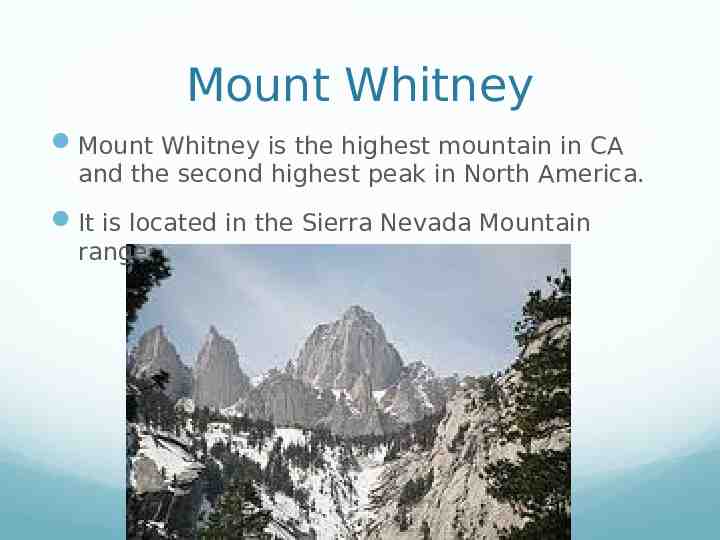
Mount Whitney Mount Whitney is the highest mountain in CA and the second highest peak in North America. It is located in the Sierra Nevada Mountain range.
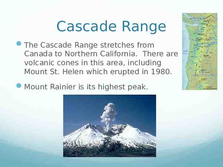
Cascade Range The Cascade Range stretches from Canada to Northern California. There are volcanic cones in this area, including Mount St. Helen which erupted in 1980. Mount Rainier is its highest peak.
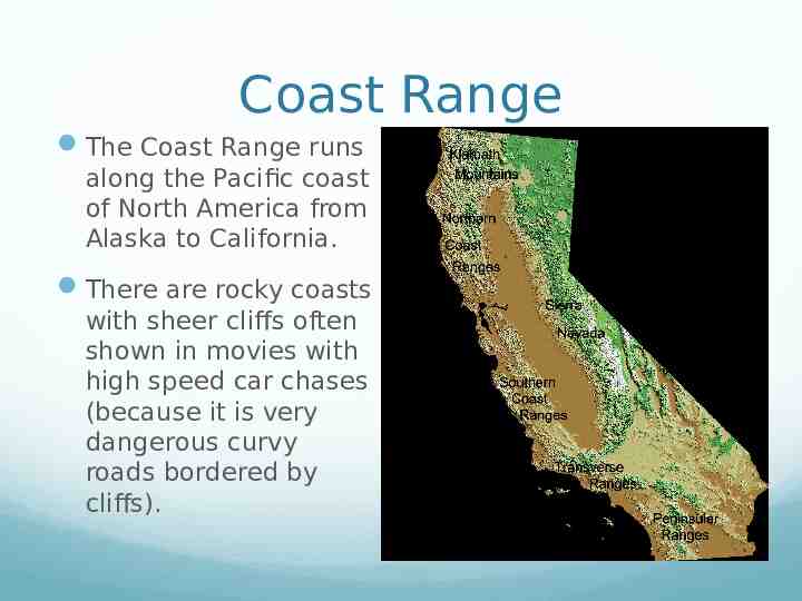
Coast Range The Coast Range runs along the Pacific coast of North America from Alaska to California. There are rocky coasts with sheer cliffs often shown in movies with high speed car chases (because it is very dangerous curvy roads bordered by cliffs).
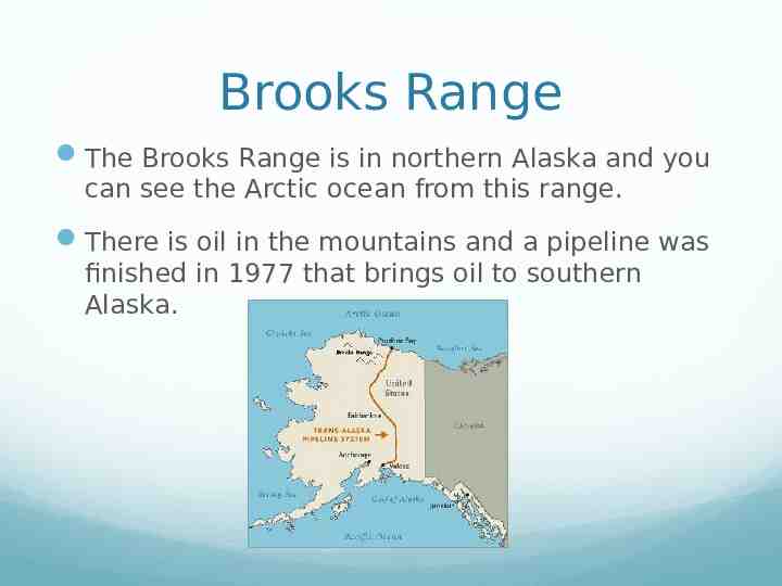
Brooks Range The Brooks Range is in northern Alaska and you can see the Arctic ocean from this range. There is oil in the mountains and a pipeline was finished in 1977 that brings oil to southern Alaska.
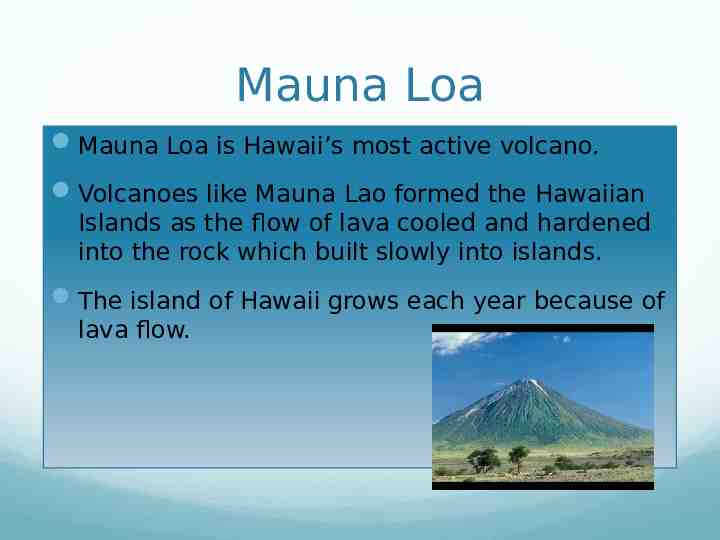
Mauna Loa Mauna Loa is Hawaii’s most active volcano. Volcanoes like Mauna Lao formed the Hawaiian Islands as the flow of lava cooled and hardened into the rock which built slowly into islands. The island of Hawaii grows each year because of lava flow.
United States Waters
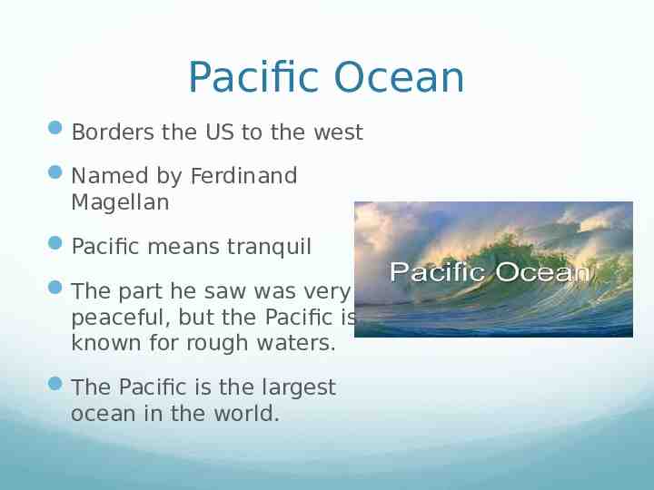
Pacific Ocean Borders the US to the west Named by Ferdinand Magellan Pacific means tranquil The part he saw was very peaceful, but the Pacific is known for rough waters. The Pacific is the largest ocean in the world.
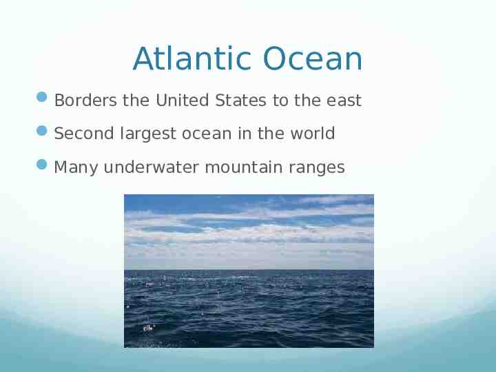
Atlantic Ocean Borders the United States to the east Second largest ocean in the world Many underwater mountain ranges
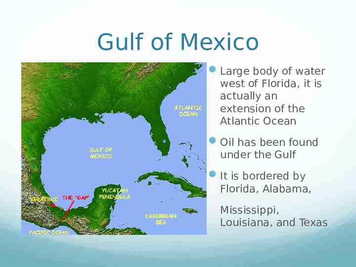
Gulf of Mexico Large body of water west of Florida, it is actually an extension of the Atlantic Ocean Oil has been found under the Gulf It is bordered by Florida, Alabama, Mississippi, Louisiana, and Texas
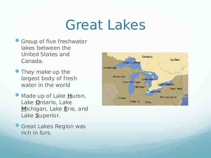
Great Lakes Group of five freshwater lakes between the United States and Canada. They make up the largest body of fresh water in the world Made up of Lake Huron, Lake Ontario, Lake Michigan, Lake Erie, and Lake Superior. Great Lakes Region was rich in furs.
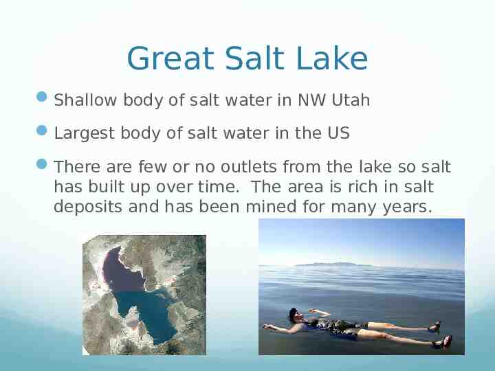
Great Salt Lake Shallow body of salt water in NW Utah Largest body of salt water in the US There are few or no outlets from the lake so salt has built up over time. The area is rich in salt deposits and has been mined for many years.
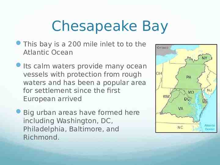
Chesapeake Bay This bay is a 200 mile inlet to to the Atlantic Ocean Its calm waters provide many ocean vessels with protection from rough waters and has been a popular area for settlement since the first European arrived Big urban areas have formed here including Washington, DC, Philadelphia, Baltimore, and Richmond.
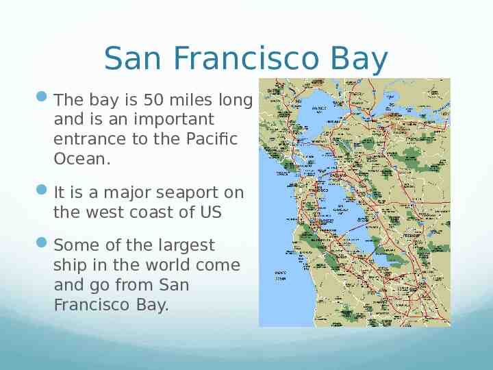
San Francisco Bay The bay is 50 miles long and is an important entrance to the Pacific Ocean. It is a major seaport on the west coast of US Some of the largest ship in the world come and go from San Francisco Bay.
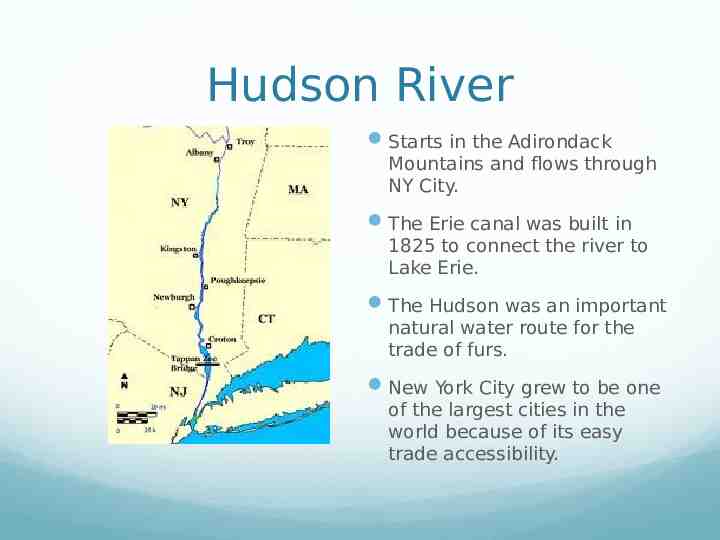
Hudson River Starts in the Adirondack Mountains and flows through NY City. The Erie canal was built in 1825 to connect the river to Lake Erie. The Hudson was an important natural water route for the trade of furs. New York City grew to be one of the largest cities in the world because of its easy trade accessibility.
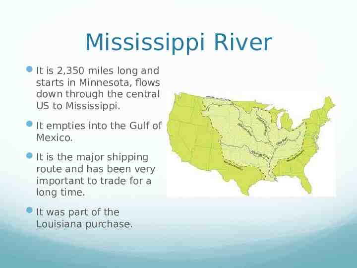
Mississippi River It is 2,350 miles long and starts in Minnesota, flows down through the central US to Mississippi. It empties into the Gulf of Mexico. It is the major shipping route and has been very important to trade for a long time. It was part of the Louisiana purchase.
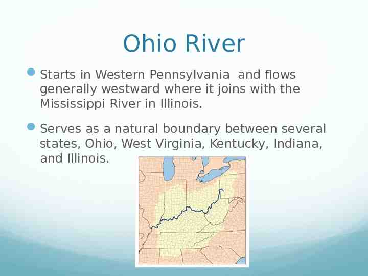
Ohio River Starts in Western Pennsylvania and flows generally westward where it joins with the Mississippi River in Illinois. Serves as a natural boundary between several states, Ohio, West Virginia, Kentucky, Indiana, and Illinois.
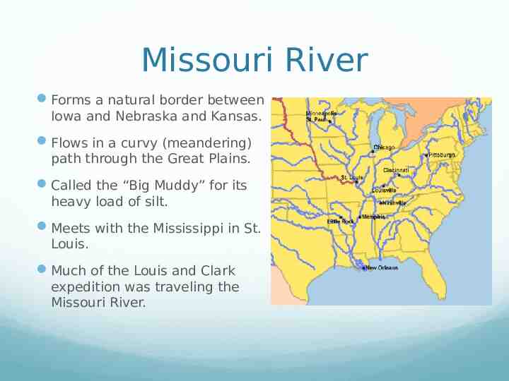
Missouri River Forms a natural border between Iowa and Nebraska and Kansas. Flows in a curvy (meandering) path through the Great Plains. Called the “Big Muddy” for its heavy load of silt. Meets with the Mississippi in St. Louis. Much of the Louis and Clark expedition was traveling the Missouri River.
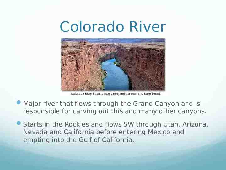
Colorado River Major river that flows through the Grand Canyon and is responsible for carving out this and many other canyons. Starts in the Rockies and flows SW through Utah, Arizona, Nevada and California before entering Mexico and empting into the Gulf of California.
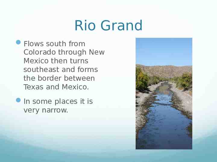
Rio Grand Flows south from Colorado through New Mexico then turns southeast and forms the border between Texas and Mexico. In some places it is very narrow.
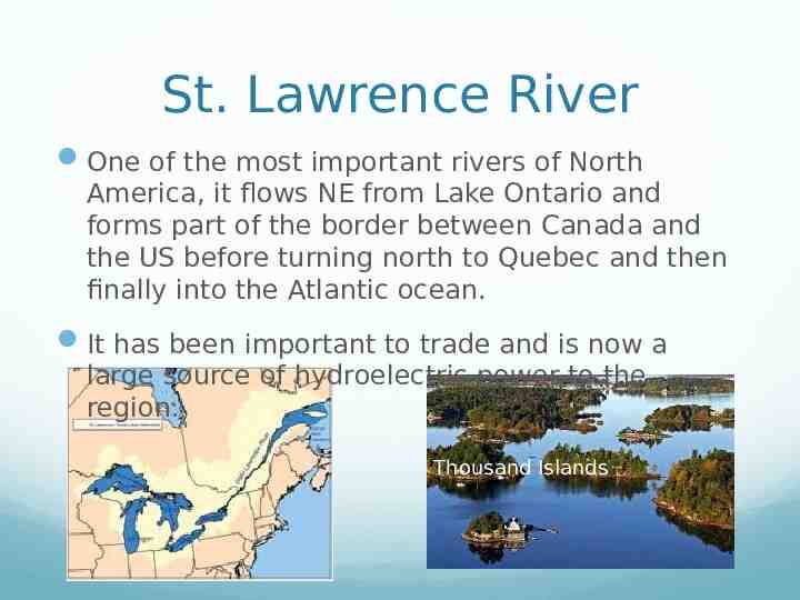
St. Lawrence River One of the most important rivers of North America, it flows NE from Lake Ontario and forms part of the border between Canada and the US before turning north to Quebec and then finally into the Atlantic ocean. It has been important to trade and is now a large source of hydroelectric power to the region. Thousand Islands
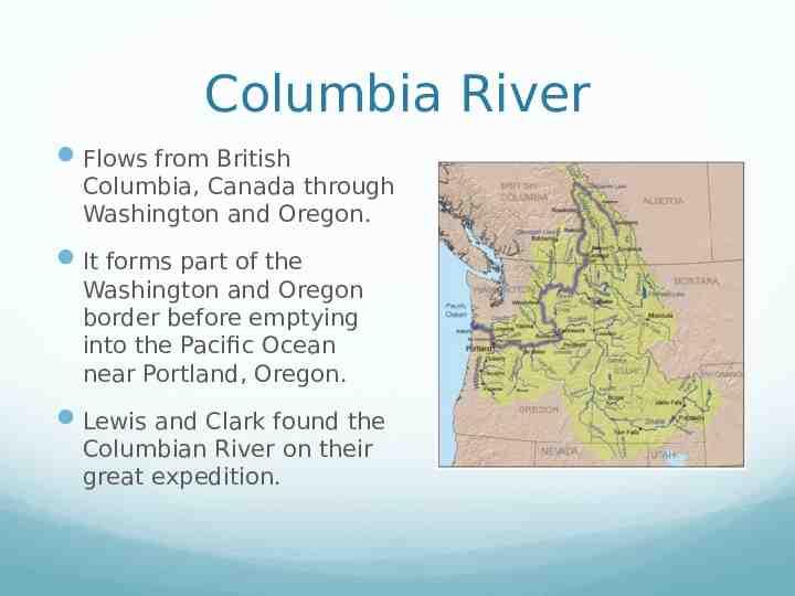
Columbia River Flows from British Columbia, Canada through Washington and Oregon. It forms part of the Washington and Oregon border before emptying into the Pacific Ocean near Portland, Oregon. Lewis and Clark found the Columbian River on their great expedition.