Introduction to GIS Joy Suh Geospatial Resources Librarian Data
32 Slides7.08 MB
Introduction to GIS Joy Suh Geospatial Resources Librarian Data Services Group GMU Libraries Fall 2016
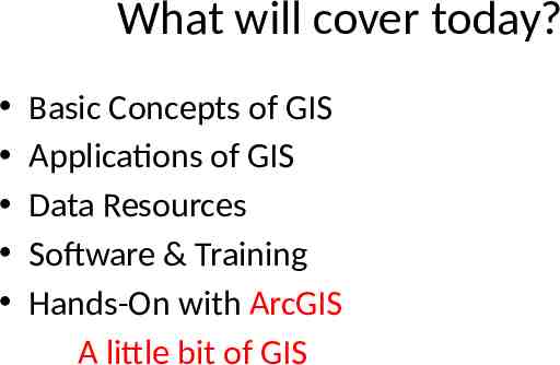
What will cover today? Basic Concepts of GIS Applications of GIS Data Resources Software & Training Hands-On with ArcGIS A little bit of GIS
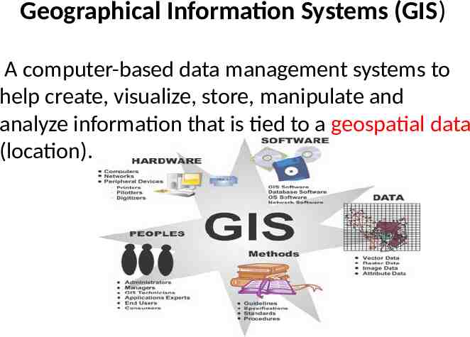
Geographical Information Systems (GIS) A computer-based data management systems to help create, visualize, store, manipulate and analyze information that is tied to a geospatial data (location).
Geospatial Data “Information that identifies the location of geographic features and characteristics of natural or man-made objects on the earth” So called “geographically reference data” or longitude and latitude (XY), or spatial data
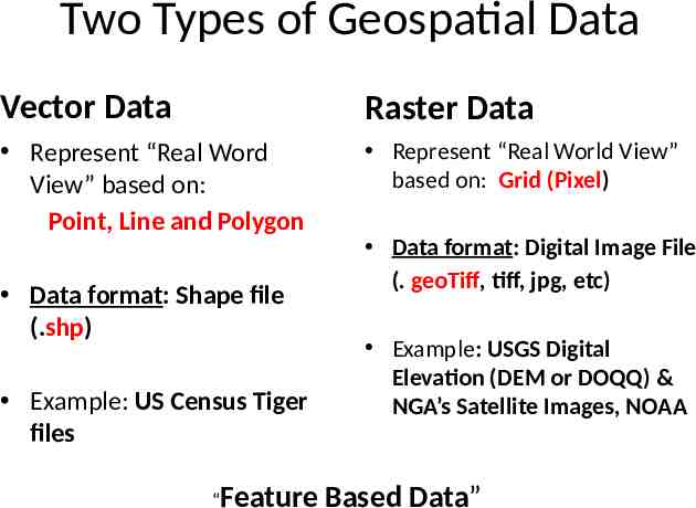
Two Types of Geospatial Data Vector Data Raster Data Represent “Real Word View” based on: Point, Line and Polygon Represent “Real World View” based on: Grid (Pixel) Data format: Shape file (.shp) Example: US Census Tiger files “Feature Data format: Digital Image File (. geoTiff, tiff, jpg, etc) Example: USGS Digital Elevation (DEM or DOQQ) & NGA’s Satellite Images, NOAA Based Data”
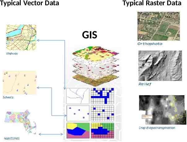
Typical Vector Data Typical Raster Data GIS
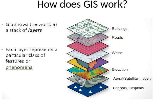
How does GIS work?
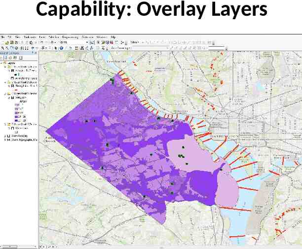
Capability: Overlay Layers
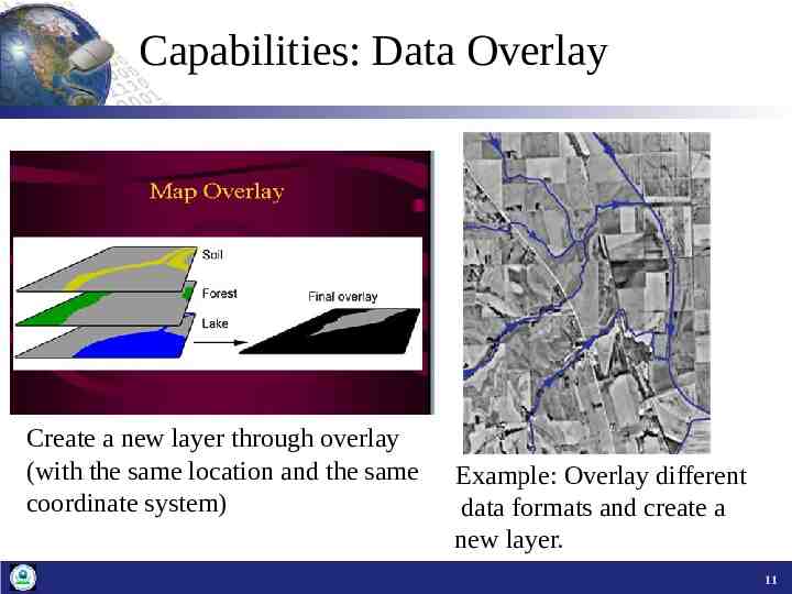
Capabilities: Data Overlay Create a new layer through overlay (with the same location and the same coordinate system) Example: Overlay different data formats and create a new layer. 11
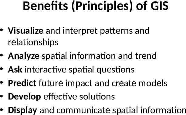
Benefits (Principles) of GIS Visualize and interpret patterns and relationships Analyze spatial information and trend Ask interactive spatial questions Predict future impact and create models Develop effective solutions Display and communicate spatial information
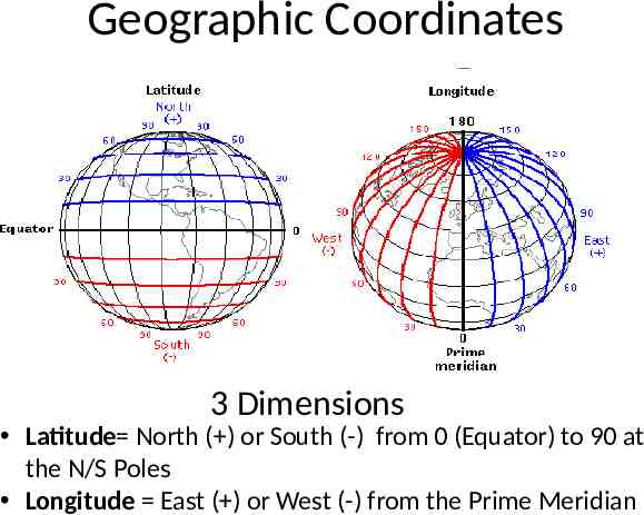
Geographic Coordinates 3 Dimensions Latitude North ( ) or South (-) from 0 (Equator) to 90 at the N/S Poles Longitude East ( ) or West (-) from the Prime Meridian
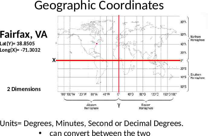
Geographic Coordinates Fairfax, VA Lat(Y) 38.8505 Long(X) -71.3032 X 2 Dimensions Units Degrees, Minutes, Second or Decimal Degrees. can convert between the two
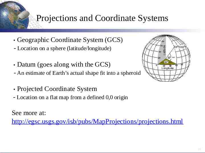
Projections and Coordinate Systems Geographic Coordinate System (GCS) - Location on a sphere (latitude/longitude) Datum (goes along with the GCS) - An estimate of Earth’s actual shape fit into a spheroid Projected Coordinate System - Location on a flat map from a defined 0,0 origin See more at: http://egsc.usgs.gov/isb/pubs/MapProjections/projections.html - 10
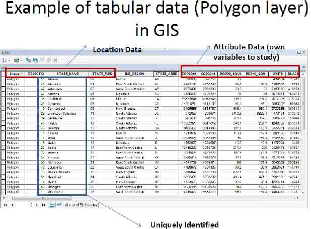
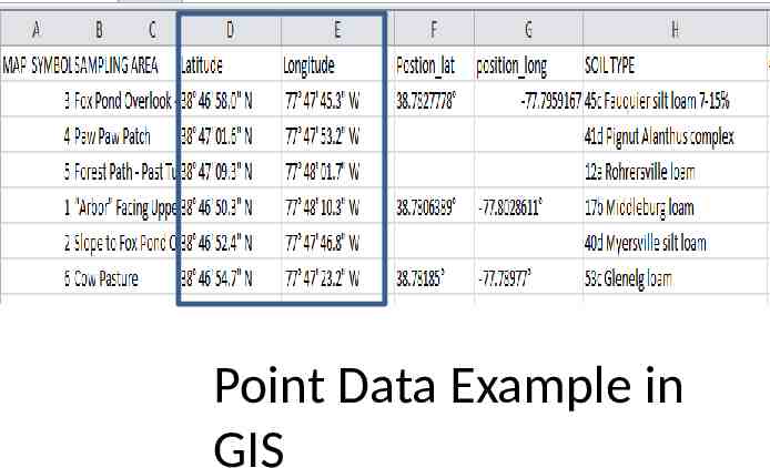
Organization of Data A Geography (Location) as unit of observation: Geographical Unit as Row, Attributes as column) —see spreadsheet examples
Point Data Example in GIS
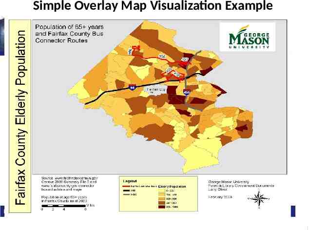
Simple Overlay Map Visualization Example 1
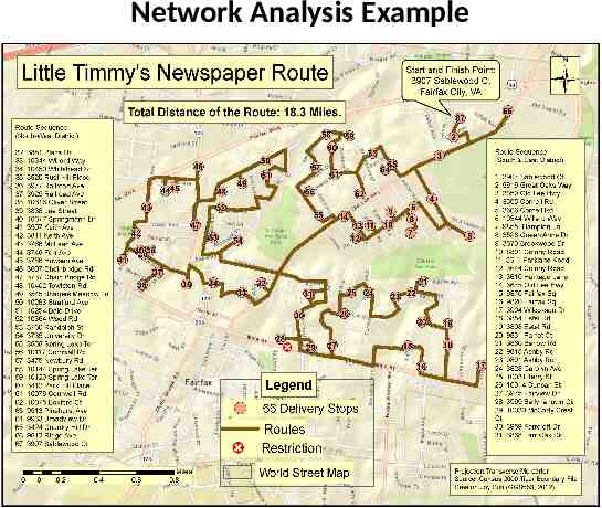
Network Analysis Example
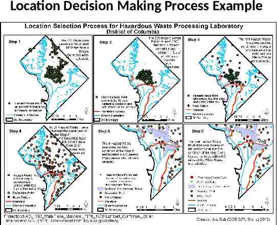
Location Decision Making Process Example
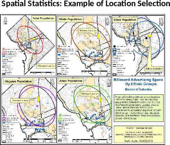
Spatial Statistics: Example of Location Selection
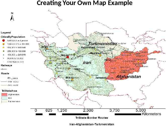
Creating Your Own Map Example
1
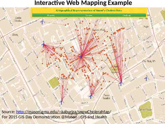
Interactive Web Mapping Example Source: http://mason.gmu.edu/ aaburiza/snowCholeraMap/ For 2015 GIS Day Demonstration @Mason : GIS and Health
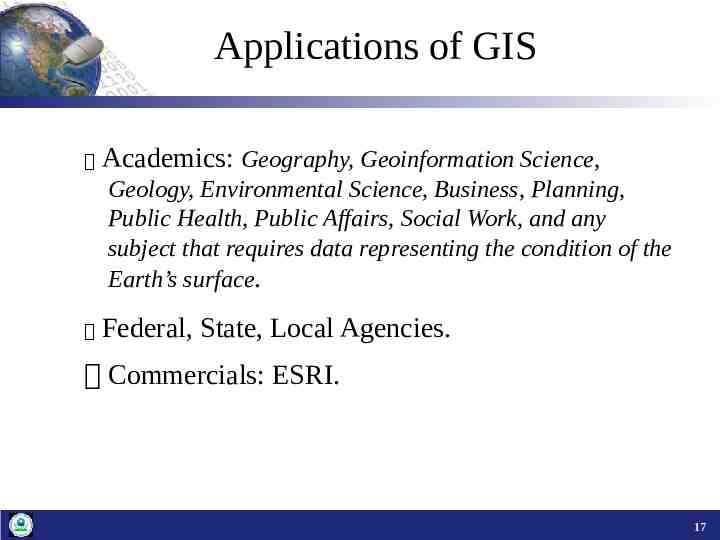
Applications of GIS Academics: Geography, Geoinformation Science, Geology, Environmental Science, Business, Planning, Public Health, Public Affairs, Social Work, and any subject that requires data representing the condition of the Earth’s surface. Federal, State, Local Agencies. Commercials: ESRI. 17
Applications of GIS www.esri.com (go to: industries) S earch GIS literature—Subject Based Database)
Brainstorm Your Map with Data Map Outcome: static vs interactive, share with public, etc. Geography (Census Hierarchies, i.e) and Data Types (Point, Polygon, Raster (image), i.e) Any similar project(s) to use as a reference 5
Sources of GIS Data Ready-made data from government agencies (Census, USGS, NGA, Forest, Agriculture, EPA): streets, aerial photos, satellite images, etc. Commercial (ESRI, Geolytics) Create your own (GPS, Field sampling, digitization from scanned maps or photos) 19
Find Geospatial Data? Go to: Library Infoguides—Geospatial Data & GIS http://infoguides.gmu.edu/geospatial/ data 19
GIS Software & Training Desktop—ArcGIS 10.3, QGIS (Open Source) Online: ArcGIS Online (AGOL), CartoDB, See more: infoguides.gmu.edu/geospatial/software Training: Data Services/GIS Workshops.
Hands-on Session ArcGIS 10.x— Be familiar with Tool Bars (ArcMap, Arc Catalog, Arc Tool Box) Do “ArcGIS Basic Exercise” (from the GIS Tutorial page) 19
Contact & URLs Joy Suh: [email protected] Bhavika Tekwani: [email protected] infogudies.gmu.edu/geospatial 19