Real-time integration of remote sensing, surface meteorology, and


37 Slides5.22 MB
Real-time integration of remote sensing, surface meteorology, and ecological models
Goals Provide Nowcast/Forecasts of water and carbon cycle variables for the conterminous United States with the Terrestrial Observation and Prediction System (TOPS)
Need for integration Integration of remote sensing, surface meteorology, and ecological models provides the best opportunity for comprehensive assessment of the state and activity of landscape processes Disciplines are traditionally separate but can be highly complementary
Remote sensing alone Useful for describing short- and longterm variation in terrestrial vegetation – Photosynthetic activity, leaf area index, absorbed radiation – Phenological development – Land use and land cover changes Less useful for detecting plant stress and hydrologic cycles
Surface meteorology alone . Provides critical information needed to describe land-atmosphere interactions Inadequate for assessment of landscape processes
Prognostic ecological models Simulate past and future climate scenarios Mass-balance simulations of carbon, water, and nutrient cycles Often do not ingest vegetation observations Thus less useful for real-time management applications
What we need A non-prognostic ecological model ingesting real-time satellite and surface meteorology observations
TOPS Overview 1 kilometer spatial resolution Remotely-sensed leaf area index (LAI) Rapid Update Cycle meteorology (RUC) Land surface model (LSM)
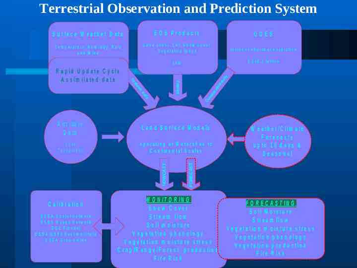
Terrestrial Observation and Prediction System E O S P ro d u c ts GOES T e m p e r a t u r e , H u m id it y , R a in a n d W in d L a n d c o v e r . L A I, S n o w c o v e r , V e g e ta tio n In d e x In c id e n t s h o r tw a v e r a d ia t io n O v e r 3 0 0 0 s t a t io n s f o r th e U .S 1km 0 .5 x 0 .5 la t/lo n Do wn sc al ed ily da Weekly d de id Gr R a p id U p d a te C y c le A s s im ila te d d a ta da i ly S u rfa c e W e a th e r D a ta S o il s T o p o g ra p h y o p e ra tin g a t W a te r s h e d to C o n t in e n ta l S c a le s C a lib r a tio n U S D A S n o te l N e tw o rk U S G S G u a g e N e tw o rk D O E F lu x n e t U S D A /U S F S F u e l m o is tu re U S D A C r o p y ie ld s W e a th e r /C lim a te F o re c a s ts u p to 1 0 d a y s & Seasonal FORECAST L a n d S u r fa c e M o d e ls NOWCAST A n c i ll a r y D a ta M O N IT O R IN G Snow Cover S tr e a m flo w S o il m o is tu r e V e g e ta tio n p h e n o lo g y V e g e ta tio n m o is tu r e s tr e s s C r o p /R a n g e /F o r e s t p r o d u c tio n F ir e R is k F O R E C A S T IN G S o il M o is tu r e S tr e a m flo w V e g e ta tio n m o is tu r e s tr e s s V e g e ta tio n p h e n o lo g y V e g e ta tio n p r o d u c tio n F ir e R is k
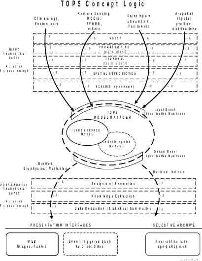
T O P S C o n c e p t L o g ic IN P U T TRANSFO RM G ATES C lim a to lo g y , E n v io n . v a rs R e m o te S e n s in g M O D IS , AVHRR, o th e rs -- A -- A -- A -- P -- A A :: a c tio n P :: p a s s -th ro u g h -- A -- A A - s p a t ia l in p u ts : p ro file s , d is tr ib u tio n s P o in t In p u t s s tr e a m flo w , flu x to w e r s IN G E S T F O R M A L F IL T E R S . { w g r ib , o th e r s } -- A -- A -- P -- A -- P TEM PO RAL {h o u rly - to -d a ily } -- A -- A S P A T IA L R E P R O J E C T IO N -- P -- A S C A L IN G { u p o r d o w n } TO PS M O DEL M ANAG ER -- P -- P -- P -- P In p u t M o d e l S p e c ific a tio n M e m b r a n e LAND SURFACE M O DEL .o th e r in te g ra te d m o d e ls . O u tp u t M o d e l S p e c ific a tio n M e m b r a n e D e r iv e d B io p h y s ic a l V a ria b le s D e r iv e d In d ic e s -- A P O S T -P R O C E S S TRANSFO RM G ATES A :: a c tio n P :: p a s s -th ro u g h A n a ly s is o f A n o m o lie s -- P -- A K n o w le d g e E x tr a c tio n -- A -- P D a ta R e d u c tio n / S ta tis tic a l S u m m a r ie s -- A P R E S E N T A T IO N IN T E R F A C E S W EB Im a g e s , T a b le s E v e n t-T rig g e re d p u s h to C lie n t S ite s S E L E C T IV E A R C H IV E N e a r-o n lin e ta p e , a g e -p o lic y d is k 2 2 J u n e 2 0 0 0 , jm g
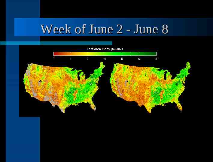
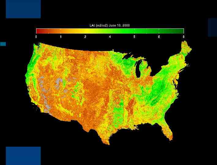
Remotely-sensed LAI Currently: Advanced Very High Resolution Radiometer (AVHRR) Future: Moderate Resolution Imaging Spectroradiometer (MODIS) Algorithm – Main: MODIS backup – Cloud contamination: historical averages
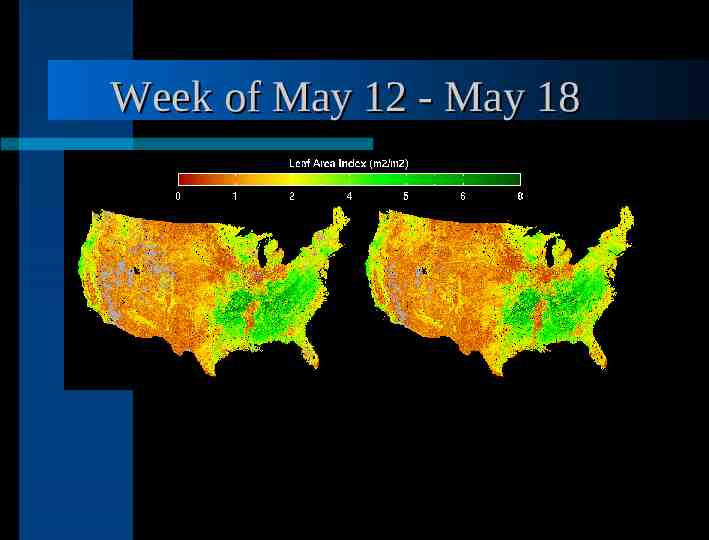
Week of May 12 - May 18
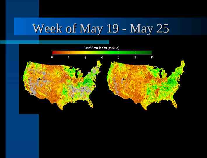
Week of May 19 - May 25
Week of May 26 - June 1
Week of June 2 - June 8
Week of June 9 - June 15
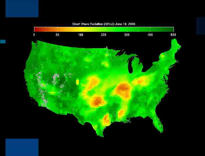
RUC-2 Produced by the National Centers for Environmental Prediction Hourly outputs 20 kilometer resolution Automated scripts gather data and process hourly values to daily values Future developments will include downscaling algorithms
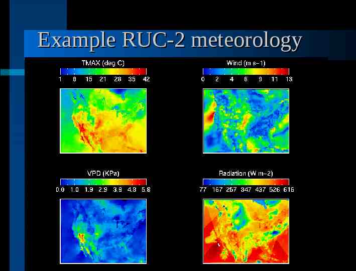
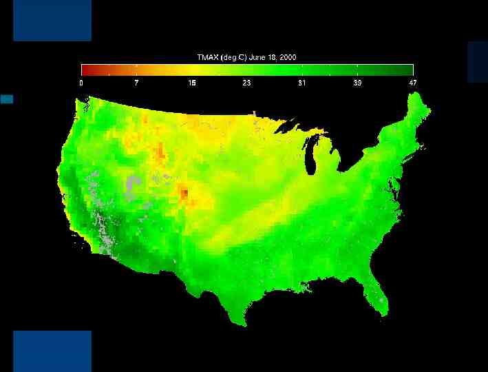
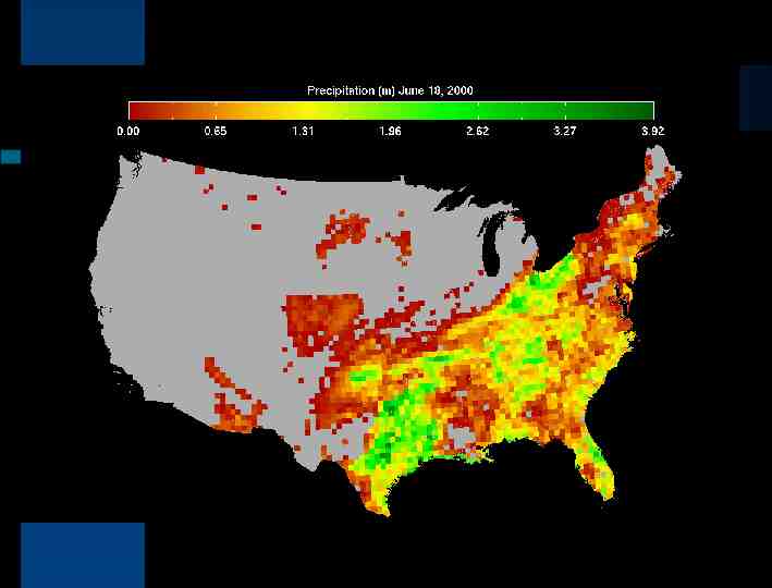
Example RUC-2 meteorology
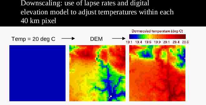
Downscaling: use of lapse rates and digital elevation model to adjust temperatures within each 40 km pixel Temp 20 deg C DEM
Ecological model Based on BIOME-BGC No complete carbon balance Forced with observed LAI
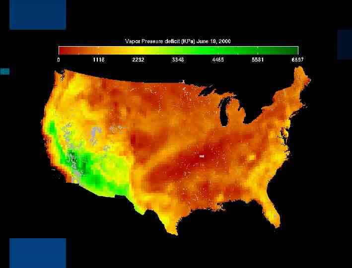
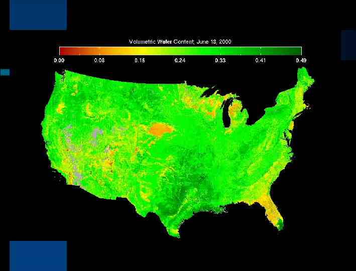
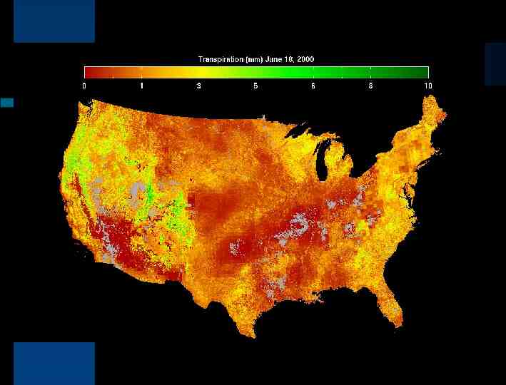
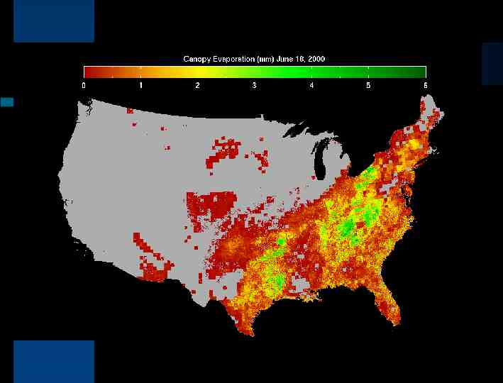
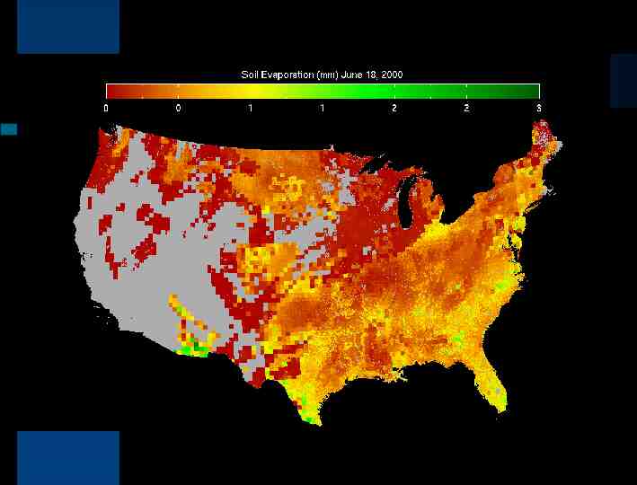
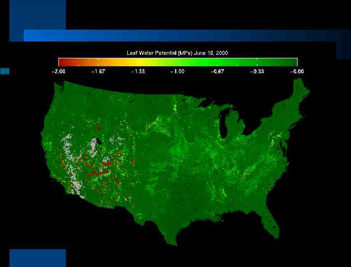
Results Beta version June 18
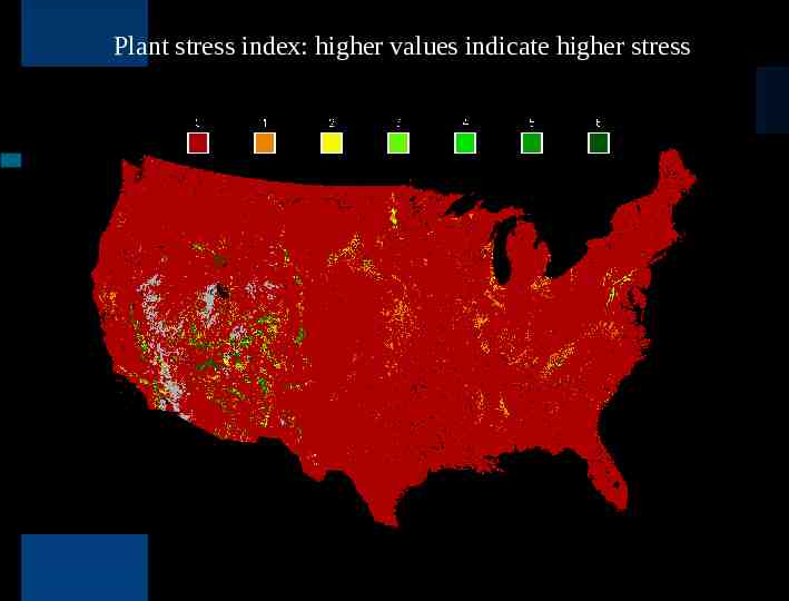
Plant stress index: higher values indicate higher stress
Planned transformed variables Accumulated stress/fire danger – incorporate lightning strike information Anomalies/departures from normal Water deficit/irrigation requirements
Forecasts Six-month goal: incorporate Forecast Systems Laboratory (FSL) short- to medium-term forecasts – seven-day forecasts – one to three month climatological forecasts One year goal: Ingest long-lead forecasts from ECPC/NCEP.
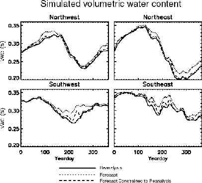
Real-time and forecast modes Must be run simultaneously – unconstrained use of forecast data leads to catastrophic errors in hydrologic cycles – important for regional scale climate models to accurately parameterize the land surface, especially in the Southwest
Conclusions Real-time management needs can be addressed with an approach integrating remote sensing, surface meteorology, and ecological modeling TOPS will provide real-time simulations of water and carbon cycles through a web-based interface within two months Within six months we will add forecast simulations constrained by current conditions System is flexible and can be adapted to variable spatial resolutions and inputs