Midterm


37 Slides6.15 MB
Midterm
Midterm Multiple choice on scantron/bring #2 pencil Major concepts moreso than details Reviewing LECTURES is key PPT files background & extra in Chapters 1, 3-4, 9, 20 in Longley et al. Will not include Web Sites of the Week (WSWs) Labs Learning Assessment/Practice Questions on class web site
GIS Data Capture: Getting the Map into the Computer Chapter 9, Longley et al.
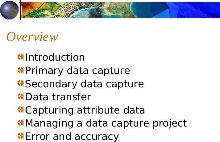
Overview Introduction Primary data capture Secondary data capture Data transfer Capturing attribute data Managing a data capture project Error and accuracy
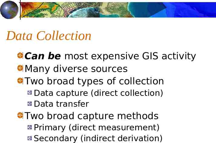
Data Collection Can be most expensive GIS activity Many diverse sources Two broad types of collection Data capture (direct collection) Data transfer Two broad capture methods Primary (direct measurement) Secondary (indirect derivation)
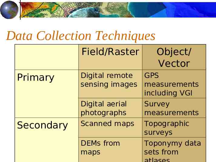
Data Collection Techniques Field/Raster Primary Secondary Object/ Vector Digital remote GPS sensing images measurements including VGI Digital aerial photographs Survey measurements Scanned maps Topographic surveys DEMs from maps Toponymy data sets from
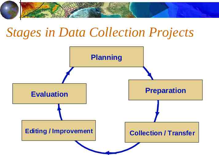
Stages in Data Collection Projects Planning Evaluation Editing / Improvement Preparation Collection / Transfer
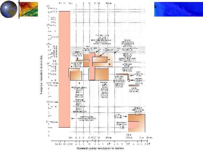
Primary Data Capture Capture specifically for GIS use Raster – remote sensing e.g., SPOT and IKONOS satellites and aerial photography, echosounding at sea Passive and active sensors Resolution is key consideration Spatial Spectral, Acoustic Temporal
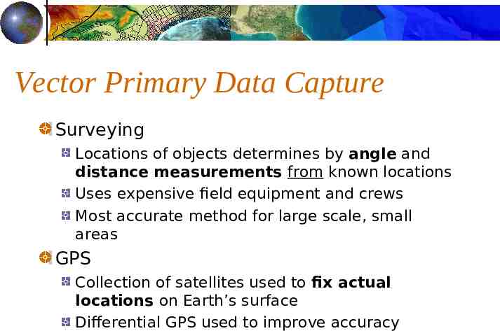
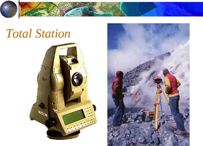
Vector Primary Data Capture Surveying Locations of objects determines by angle and distance measurements from known locations Uses expensive field equipment and crews Most accurate method for large scale, small areas GPS Collection of satellites used to fix actual locations on Earth’s surface Differential GPS used to improve accuracy
Total Station
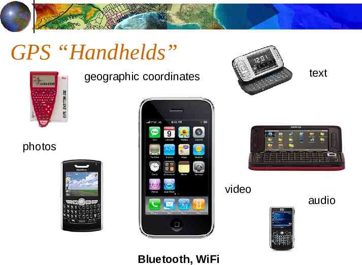
GPS “Handhelds” text geographic coordinates photos video Bluetooth, WiFi audio
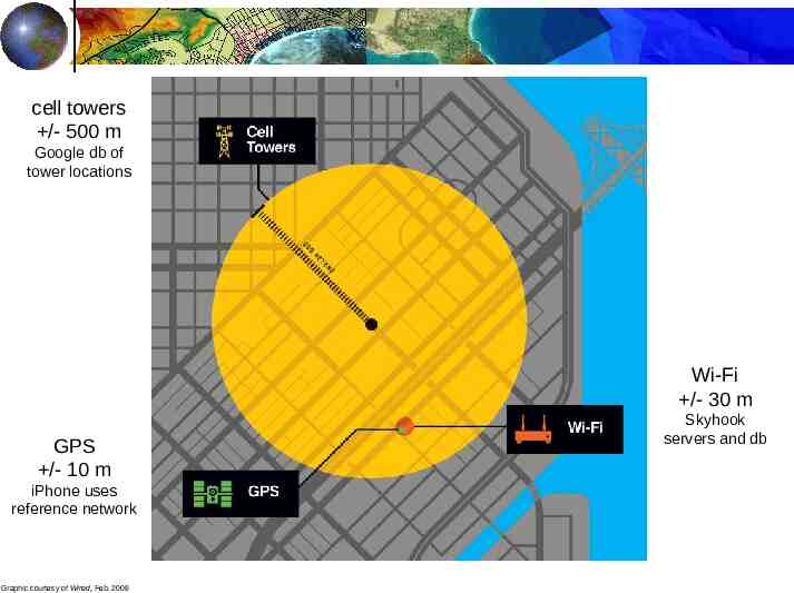
cell towers /- 500 m Google db of tower locations Wi-Fi /- 30 m GPS /- 10 m iPhone uses reference network Graphic courtesy of Wired, Feb. 2009 Skyhook servers and db
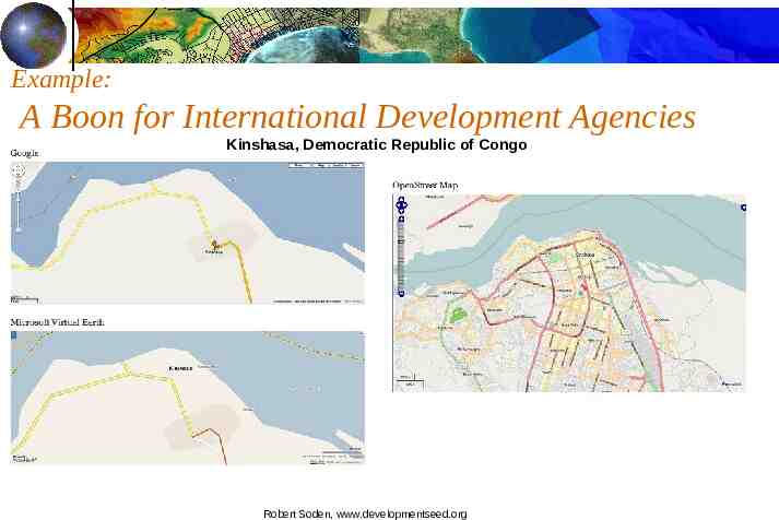
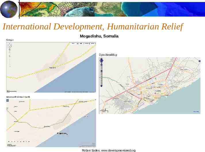
“Power to the People:”VGI & PPGIS “Volunteered Geographic Information” Wikimapia.org Openstreetmap.org Aka “crowdsourcing” “Public Participation GIS” GEO 599, Fall 2007 Papers still online at dusk.geo.orst.edu/virtual/
Example: A Boon for International Development Agencies Kinshasa, Democratic Republic of Congo Robert Soden, www.developmentseed.org
International Development, Humanitarian Relief Mogadishu, Somalia Robert Soden, www.developmentseed.org
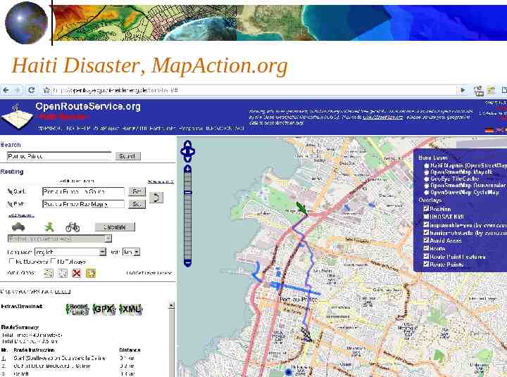
Haiti Disaster, MapAction.org
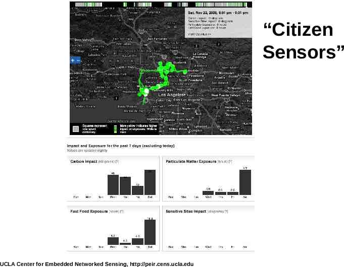
“Citizen Sensors” UCLA Center for Embedded Networked Sensing, http://peir.cens.ucla.edu
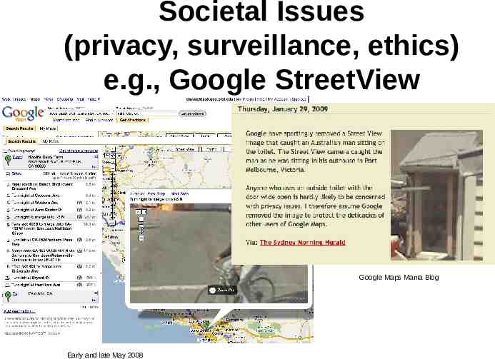
Societal Issues (privacy, surveillance, ethics) e.g., Google StreetView Google Maps Mania Blog Early and late May 2008
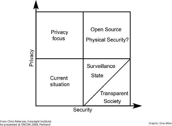
More surveillance (electronic, video, biological, chemical) integrated into national system From Chris Peterson, Foresight Institute As presented at OSCON 2008, Portland
From Chris Peterson, Foresight Institute As presented at OSCON 2008, Portland Graphic: Gina Miller
Sewer monitoring has begun “The test doesn’t screen people directly but instead seeks out evidence of illicit drug abuse in drug residues and metabolites excreted in urine and flushed toward municipal sewage treatment plants.” From Chris Peterson, Foresight Institute As presented at OSCON 2008, Portland
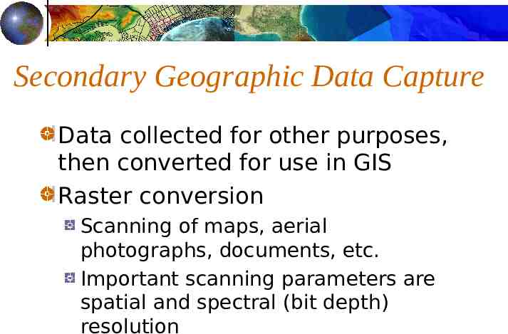
Secondary Geographic Data Capture Data collected for other purposes, then converted for use in GIS Raster conversion Scanning of maps, aerial photographs, documents, etc. Important scanning parameters are spatial and spectral (bit depth) resolution
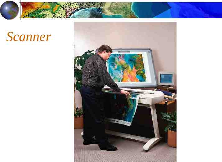
Scanner
Vector Secondary Data Capture Collection of vector objects from maps, photographs, plans, etc. Photogrammetry – the science and technology of making measurements from photographs, etc. Digitizing Manual (table) Heads-up and vectorization
Digitizer
GEOCODING spatial information --- digital form capturing the map (digitizing, scanning) sometimes also capturing the attributes “mapematical” calculation, e.g., address matching WSW
The Role of Error Map and attribute data errors are the data producer's responsibility, GIS user must understand error. Accuracy and precision of map and attribute data in a GIS affect all other operations, especially when maps are compared across scales.
Accuracy closeness to TRUE values results, computations, or estimates compromise on “infinite complexity” generalization of the real world difficult to identify a TRUE value e.g., accuracy of a contour Does not exist in real world Compare to other sources
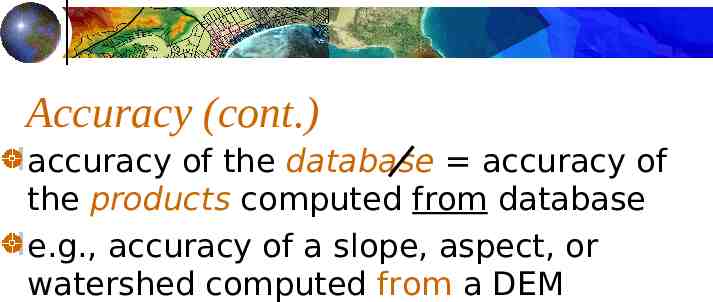
Accuracy (cont.) accuracy of the database accuracy of the products computed from database e.g., accuracy of a slope, aspect, or watershed computed from a DEM
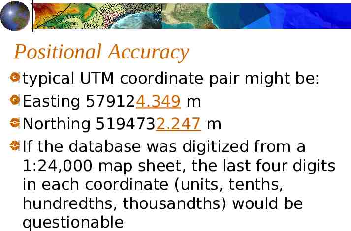
Positional Accuracy typical UTM coordinate pair might be: Easting 579124.349 m Northing 5194732.247 m If the database was digitized from a 1:24,000 map sheet, the last four digits in each coordinate (units, tenths, hundredths, thousandths) would be questionable
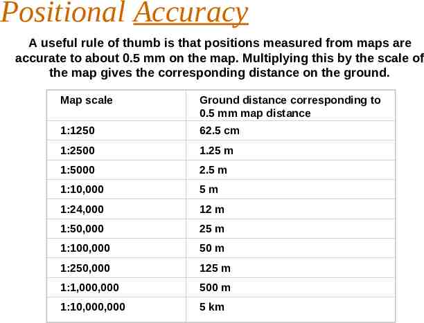
Positional Accuracy A useful rule of thumb is that positions measured from maps are accurate to about 0.5 mm on the map. Multiplying this by the scale of the map gives the corresponding distance on the ground. Map scale Ground distance corresponding to 0.5 mm map distance 1:1250 62.5 cm 1:2500 1.25 m 1:5000 2.5 m 1:10,000 5m 1:24,000 12 m 1:50,000 25 m 1:100,000 50 m 1:250,000 125 m 1:1,000,000 500 m 1:10,000,000 5 km
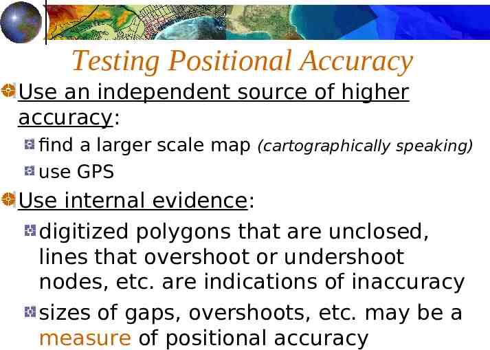
Testing Positional Accuracy Use an independent source of higher accuracy: find a larger scale map (cartographically speaking) use GPS Use internal evidence: digitized polygons that are unclosed, lines that overshoot or undershoot nodes, etc. are indications of inaccuracy sizes of gaps, overshoots, etc. may be a measure of positional accuracy
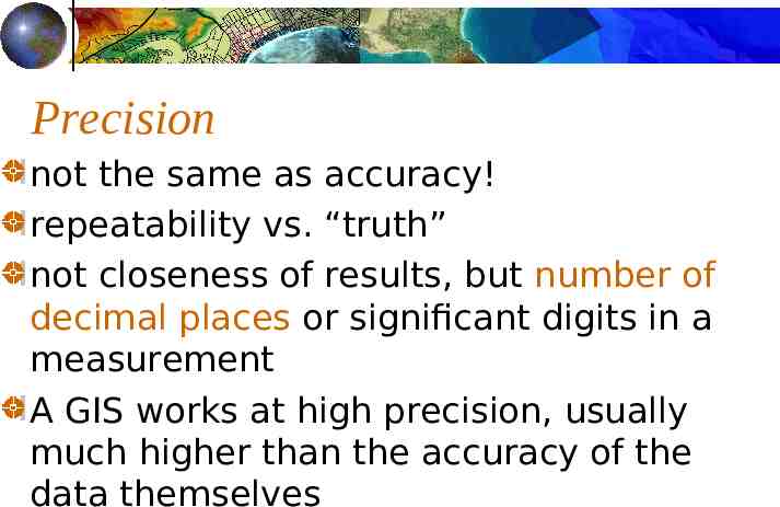
Precision not the same as accuracy! repeatability vs. “truth” not closeness of results, but number of decimal places or significant digits in a measurement A GIS works at high precision, usually much higher than the accuracy of the data themselves
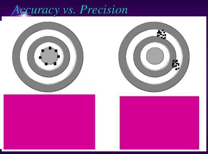
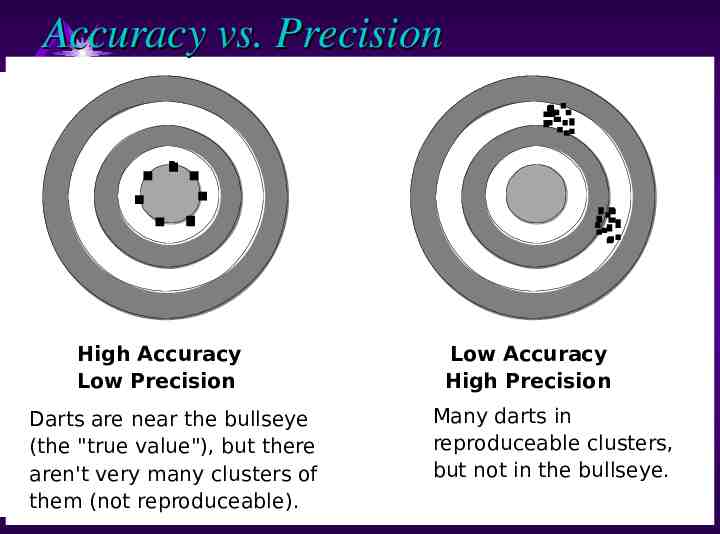
Accuracy vs. Precision High Accuracy Low Precision Darts are near the bullseye (the "true value"), but there aren't very many clusters of them (not reproduceable). Low Accuracy High Precision Many darts in reproduceable clusters, but not in the bullseye.
Accuracy vs. Precision High Accuracy Low Precision Darts are near the bullseye (the "true value"), but there aren't very many clusters of them (not reproduceable). Low Accuracy High Precision Many darts in reproduceable clusters, but not in the bullseye.
Components of Data Quality positional accuracy attribute accuracy logical consistency completeness lineage