Geocoding and Georeferencing Scott Bell GIS Institute

20 Slides636.50 KB
Geocoding and Georeferencing Scott Bell GIS Institute
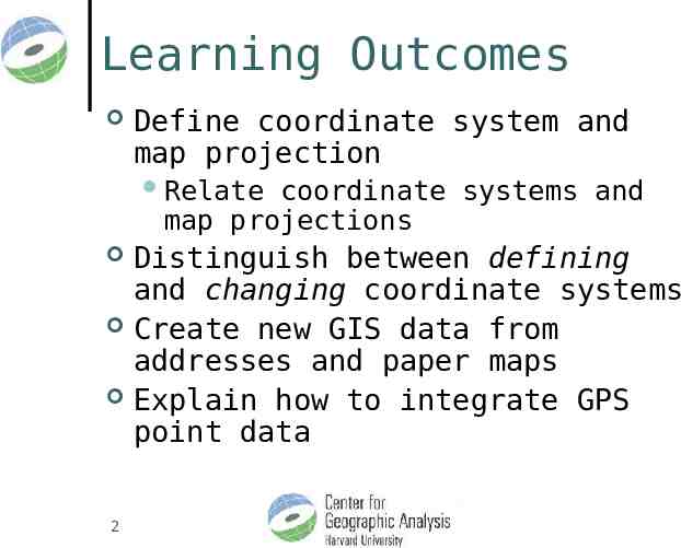
Learning Outcomes Define coordinate system and map projection Relate coordinate systems and map projections Distinguish between defining and changing coordinate systems Create new GIS data from addresses and paper maps Explain how to integrate GPS point data 2
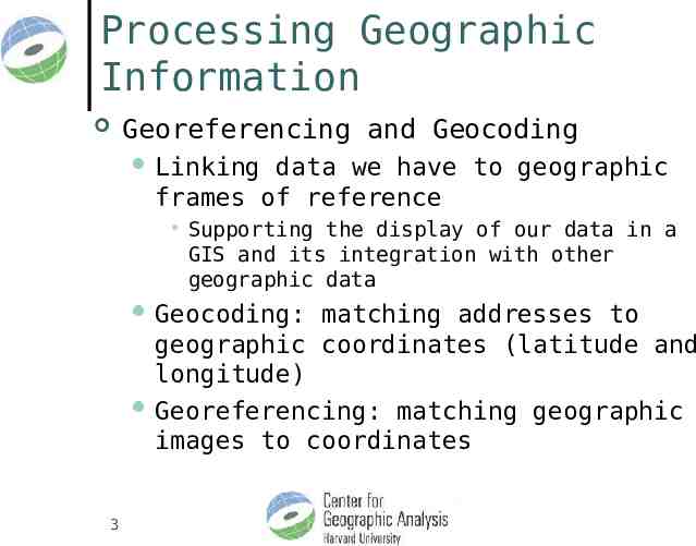
Processing Geographic Information Georeferencing and Geocoding Linking data we have to geographic frames of reference Supporting the display of our data in a GIS and its integration with other geographic data Geocoding: matching addresses to geographic coordinates (latitude and longitude) Georeferencing: matching geographic images to coordinates 3
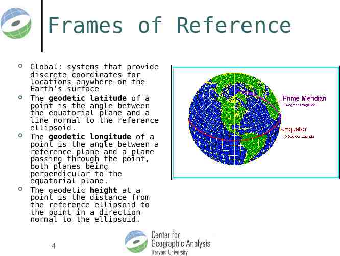
Frames of Reference Global: systems that provide discrete coordinates for locations anywhere on the Earth’s surface The geodetic latitude of a point is the angle between the equatorial plane and a line normal to the reference ellipsoid. The geodetic longitude of a point is the angle between a reference plane and a plane passing through the point, both planes being perpendicular to the equatorial plane. The geodetic height at a point is the distance from the reference ellipsoid to the point in a direction normal to the ellipsoid. 4
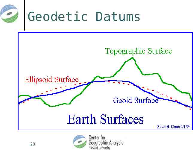
Frames of Reference Global Frames of reference are applied to a model of the Earth (size and shape) Earth’s actual shape is too complicated Spheroidal and Ellipsoidal models are used Any single model of the Earth’s size and shape is called a geodetic datum 5
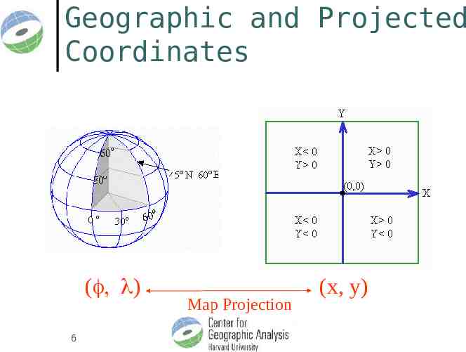
Geographic and Projected Coordinates ( ) 6 Map Projection (x, y)
Coordinate Systems in ArcGIS Latitude and Longitude (3-D object surface, locations indicated in degrees) Projected (2 D and Planar, X, Y in distances) All GIS data is stored according to a coordinate system Sometimes the information about the coordinate system DOESN’T come with the data (but the underlying information is still stored with respect to one) In these situations we need to define or specify the coordinate system (“define” command) Sometimes we want to change the data from one coordinate system to another In these situations need to transform or project the data from one coordinate system to another (“project” command) 7
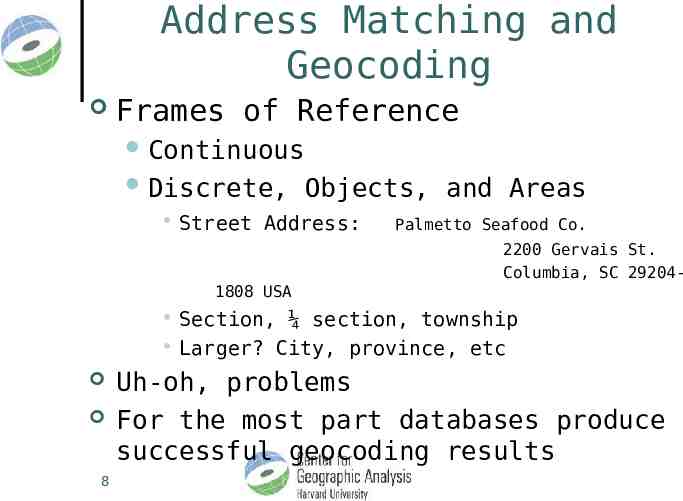
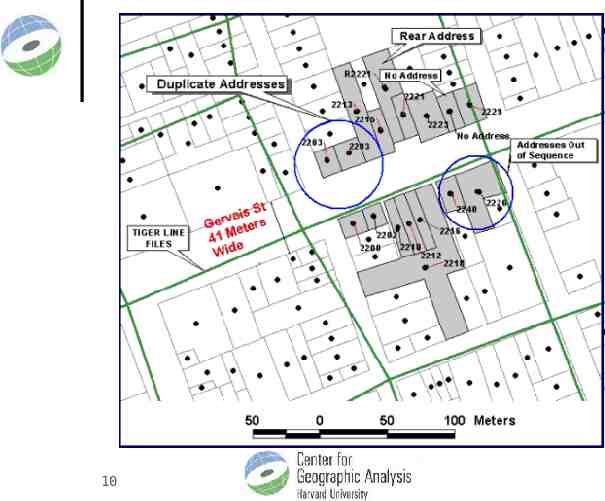
Address Matching and Geocoding Frames of Reference Continuous Discrete, Objects, and Areas Street Address: Palmetto Seafood Co. 2200 Gervais St. Columbia, SC 29204- 1808 USA Section, ¼ section, township Larger? City, province, etc 8 Uh-oh, problems For the most part databases produce successful geocoding results
9
10
11 S4, Brown University
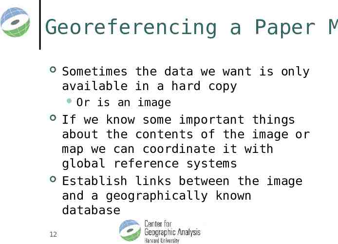
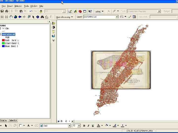
Georeferencing a Paper M Sometimes the data we want is only available in a hard copy Or 12 is an image If we know some important things about the contents of the image or map we can coordinate it with global reference systems Establish links between the image and a geographically known database
13 S4, Brown University
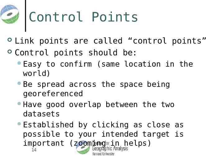
Control Points Link points are called “control points” Control points should be: Easy to confirm (same location in the world) Be spread across the space being georeferenced Have good overlap between the two datasets Established by clicking as close as possible to your intended target is important (zooming in helps) 14
Frames of Reference Global Frames of reference are applied to a model of the Earth (size and shape) Earth’s actual shape is too complicated Spheroidal and Ellipsoidal models are used Any single model of the Earth’s size and shape is called a geodetic datum 15
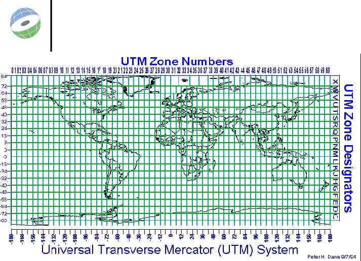
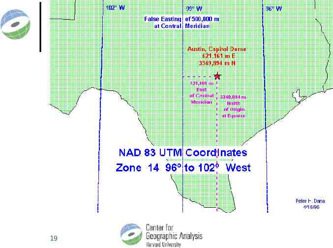
Universal Transverse Mercator Locations indicated in meters (from a pair of origins) Lat/Long locations in degrees make it difficult to derive distances between places or make measurements in non-spherical coordinates Most of us intuitively understand meters, kilometers, etc. for distance and area better than degrees, minutes, and seconds 16
UTM However This apparent simplicity comes at the cost of a complex frame of reference and multiple origins 17 S4, Brown University
18 S4, Brown University
19
Geodetic Datums 20