Around the Ring of Fire Locating Plate Boundaries of the Pacific Rim
7 Slides1.08 MB
Around the Ring of Fire Locating Plate Boundaries of the Pacific Rim
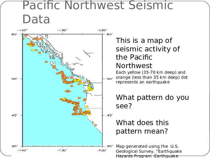
Pacific Northwest Seismic Data This is a map of seismic activity of the Pacific Northwest Each yellow (35-70 km deep) and orange (less than 35 km deep) dot represents an earthquake What pattern do you see? What does this pattern mean? Map generated using the U.S. Geological Survey. “Earthquake Hazards Program :Earthquake
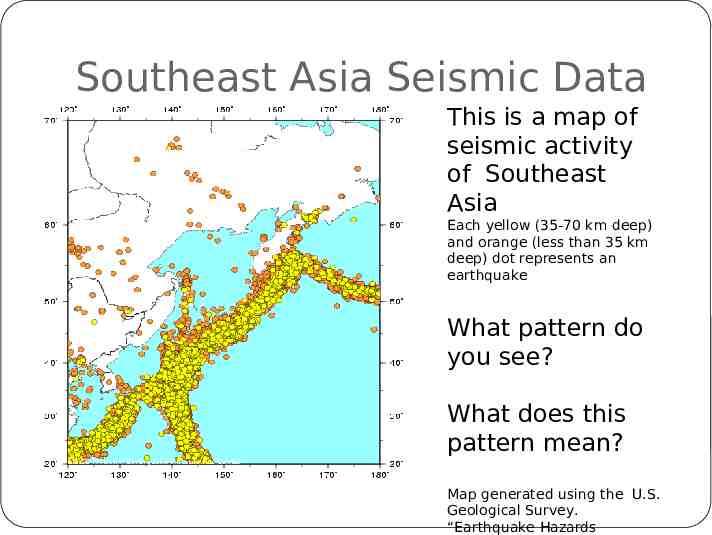
Southeast Asia Seismic Data This is a map of seismic activity of Southeast Asia Each yellow (35-70 km deep) and orange (less than 35 km deep) dot represents an earthquake What pattern do you see? What does this pattern mean? Map generated using the U.S. Geological Survey. “Earthquake Hazards
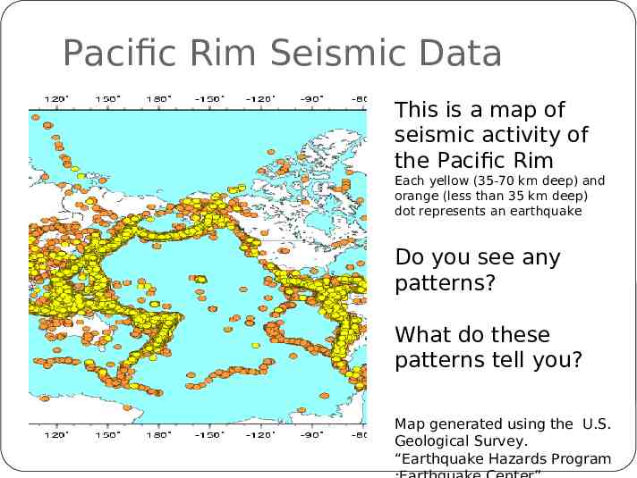
Pacific Rim Seismic Data This is a map of seismic activity of the Pacific Rim Each yellow (35-70 km deep) and orange (less than 35 km deep) dot represents an earthquake Do you see any patterns? What do these patterns tell you? Map generated using the U.S. Geological Survey. “Earthquake Hazards Program
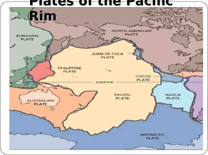
Plates of the Pacific Rim
Analyze your map 1. How many plates underlie of the Pacific Ocean also known as the Ring of Fire? 2. Are all plates the same size? 3. How many plates interact near Washington? 4. How many plates interact near Japan? 5. Explain how earthquakes can be used to infer plate boundaries.
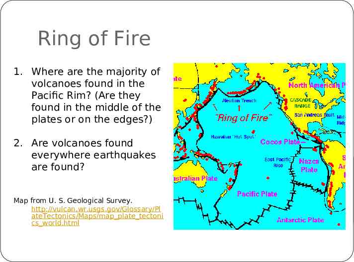
Ring of Fire 1. Where are the majority of volcanoes found in the Pacific Rim? (Are they found in the middle of the plates or on the edges?) 2. Are volcanoes found everywhere earthquakes are found? Map from U. S. Geological Survey. http://vulcan.wr.usgs.gov/Glossary/Pl ateTectonics/Maps/map plate tectoni cs world.html