Sampling data in fieldwork


18 Slides377.07 KB
Sampling data in fieldwork
Getting started You’ll need a notepad on which to make notes as you go along, or you could make notes, paste images, etc. on your device. You can view these slides: as a slide-show for any animations and to follow links in ‘normal’ view if you want to add call-outs or extra slides to make notes, paste images, answer questions. Geographical Association, 2020
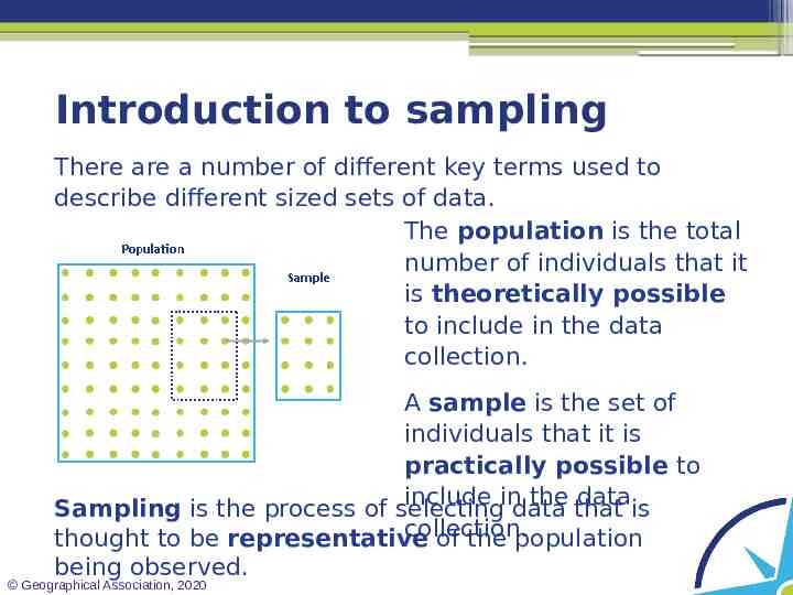
Introduction to sampling There are a number of different key terms used to describe different sized sets of data. The population is the total number of individuals that it is theoretically possible to include in the data collection. A sample is the set of individuals that it is practically possible to include in the data Sampling is the process of selecting data that is collection. thought to be representative of the population being observed. Geographical Association, 2020
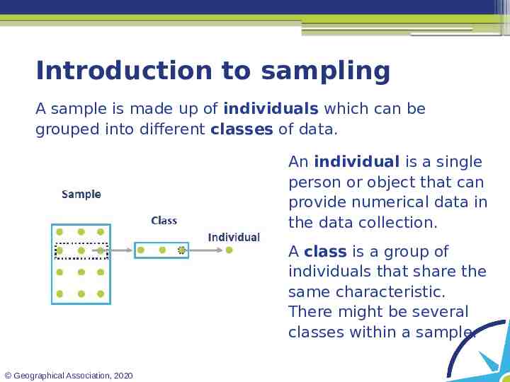
Introduction to sampling A sample is made up of individuals which can be grouped into different classes of data. An individual is a single person or object that can provide numerical data in the data collection. A class is a group of individuals that share the same characteristic. There might be several classes within a sample. Geographical Association, 2020
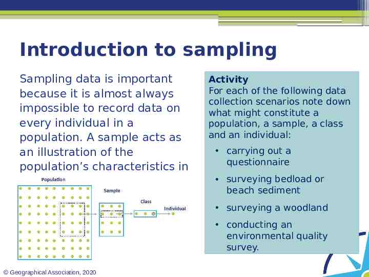
Introduction to sampling Sampling data is important because it is almost always impossible to record data on every individual in a population. A sample acts as an illustration of the population’s characteristics in a more manageable form. Activity For each of the following data collection scenarios note down what might constitute a population, a sample, a class and an individual: carrying out a questionnaire surveying bedload or beach sediment surveying a woodland conducting an environmental quality survey. Geographical Association, 2020
Sample size The number of individuals in a researcher’s data sample is called the sample size – this should be determined by the plans they have for analysing it once it has been collected. In order to carry out certain statistical tests, a minimum number of individuals need to be in a sample. For example, to carry out a Spearman’s Rank Correlation Coefficient test, a sample has to have a minimum of ten pairs of individuals in the sample. If no statistical test is going to be used, it is always best to try to collect as large a sample size as possible. Geographical Association, 2020
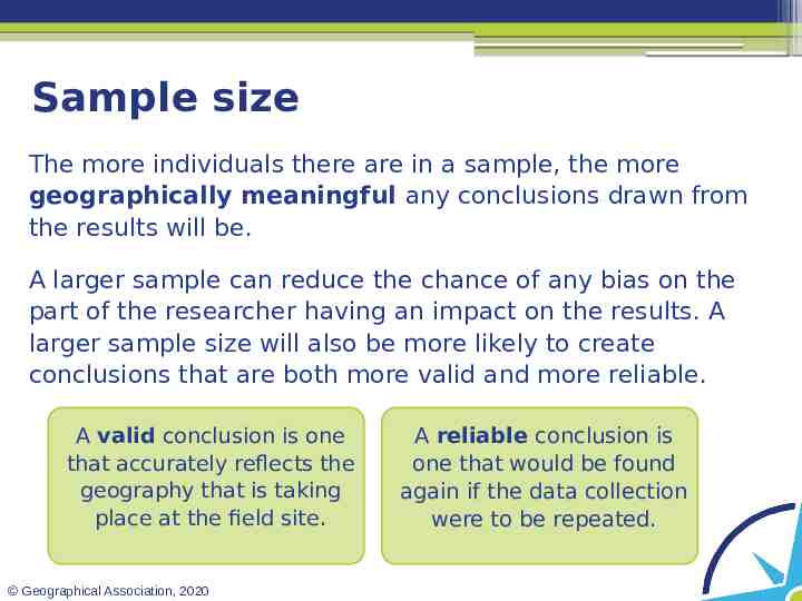
Sample size The more individuals there are in a sample, the more geographically meaningful any conclusions drawn from the results will be. A larger sample can reduce the chance of any bias on the part of the researcher having an impact on the results. A larger sample size will also be more likely to create conclusions that are both more valid and more reliable. A valid conclusion is one that accurately reflects the geography that is taking place at the field site. Geographical Association, 2020 A reliable conclusion is one that would be found again if the data collection were to be repeated.
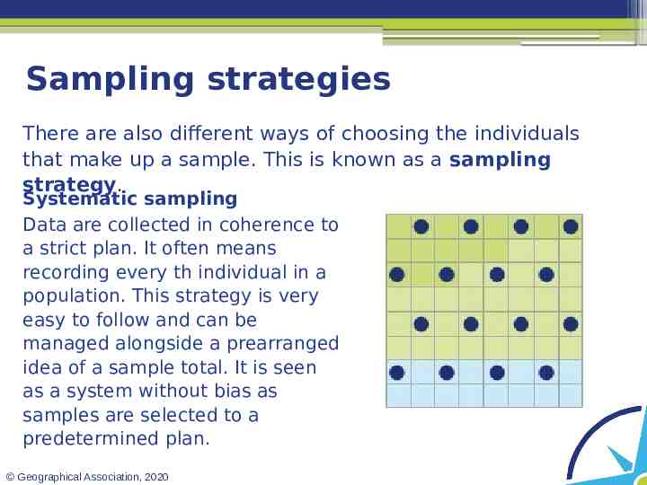
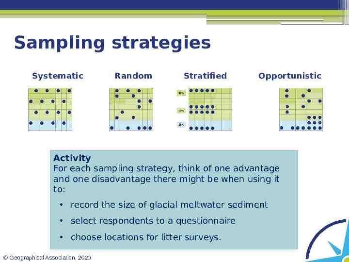
Sampling strategies There are also different ways of choosing the individuals that make up a sample. This is known as a sampling strategy. Systematic sampling Data are collected in coherence to a strict plan. It often means recording every th individual in a population. This strategy is very easy to follow and can be managed alongside a prearranged idea of a sample total. It is seen as a system without bias as samples are selected to a predetermined plan. Geographical Association, 2020
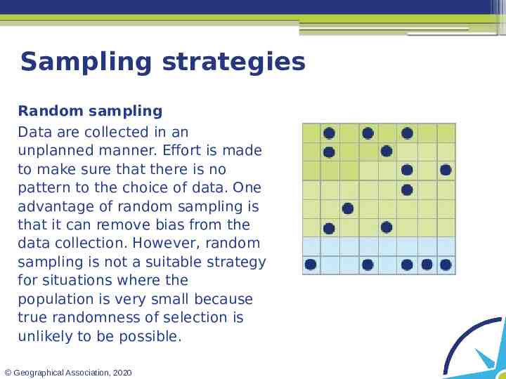
Sampling strategies Random sampling Data are collected in an unplanned manner. Effort is made to make sure that there is no pattern to the choice of data. One advantage of random sampling is that it can remove bias from the data collection. However, random sampling is not a suitable strategy for situations where the population is very small because true randomness of selection is unlikely to be possible. Geographical Association, 2020
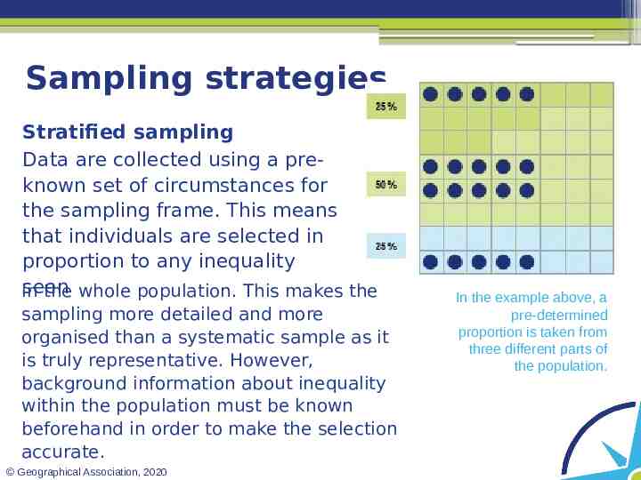
Sampling strategies Stratified sampling Data are collected using a preknown set of circumstances for the sampling frame. This means that individuals are selected in proportion to any inequality seen in the whole population. This makes the sampling more detailed and more organised than a systematic sample as it is truly representative. However, background information about inequality within the population must be known beforehand in order to make the selection accurate. Geographical Association, 2020 In the example above, a pre-determined proportion is taken from three different parts of the population.
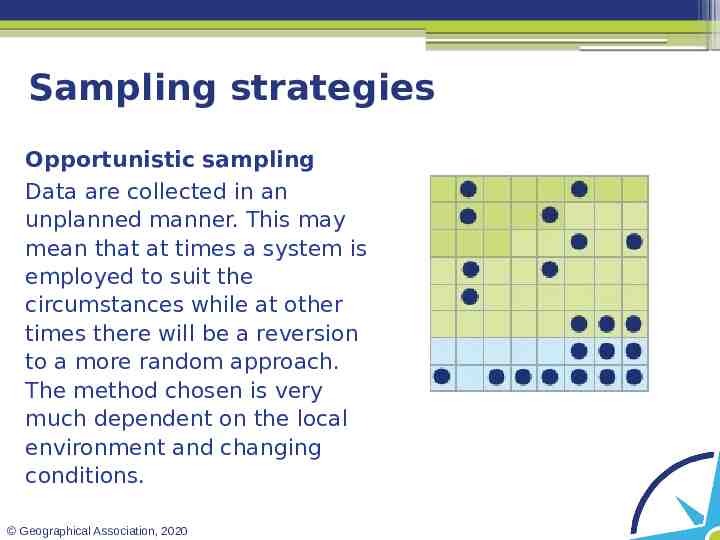
Sampling strategies Opportunistic sampling Data are collected in an unplanned manner. This may mean that at times a system is employed to suit the circumstances while at other times there will be a reversion to a more random approach. The method chosen is very much dependent on the local environment and changing conditions. Geographical Association, 2020
Sampling strategies Systematic Random Stratified Opportunistic Activity For each sampling strategy, think of one advantage and one disadvantage there might be when using it to: record the size of glacial meltwater sediment select respondents to a questionnaire choose locations for litter surveys. Geographical Association, 2020
Point, line and area sampling How we sample data spatially can depend on whether we are looking to explore a single point on a map, a series of points in a line, or an area (a polygon). Look at the short explanation here regarding the use of points, lines and polygons. Geographical Association, 2020 Reflection How might a pilot study help in the design of a sampling technique and data collection method? Could two spatial sampling techniques be combined (such as using quadrats along a transect)? What are the advantages and disadvantages of combining spatial sampling techniques?
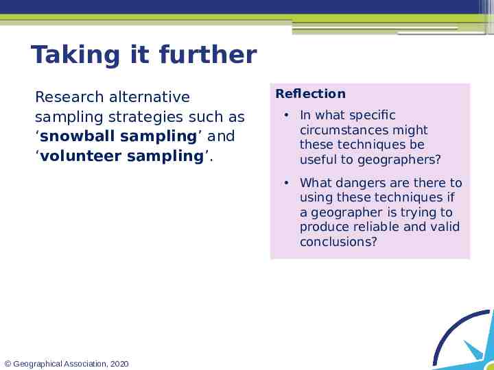
Taking it further Research alternative sampling strategies such as ‘snowball sampling’ and ‘volunteer sampling’. Reflection In what specific circumstances might these techniques be useful to geographers? What dangers are there to using these techniques if a geographer is trying to produce reliable and valid conclusions? Geographical Association, 2020
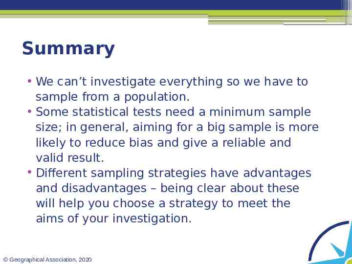
Summary We can’t investigate everything so we have to sample from a population. Some statistical tests need a minimum sample size; in general, aiming for a big sample is more likely to reduce bias and give a reliable and valid result. Different sampling strategies have advantages and disadvantages – being clear about these will help you choose a strategy to meet the aims of your investigation. Geographical Association, 2020
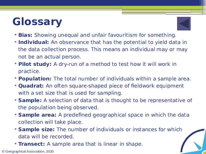
Glossary Bias: Showing unequal and unfair favouritism for something. Individual: An observance that has the potential to yield data in the data collection process. This means an individual may or may not be an actual person. Pilot study: A dry-run of a method to test how it will work in practice. Population: The total number of individuals within a sample area. Quadrat: An often square-shaped piece of fieldwork equipment with a set size that is used for sampling. Sample: A selection of data that is thought to be representative of the population being observed. Sample area: A predefined geographical space in which the data collection will take place. Sample size: The number of individuals or instances for which data will be recorded. Transect: A sample area that is linear in shape. Geographical Association, 2020
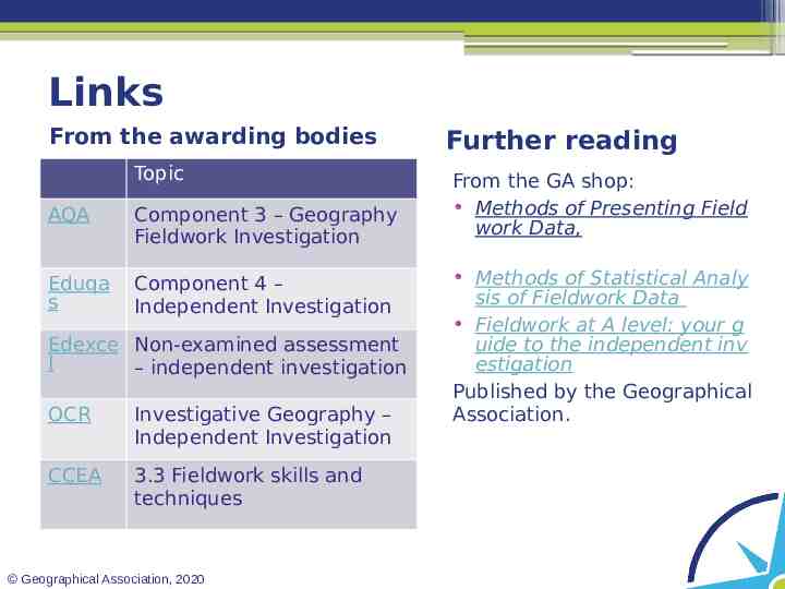
Links From the awarding bodies Topic AQA Component 3 – Geography Fieldwork Investigation Eduqa s Component 4 – Independent Investigation Edexce Non-examined assessment l – independent investigation OCR Investigative Geography – Independent Investigation CCEA 3.3 Fieldwork skills and techniques Geographical Association, 2020 Further reading From the GA shop: Methods of Presenting Field work Data, Methods of Statistical Analy sis of Fieldwork Data Fieldwork at A level: your g uide to the independent inv estigation Published by the Geographical Association.
Acknowledgements This presentation has been written by Chloë Searl, an experienced field studies tutor and author from the Isle of Wight. Geographical Association, 2020