GTECH 361 Lecture 13a Address Matching


22 Slides326.50 KB
GTECH 361 Lecture 13a Address Matching
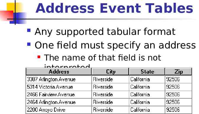
Address Event Tables Any supported tabular format One field must specify an address The name of that field is not interpreted
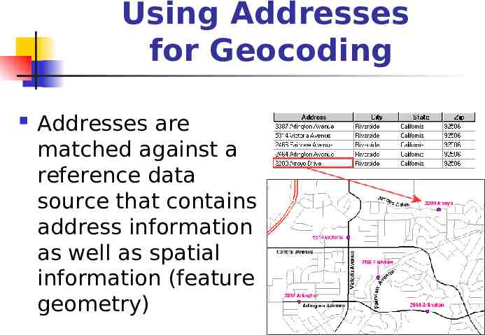
Using Addresses for Geocoding Addresses are matched against a reference data source that contains address information as well as spatial information (feature geometry)
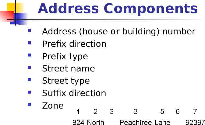
Address Components Address (house or building) number Prefix direction Prefix type Street name Street type Suffix direction Zone
Geocoding Styles Single field US one address US one address with AltName US one address with zone US one address with zone and AltName US one range US streets ZIP 5-digit ZIP 4 For more information about geocoding styles, click the Contents tab in the ArcGIS online help and locate the topics Geocoding addresses Preparing reference data for a geocoding service and Geocoding addresses Preparing address data for geocoding
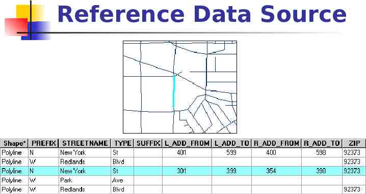
Reference Data Source
Reference Data Source In US Streets style addresses, four attributes define the address ranges for each side of the street L ADD FROM L ADD TO R ADD FROM R ADD TO
Geocoding Service Defines the process for converting addresses into geometric shapes path to the reference data source and address event table algorithms for standardizing address descriptions and matching them to the reference data parameters for reading address data matching the address data to the reference data creating output
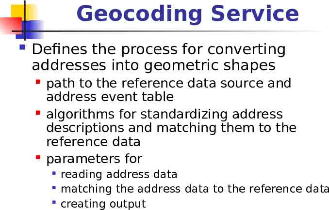
Geocoding Services Geocoding services are stored in the Geocoding Services folder in the Catalog
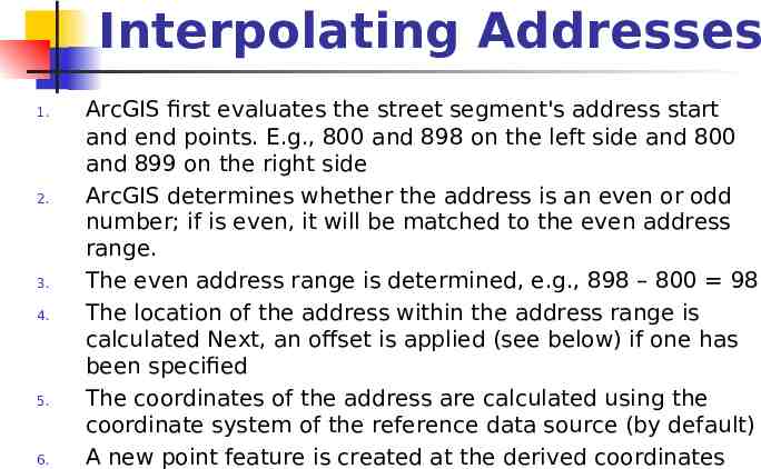
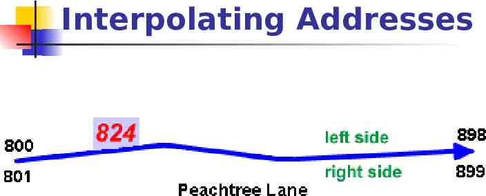
Interpolating Addresses 1. 2. 3. 4. 5. 6. ArcGIS first evaluates the street segment's address start and end points. E.g., 800 and 898 on the left side and 800 and 899 on the right side ArcGIS determines whether the address is an even or odd number; if is even, it will be matched to the even address range. The even address range is determined, e.g., 898 – 800 98 The location of the address within the address range is calculated Next, an offset is applied (see below) if one has been specified The coordinates of the address are calculated using the coordinate system of the reference data source (by default) A new point feature is created at the derived coordinates
Interpolating Addresses
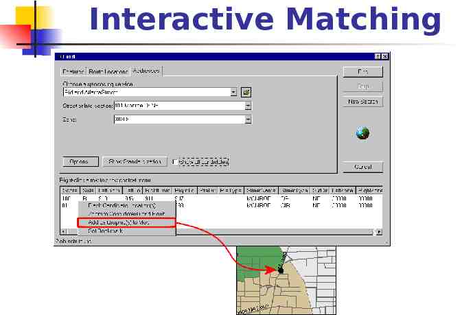
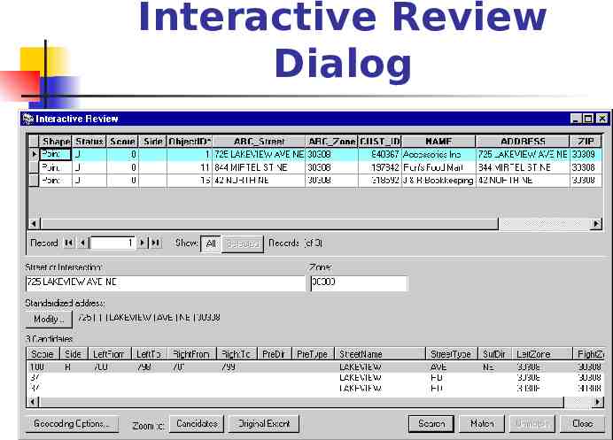
Interactive Matching
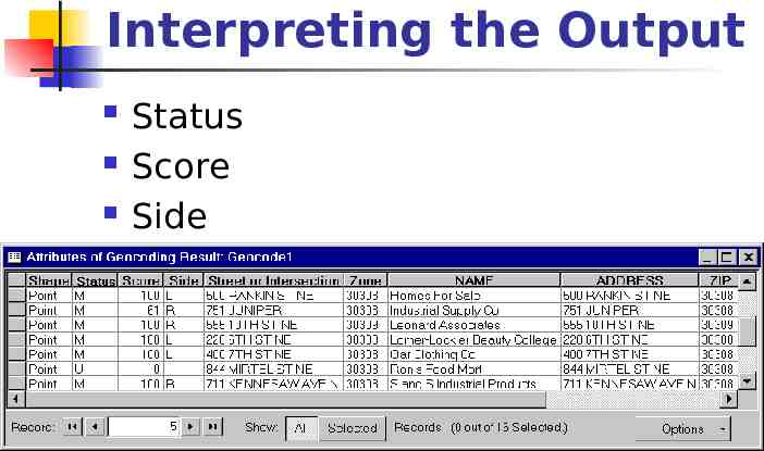
Interpreting the Output Status Score Side
Setting Up a Geocoding Service Create a geocoding service in ArcCatalog that defines Geocoding style Reference data source Address event table Specific steps to match addresses Can be used either in ArcMap or in ArcCatalog
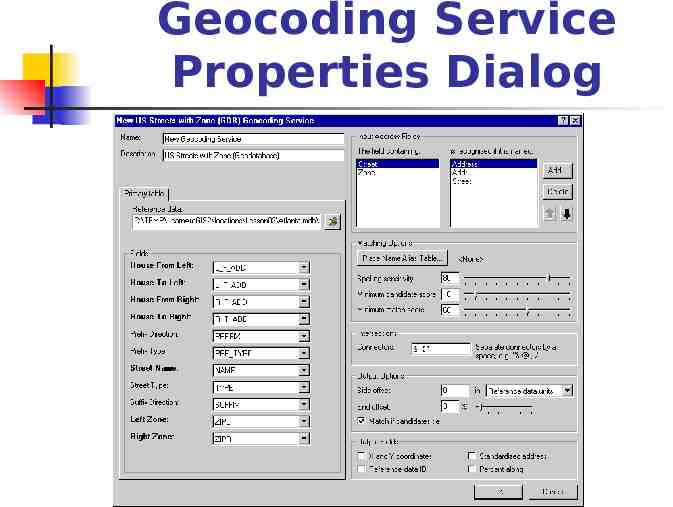
Geocoding Service Properties Dialog
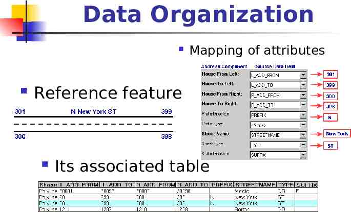
Data Organization Mapping of attributes Reference feature Its associated table
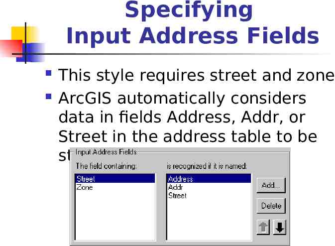
Specifying Input Address Fields This style requires street and zone ArcGIS automatically considers data in fields Address, Addr, or Street in the address table to be street address data
Alias Tables
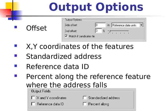
Output Options Offset X,Y coordinates of the features Standardized address Reference data ID Percent along the reference feature where the address falls
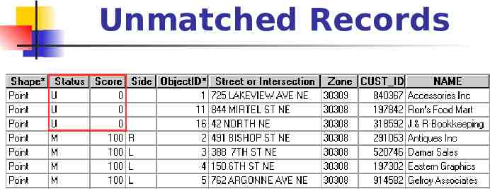
Unmatched Records
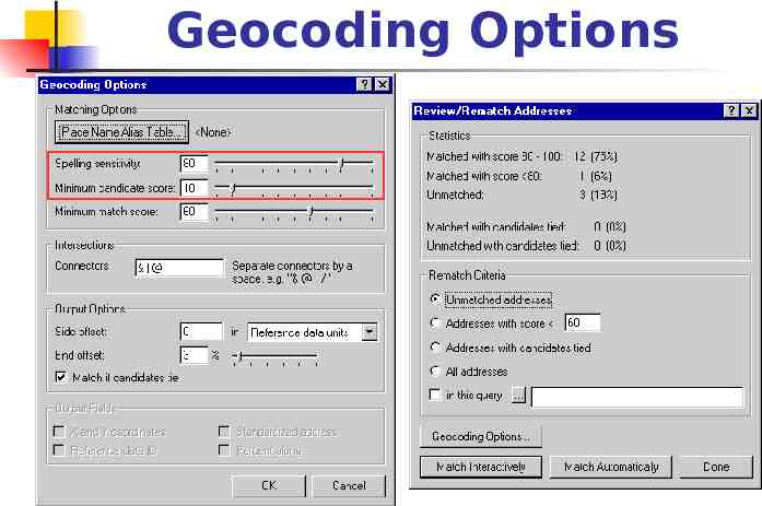
Geocoding Options
Interactive Review Dialog