U-boat Weather Reporting Equipment – Automatic Stations Land/Sea


33 Slides9.87 MB
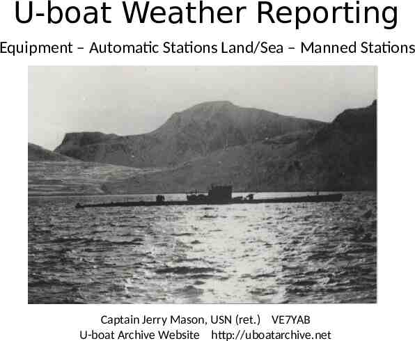
U-boat Weather Reporting Equipment – Automatic Stations Land/Sea – Manned Stations Captain Jerry Mason, USN (ret.) VE7YAB U-boat Archive Website http://uboatarchive.net
German Meteorological Activities in WWII Weather forecasting has always been important in military operations Blitzkrieg France Bismarck breakout Battle of Britain European weather forms in the Arctic moving west to east Greenland, Jan Mayen and Spitzbergen were ideal reporting locations At first neutral Denmark and Norway transmitted weather reports in international code Cooperation ceased after the invasion of Denmark and Norway in April 1940
German Meteorological Activities in WWII Initially weather reporting was done by weather trawlers – with disastrous consequences Two U-boats were continually assigned from August 1940 to January 1941 The Plan: Manned stations provided weather reports from remote sites during winter months HMS Tatar seized Lauenburg 28 June 1941 Automatic weather stations on land and sea covered the summer months U-boats ferried personnel to and from manned weather stations, escorted weather ships and deployed automatic weather stations German Air Force performed weather reconnaissance with aircraft also with manned and automatic stations Weather Reconnaissance DO 17 1940
U-boat Weather Equipment Thermometers Hand anemometer Aspirated psychrometer Hydrometer/Thermometer
U-boat Weather Equipment Barometer Both aneroid type Mounted in the control room Usable from 400 – 3000 mb Second in the Captain’s cabin Barograph Mounted in the radio room Strips were included with the war diary
U-boat Weather Equipment Hypsometer Used to calibrate the aneroid barometers Measured temperature at which distilled water boiled Read directly in millibars
Short Signal Weather Report Format Normal weather Sp R BB PPP A C W Z V DDD K L T M G UUU Ice weather Sp R B B PPP A C W Z V DDD K L T M G E UUU 24 letters sent in 10 seconds Sp Message key R Sea area (grid map) and change in wind direction (last 3 hours) BB ID letters for position PPP Barometric pressure A Pressure change (last 3 hours) C Clouds W Sky covering and rain fall Z Weather change (last 12 hours) V Horizontal visibility and fog conditions DDD Wind direction and strength K Changes in wind strength, swell and height L Length and direction of the swell T Air temperature in degrees Celsius M Difference between air and water temp. G Time of observation in hours in DGZ E Ice conditions UUU Signature of U-boat
Radiosonde Developed by and for the German Navy 1936 – 1939 Wilhelmshaven Naval Meteorological Observatory Design based on control of transmitter frequency by meteorological sensors Sensing elements contain fixed calibration points that cause abrupt frequency changes All electronic – no mechanical error Measured temperature, pressure, humidity Transmitted via HF radio on two frequencies Designed for transport, storage and use from ships and expeditions
Radiosonde Launch Hydrogen filled balloon 1.5 - 2 meters in diameter U-boats carried hydrogen in cylinders, manned stations generated hydrogen by mixing Aluminium and H2SO4 Two antennas and a parachute At launch antennas are coiled up, they extend automatically after launch Rate of ascent 300 meters/minute Tracked with a theodolite for wind speed Reached 17 km in about 90 minutes Antenna extension mechanism with coiled antenna and air brake
Radiosonde Circuitry Two shortwave transmitters in one unit Each contained as oscillator an independent audio circuit Circuits differ only by their capacitors C1 100 pF temperature sensitive C2 60 pF fixed Special double grid tube Grid heater 2 V (dry Rulag battery) Anode voltage 45 V (wet Thor Fill battery) Transmitter I air temperature 8,000 kHz 37.5 meters (room temperature) 1 C change of 2.7 kHz Transmitter II air pressure and humidity 10,400 kHz 28.8 meters Open antenna circuits - length λ / 2.2 - Total antenna length 35 meters
Radiosonde Sensors Naval probe contains 5 meteorological sensors 2 contact thermometers 2 pressure gauges temperature sensitive capacitor 27 to -58 C Dry bulb contact thermometer (range 27C to -60 C) served to calibrate the capacitor 30 platinum contacts divide the range in 3 C steps mercury-thallium – freezing point -60 C Wet bulb contact thermometer (range 27C to -35 C) determine humidity by psychrometric method same construction mercury filled braided sock kept moist with distilled water Pressure gauges 1000 to 450 mb mercury filled 600 to 80 mb mercury-thallium filled 5/6 contacts provide a total of 22 points
Radiosonde Interpretation Two E381S receivers were used to monitor radiosonde ascents Operators adjusted tuning to match the tones from the probe Tuning knob mechanically coupled to a wax paper recorder Dry temperature recording With frequency jumps of the dry thermometer and continuous measurement of the capacitor (1) inversion, (2) isothermal conditions. Wet thermometer and pressure component recording Pressure component jumps are 10 x the size and in a different direction than the wet temperature jumps (Ü) overlap of the ranges of the two pressure components.
Telefunken E381S Receiver Size: 57 cm wide x 27 cm high x 35 cm deep Weight: 20 kg Reception principle: TRF with reaction Tuned circuits 2 AM circuits Frequency Range: 14.6 kHz to 20 MHz Valve lineup: RES094 (RF), 3 x RE084 (detector, audio and output stages) Power: 4V 0.35A, 100V 20 mA Year: 1933
Weather Radio Sea WFS Developed for the Naval Weather Service by Siemens and Schukert Designed and tested from 1940 – 40 ordered in 1942 7 meter long x 52 cm diameter steel cylinder – 12 meter antenna Weight 1500 kg Anchor up to depth 300 meters Air pressure (aneroid barometer) and temperature (helix bimetallic) Electrically wound timer – sampled 4 times/day Encrypted into Morse code transmitted 10 times on HF in 60-80 seconds Designed for endurance of 10 weeks WFS 106 being loaded aboard U-703 in Trondheim 18 July 1943
Weather Radio Sea WFS Lo150FK41a (3-12 MHz) 150 Watt transmitter Based on the Lo40K39 40 watt transmitter 150 watt radiated power achieved by replacing both RL 12P35 tubes with RS 391 tubes and raising anode voltage from 600 to 900 volts Sealed lead–acid batteries – anode voltage 900 Volts Nickel-cadmium batteries – tube heating WFS 133 “Ernst” during loading from supply ship "Kärnten“ to U-703 on 11 September 1944 The boat was lost before the buoy was deployed
Weather Radio Sea WFS 1 WFS 2 29.09.40 U103* 2 WFS 33 07.01.42 U-156 3 WFS 22 08.01.42 U-156 4 WFS B 28.04.42 U-159 5 WFS A 29.04.42 U-159 6 WFS 24.08.42 U-516 7 WFS 30.08.42 U-516 8 WFS 31.10.42 U-519 9 WFS 104 08.11.42 U-519 10 WFS 112 29.04.43 U-531 11 WFS 26.06.43 U194** 12 WFS 106 23.07.43 U-703 13 WFS 107 27.07.43 U-703 14 WFS 133 10.09.44 U-703** 15 WFS 18.11.44 U1165 Buoys stored in over deck torpedo canisters – anchors*in the over deck Operational testing Upper and lower antenna parts in the torpedo room up thebefore torpedo loading hatch ** through U-boat lost deployment Torpedo crane used to move heavy components – Limit: Wind 2, Swell 2, Sea State 2 Assembly and deployment took about 1.5 hours during which the boat could not dive
Weather Radio Land WFL Same components as WFS 20 ordered in 1942 1 meter high steel pots 52 cm in diameter Weighed no more than 100 kg each Pot M – wind measurement sensors and nickelcadmium batteries Pot M – 10 meter antenna with temperature and air pressure sensors Pot F – Lo150FK41a 150 Watt transmitter Pot B – Sealed lead–acid batteries number depended on desired endurance Air pressure, temperature, wind strength and direction were sampled 4 times/day Encrypted in Morse code transmitted 10 times in up to 120 seconds Designed for an endurance of 10 – 24 weeks
Weather Radio Land WFL WFL Station Date Boat 21 “Gustav” Spitzbergen 29.09.42 U377 22 “Edwin” Bäreninsel 01.12.42 U-657 23 “Edwin II” Bäreninsel 18.03.42 WBS 2 24 “Robert” Bäreninsel 09.07.43 U-629 25 “Gerhard” Nowaja Semlja 22.08.43 U703 26 “Kurt” Labrador 23.10.43 U-537 27 “Dietrich” Bäreninsel 07.09.43 U355 28 ----29 “Christian” Bäreninsel 06.12.43 U-713
Weather Radio Land WFL WFL 33 “Edwin III” has an interesting story Deployed 1 July 1944 on North Spitzbergen by U-737 Last weather data received in May 1945 (11 months) Discovered in 1982 - salvaged in 1984 Restored and exhibited in Forsvarsmuseum in Oslo
WFL 26 “Kurt” U-537 Type IXC U-537 Kapitänleutnant Peter Schrewe Departed Bergen on its first war patrol 30 September 1943 Two meteorologists: Dr. Kurt Sommermeyer & Walter Hildebrant Suffered damage from heavy seas during Atlantic crossing Arrived at dawn 22 October off the Labrador coast
WFL 26 “Kurt” U-537 U-537 anchored in Martin Bay at 12:00 local Dr. Sommermeyer quickly identified the site The meteorologists & ten sailors worked to put the station ashore by rubber boat over the beach 50 meters up a hill and 400 meters inland Armed lookouts posted while other crew members repaired storm damage
WFL 26 “Kurt” Working throughout the night the station was completed about 12:00 local the next day To disguise the station empty US cigarette packs were strewn about and one canister was marked “Canadian Metor. Service” The boat waited until the first transmission was heard that evening then put to sea U-537 conducted an unsuccessful patrol off Newfoundland arriving in Lorient 8 December The boat’s next patrol took it to Batavia (Jakarta) where it was lost on 10 November 1944 U-537
WFL 26 “Kurt” U-537 Forgotten until 1977 Kurt was discovered by geomorphologist Peter Johnson Retired Siemens engineer Franz Selinger contacted Canadian National Defense Historian W.A.B. Douglas Douglas went to the site in 1981 and recovered the station Kurt is now exhibited at the Canadian War Museum in Ottawa Above: U-537 anchored in Martin Bay Below: Kurt during its recovery
Manned Weather Stations Navy deployed manned weather stations to the Arctic in the winters of 1942-1945 Reasonably safe from October until spring pack ice allowed enemy access in about June Air Force manned stations had smaller crews (2-4 men), established and supplied by aircraft Navy stations were larger (8-12 men), self sufficient in prefabricated huts, adequate supplies to overwinter, equipped with meteorological equipment and radiosondes, radio gear and weapons for self defense (1800 items, 1220 cases of provisions, 80,000 kg) Crews were totally dependent on themselves during the dark winter months Radio links with the Navy Radio Station Tromsö was their only contact with the outside world At right: Weather station Knospe on Spitzbergen 1941/2
Manned Weather Stations † * Lost to British Navy, Luftwaffe station, †† ** 1 “Sachsen” Denmark Strait 1940 2 “Sachsen” Jan Mayen area 41 3 “Lauenberg” Jan Mayen area 41† 4 “Bansö” West Spitzbergen 41/42* 5 “Knospe” West Spitzbergen 41/42 6 “Nussbaum” West Spitzbergen 41/42 7 “Holzauge” East Greenland 42/43 8 “Kreuzritter” West Spitzbergen 43/44 9 “Bassgeiger” East Greenland 43/44 10 “Hessen” North Atlantic 44*** 11 “Schatzgräber” Franz Josef land 43/44 12 “Svartisen” Hopen Island 43/44* 13 “Edelweiss” East Greenland 44†† 14 “Edelweis II” East Greenland 44†† 15 “Zugvogel” North Atlantic 44/45††† 16 “Hellhus” Hopen Island Lost to US Coast Guard, ††† Lost unknown causes 44/45* Abwehr station, *** Did not reach station 17 “Landvik” South Spitzbergen 44/45**
“Haudegen” Station “Haudegen” (Swashbuckler) established on Nordaustlandet on Spitzbergen September 1944 to September 1945 – last unit of the German Armed Forced to surrender 12 men: Leader Dr. Dege, 3 meteorologists, 6 radioman and two sailors Dr. Dege, 34 yo geomorphologist, had made three research trips to Spitzbergen in 1935, 1936 & 1938 Dr. Dege was keen to carry out an extensive scientific program Based on Dr. Dege’s experience “Haudegen” was established in Wirdiebucht in Rijpfjord They recorded eight daily meteorological observations - encrypted until the German surrender Afterwards reports were transmitted in the clear in the international meteorological key and Nordaustlandet was intensively studied
“Haudegen” Station 575 nm north of Hammerfest Main station Evasion camps
1944 27 Aug 9 Sep “Haudegen” Timeline K.J. Busch and U-307 sort supplies in Ramsfjorden K.J. Busch and U-307 depart Norway for Nordaustlandet 14 Sep Offload & construction of the main station 17 Sep U-307 set off to establish 3 evasion camps 26 Sep Radio station ready to operate 27 Sep K.J. Busch and U-307 depart – weather reports begin 18 Oct Sun disappears 1945 Average temp. -10 C 1 Mar Sun reappears January low of -33.6 C 3 Mar Mines installed July high of 9.6 C 7 May Germany surrenders 8 May Mines detonated - weather reports as Station “X02” 15 May First expedition to Camp A1 15 Jun Last expedition to Camp A2 3 Sep Station surrenders 5 Sep Last weather report sent Eight daily observations, 140 radiosondes, 1222 weather reports
Lorenz Lo40K39 Transmitter Size: 55 cm wide x 60 cm high x 30 cm deep Weight: Tx. 35.4 kg Pw. 38.5 kg 73.9 kg Power: 40 W Frequency Range: 3-16.7 MHz Valve lineup: 3 RL12P35 Power: 220 V AC Year: 1937
“Haudegen” Radio Gear Main antenna built between two guy-wire masts aligned with the remote radio station in Tromsö Two auxiliary antennas for the Radione receiver and the Radiosonde receiver Emergency radio station at Camp A2 Telefunken Stat. 272 Bs 15W Naval Landing Station (transceiver) , 3000 – 5000 kHz Powered by a treadmill Spez.955 Bs
Video Placeholder
“Haudegen” Today After 3 months in captivity Dr. Dege and his men were sent home The men tried to meet every year for a reunion – complicated by the Cold War Dr. Dege died in 1972 – two men in their 90’s survive today Dr. Dege’s diary was found by son Dr. Eckart Dege in 1985 The station is still standing, a new roof was installed in 2015 - the site is protected
The End Learn more about U-boats including radio equipment and the war diaries of boats that supported weather reporting at: http://uboatarchive.net Download the presentation at: http://uboatarchive.net/Presentations/Presen tations.htm Read about the Haudegen station in War North of 80 – The last German Weather Station of World War II – by Dr. Wilhelm Dege