Alabama History Chapter 1 Mrs. Wallace


18 Slides728.50 KB
Alabama History Chapter 1 Mrs. Wallace
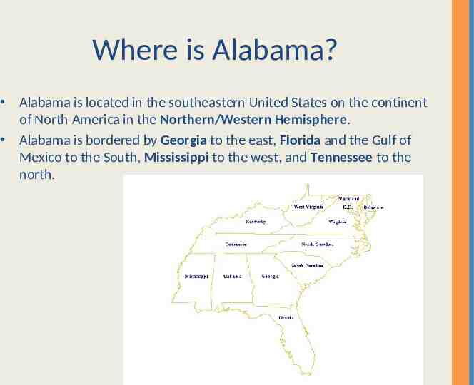
Where is Alabama? Alabama is located in the southeastern United States on the continent of North America in the Northern/Western Hemisphere. Alabama is bordered by Georgia to the east, Florida and the Gulf of Mexico to the South, Mississippi to the west, and Tennessee to the north.
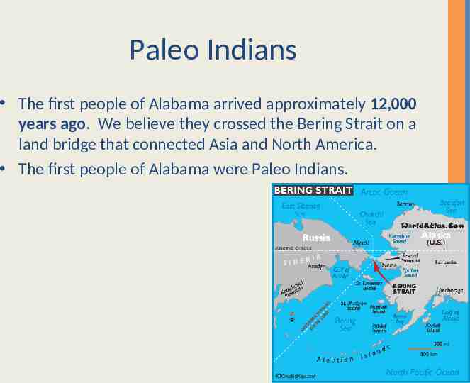
Paleo Indians The first people of Alabama arrived approximately 12,000 years ago. We believe they crossed the Bering Strait on a land bridge that connected Asia and North America. The first people of Alabama were Paleo Indians.
Vocabulary to Know Archaeologists- study past cultures by looking at their tools, weapons, buildings, and other remains Prehistoric- means before history was written down Geologists- scientists who study how the earth was formed
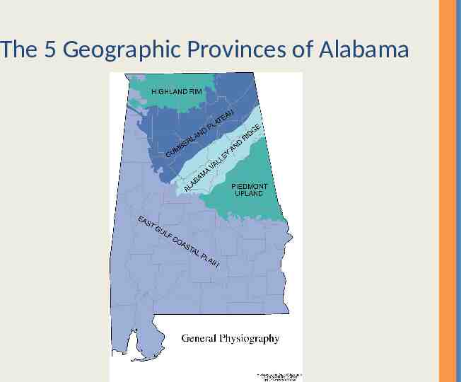
The 5 Geographic Provinces of Alabama The Highland Rim- level plains of fertile soil and gently rolling hills Cumberland Plateau- steep canyons and coal deposits The Ridge and Valley Province- includes Birmingham and Red Mountain- known for iron ore, coal, and limestone The Piedmont Province- means “foot of the mountains” Mount Cheaha (the highest point in Alabama is located here) The Coastal Plain- The border between the Piedmont and the Coastal Plain is called the fall line. It makes up more than half of the state. A band of dark rich soil called the black belt is found in the Coastal Plain.
The 5 Geographic Provinces of Alabama
Paleo Indians When the Paleo Indians came to Alabama they came following herds of now extinct food animals. They were hunters and gatherers. The Paleo Indians found places to live that would be both safe and close to food sources. Paleo Indians were skilled at using natural resources. They were also excellent artists. Scientists have found petroglyphs carved into rocks. These offer clues about the religious beliefs. Paleo Indians hunted large prehistoric animals like mastodons and woolly mammoths.
Archaic Indians Like the Paleo Indians, the Archaic Indians were hunters and gatherers. The Archaic Indians made use of other resources too. Unlike the Paleo Indians, Archaic Indians tended to stay longer in one place. Archaic Indians lived on the rivers, where they harvested fish and shellfish during the summer. In the fall and winter they moved to the forests to collect nuts and to hunt. Archaic people developed many tools, such as the atlatl, or throwing stick for hunting. Burial sites show that the Archaic Indians traded for special items.
Archaic Indians Vocabulary: Horticulture: Archaic Indians paid attention to where certain plants grew well and tried to encourage plant growth. Archaeologists believe that finding rare or precious items in a person’s grave probably meant they were important to the group. Scientists also think the Archaic people believed in life after death. Archaic Indians made bowls and other items from stone.
Archaic Indian and Atlatl
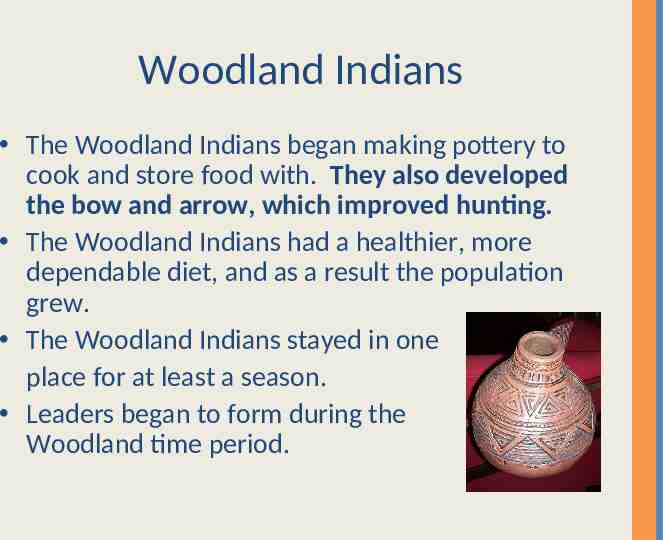
Woodland Indians The Woodland Indians began making pottery to cook and store food with. They also developed the bow and arrow, which improved hunting. The Woodland Indians had a healthier, more dependable diet, and as a result the population grew. The Woodland Indians stayed in one place for at least a season. Leaders began to form during the Woodland time period.
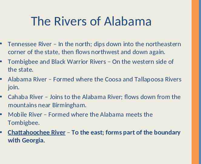
The Rivers of Alabama Tennessee River – In the north; dips down into the northeastern corner of the state, then flows northwest and down again. Tombigbee and Black Warrior Rivers – On the western side of the state. Alabama River – Formed where the Coosa and Tallapoosa Rivers join. Cahaba River – Joins to the Alabama River; flows down from the mountains near Birmingham. Mobile River – Formed where the Alabama meets the Tombigbee. Chattahoochee River – To the east; forms part of the boundary with Georgia.
Alabama Rivers
Mississippian Period and Native Americans Native Americans were attracted to the abundant plant and animal life found in and along these waterways. With hundreds of miles of waterways, Native Americans did not have to travel far to find good water and transportation. People during the Mississippian period lived in chiefdoms. Chiefs and priests lived in town, and they made the laws and led the people in peace and war. Mississippians still hunted and fished, but farming was central to their society. Mississippian society included nobles and commoners. Nobles were related to the chief or priests. Commoners served the nobles.
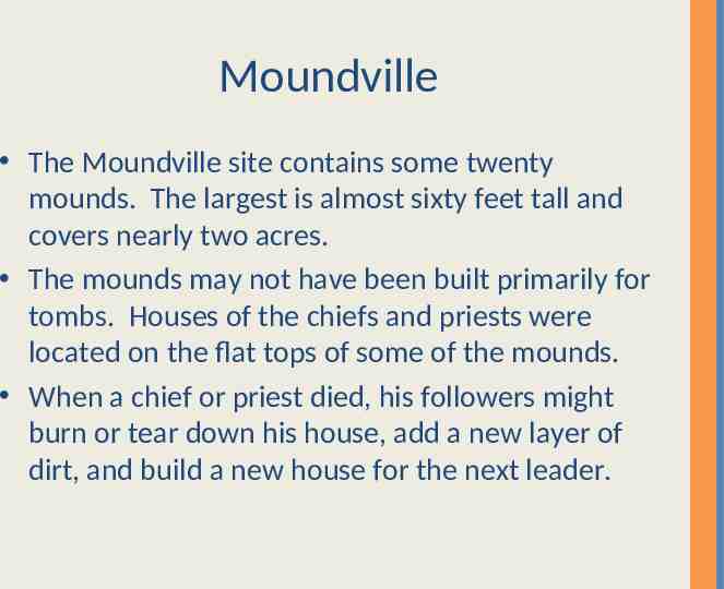
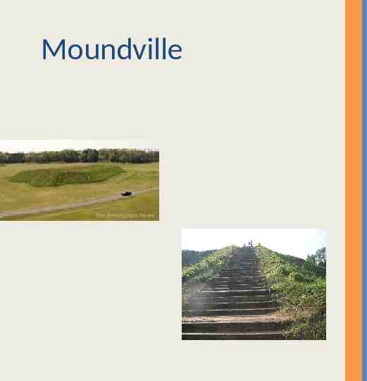
Moundville The Moundville site contains some twenty mounds. The largest is almost sixty feet tall and covers nearly two acres. The mounds may not have been built primarily for tombs. Houses of the chiefs and priests were located on the flat tops of some of the mounds. When a chief or priest died, his followers might burn or tear down his house, add a new layer of dirt, and build a new house for the next leader.
Moundville
Bottle Creek Located on an island in the delta of the Mobile and Tensaw Rivers. Contained at least eighteen mounds, and the city was the social and governmental center of the region. Both Moundville and Bottle Creek went into decline and people began moving away, leaving the sites all but deserted. We do not know for sure why the Mississippian culture declined. Scientists think warfare and diseases brought by Europeans caused this decline.
Vocabulary to Know migration – the movement of people or animals from one place to another fossil – remains of a living thing from a former geologic age inhabitants – people who live in a particular place erosion – the wearing away of land by wind, water, or weather over a long period of time middens – garbage dumps used by Archaic Indians chiefdoms – groups of tribes with common goals and beliefs that unite for power palisades – a fence of stakes set firmly in the ground to enclose or protect a place