VCE Geography Implementation of VCE Study Design for 2022 – 2026 Unit


43 Slides695.32 KB
VCE Geography Implementation of VCE Study Design for 2022 - 2026 Unit 1 and Unit 2
The copyright in this PowerPoint presentation is owned by the Victorian Curriculum and Assessment Authority or in the case of some materials, by third parties. No part may be reproduced by any process except in accordance with the provisions of the Copyright Act 1968 or with permission from the Copyright Officer at the Victorian Curriculum and Assessment Authority.
Acknowledgment of Country I would like to acknowledge the traditional custodians of the many lands across Victoria on which each of you are living, learning and working from today. For those of you in the Melbourne metropolitan area, we acknowledge the traditional custodians of the Kulin Nations. For myself, I acknowledge the Wadawurrung people of the Lake Burrumbeet region, near Ballarat, from where I am working today. When acknowledging country, we recognise Aboriginal and Torres Strait Islander peoples’ spiritual and cultural connection to country and acknowledge their continued care of the lands and waterways over generations, while celebrating the continuation of a living culture that has a unique role in this region. I would like to pay my respects to Elders past, present and emerging, for they hold the memories, traditions, culture and hopes of all Aboriginal and Torres Strait Islander peoples across the nation, and hope they will walk with us on our journey. I particularly welcome any first nations people who are joining us today.
Purpose Support VCE Units 1 and 2 teachers in implementing and delivering the newly accredited Geography Study Design 2022 - 2026 Answer questions related to the newly accredited study design content and school-based assessment in a live Q and A webinar session on Wednesday 12 May
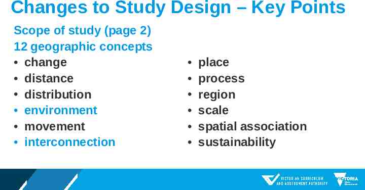
Changes to Study Design – Key Points Scope of study (page 2) 12 geographic concepts change distance distribution environment movement interconnection place process region scale spatial association sustainability
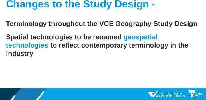
Changes to the Study Design Terminology throughout the VCE Geography Study Design Spatial technologies to be renamed geospatial technologies to reflect contemporary terminology in the industry
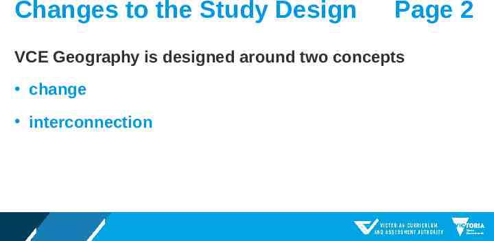
Changes to the Study Design Page 2 VCE Geography is designed around two concepts change interconnection
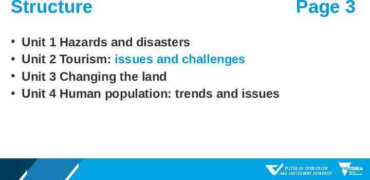
Structure Unit 1 Hazards and disasters Unit 2 Tourism: issues and challenges Unit 3 Changing the land Unit 4 Human population: trends and issues Page 3
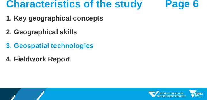
Characteristics of the study 1. Key geographical concepts 2. Geographical skills 3. Geospatial technologies 4. Fieldwork Report Page 6
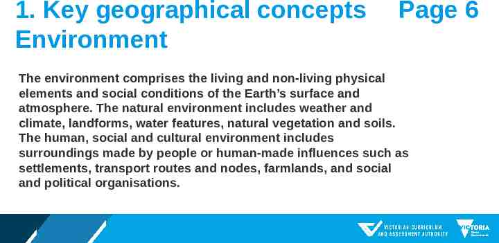
1. Key geographical concepts Environment Page 6 The environment comprises the living and non-living physical elements and social conditions of the Earth’s surface and atmosphere. The natural environment includes weather and climate, landforms, water features, natural vegetation and soils. The human, social and cultural environment includes surroundings made by people or human-made influences such as settlements, transport routes and nodes, farmlands, and social and political organisations.
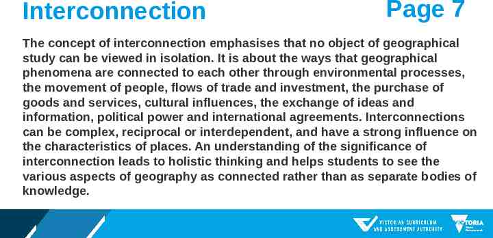
Interconnection Page 7 The concept of interconnection emphasises that no object of geographical study can be viewed in isolation. It is about the ways that geographical phenomena are connected to each other through environmental processes, the movement of people, flows of trade and investment, the purchase of goods and services, cultural influences, the exchange of ideas and information, political power and international agreements. Interconnections can be complex, reciprocal or interdependent, and have a strong influence on the characteristics of places. An understanding of the significance of interconnection leads to holistic thinking and helps students to see the various aspects of geography as connected rather than as separate bodies of knowledge.
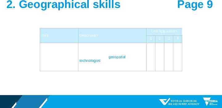
Page 9 2. Geographical skills Unit application Skill Description Cartography – map creation Use of both primary data collected in the field and secondary data from online databases to create maps and map layers using geospatial technologies. These maps should be at an appropriate scale and follow geographic conventions 1 2 3 4
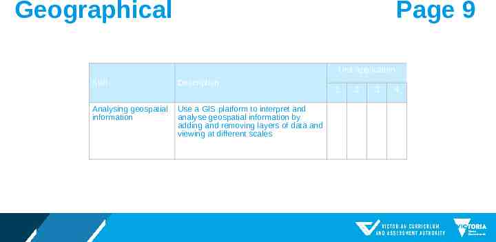
Page 9 Geographical Unit application Skill Description Analysing geospatial information Use a GIS platform to interpret and analyse geospatial information by adding and removing layers of data and viewing at different scales 1 2 3 4
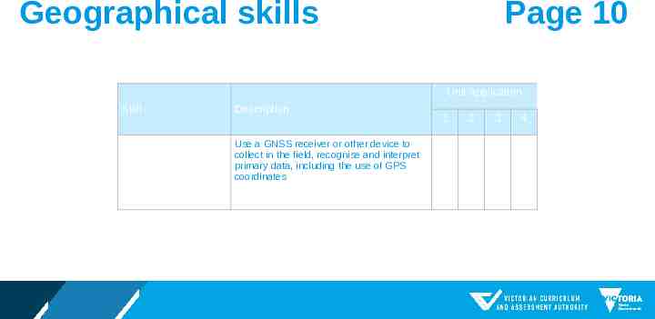
Page 10 Geographical skills Unit application Skill Description Global Navigation Satellite System (GNSS) Use a GNSS receiver or other device to collect in the field, recognise and interpret primary data, including the use of GPS coordinates 1 2 3 4
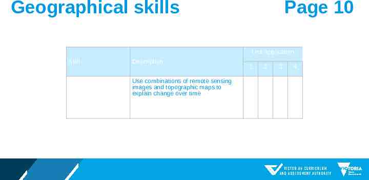
Page 10 Geographical skills Unit application Skill Description Map use, interpretation and analysis Use combinations of remote sensing images and topographic maps to explain change over time 1 2 3 4
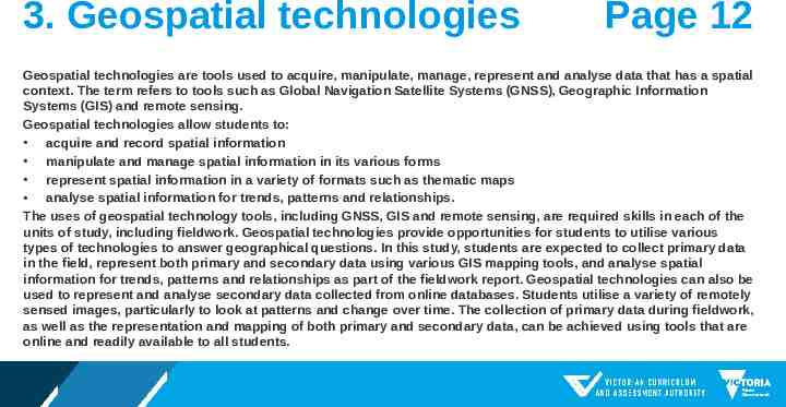
3. Geospatial technologies Page 12 Geospatial technologies are tools used to acquire, manipulate, manage, represent and analyse data that has a spatial context. The term refers to tools such as Global Navigation Satellite Systems (GNSS), Geographic Information Systems (GIS) and remote sensing. Geospatial technologies allow students to: acquire and record spatial information manipulate and manage spatial information in its various forms represent spatial information in a variety of formats such as thematic maps analyse spatial information for trends, patterns and relationships. The uses of geospatial technology tools, including GNSS, GIS and remote sensing, are required skills in each of the units of study, including fieldwork. Geospatial technologies provide opportunities for students to utilise various types of technologies to answer geographical questions. In this study, students are expected to collect primary data in the field, represent both primary and secondary data using various GIS mapping tools, and analyse spatial information for trends, patterns and relationships as part of the fieldwork report. Geospatial technologies can also be used to represent and analyse secondary data collected from online databases. Students utilise a variety of remotely sensed images, particularly to look at patterns and change over time. The collection of primary data during fieldwork, as well as the representation and mapping of both primary and secondary data, can be achieved using tools that are online and readily available to all students.
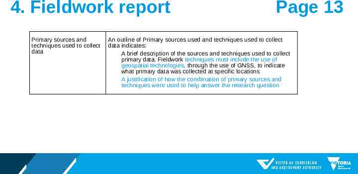
4. Fieldwork report Primary sources and techniques used to collect data Page 13 An outline of Primary sources used and techniques used to collect data indicates: A brief description of the sources and techniques used to collect primary data. Fieldwork techniques must include the use of geospatial technologies, through the use of GNSS, to indicate what primary data was collected at specific locations A justification of how the combination of primary sources and techniques were used to help answer the research question
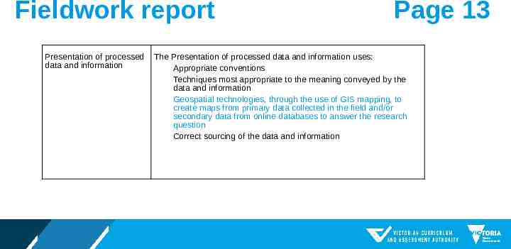
Fieldwork report Presentation of processed data and information Page 13 The Presentation of processed data and information uses: Appropriate conventions Techniques most appropriate to the meaning conveyed by the data and information Geospatial technologies, through the use of GIS mapping, to create maps from primary data collected in the field and/or secondary data from online databases to answer the research question Correct sourcing of the data and information
Outcomes Instructional terms Describe and explain replaced with analyse Order of key knowledge and key skills changed Matched Ascending order of difficulty
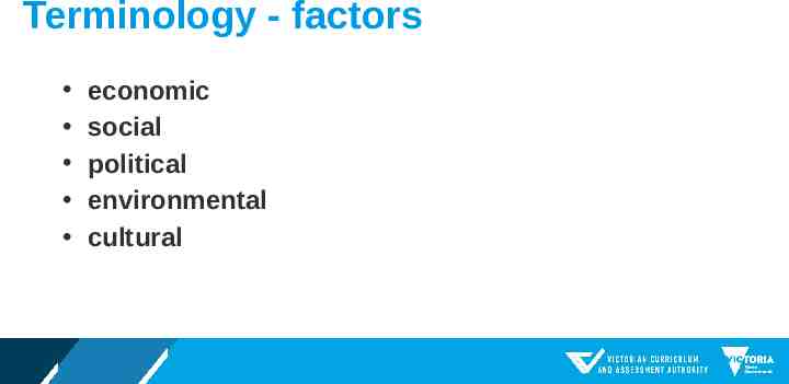
Terminology - factors economic social political environmental cultural
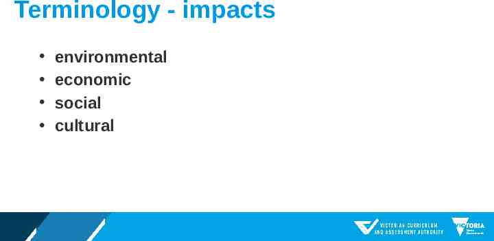
Terminology - impacts environmental economic social cultural
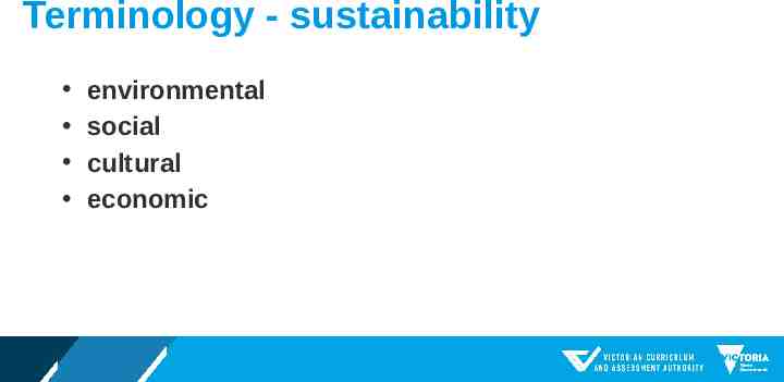
Terminology - sustainability environmental social cultural economic
Terminology trend issue challenge
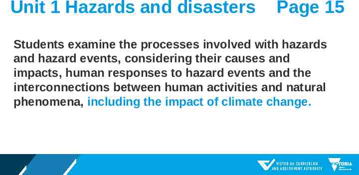
Unit 1 Hazards and disasters Page 15 Students examine the processes involved with hazards and hazard events, considering their causes and impacts, human responses to hazard events and the interconnections between human activities and natural phenomena, including the impact of climate change.
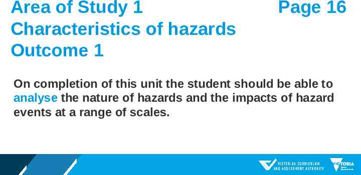
Area of Study 1 Characteristics of hazards Outcome 1 Page 16 On completion of this unit the student should be able to analyse the nature of hazards and the impacts of hazard events at a range of scales.
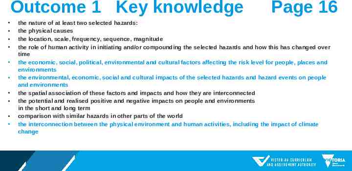
Outcome 1 Key knowledge Page 16 the nature of at least two selected hazards: the physical causes the location, scale, frequency, sequence, magnitude the role of human activity in initiating and/or compounding the selected hazards and how this has changed over time the economic, social, political, environmental and cultural factors affecting the risk level for people, places and environments the environmental, economic, social and cultural impacts of the selected hazards and hazard events on people and environments the spatial association of these factors and impacts and how they are interconnected the potential and realised positive and negative impacts on people and environments in the short and long term comparison with similar hazards in other parts of the world the interconnection between the physical environment and human activities, including the impact of climate change
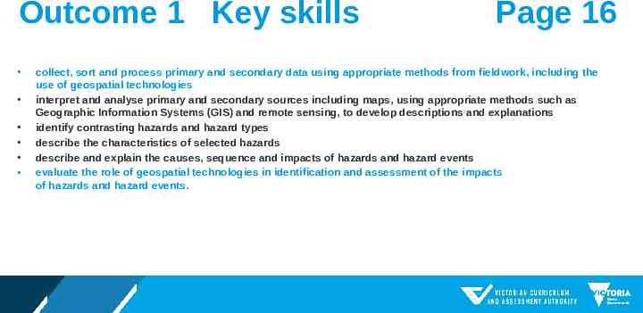
Outcome 1 Key skills Page 16 collect, sort and process primary and secondary data using appropriate methods from fieldwork, including the use of geospatial technologies interpret and analyse primary and secondary sources including maps, using appropriate methods such as Geographic Information Systems (GIS) and remote sensing, to develop descriptions and explanations identify contrasting hazards and hazard types describe the characteristics of selected hazards describe and explain the causes, sequence and impacts of hazards and hazard events evaluate the role of geospatial technologies in identification and assessment of the impacts of hazards and hazard events.
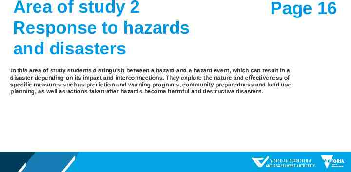
Area of study 2 Response to hazards and disasters Page 16 In this area of study students distinguish between a hazard and a hazard event, which can result in a disaster depending on its impact and interconnections. They explore the nature and effectiveness of specific measures such as prediction and warning programs, community preparedness and land use planning, as well as actions taken after hazards become harmful and destructive disasters.
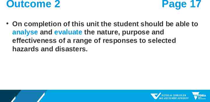
Outcome 2 Page 17 On completion of this unit the student should be able to analyse and evaluate the nature, purpose and effectiveness of a range of responses to selected hazards and disasters.
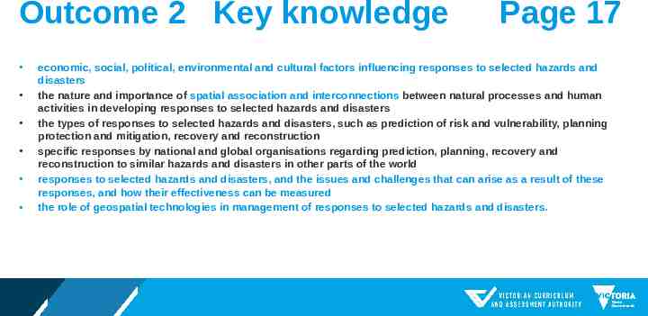
Outcome 2 Key knowledge Page 17 economic, social, political, environmental and cultural factors influencing responses to selected hazards and disasters the nature and importance of spatial association and interconnections between natural processes and human activities in developing responses to selected hazards and disasters the types of responses to selected hazards and disasters, such as prediction of risk and vulnerability, planning protection and mitigation, recovery and reconstruction specific responses by national and global organisations regarding prediction, planning, recovery and reconstruction to similar hazards and disasters in other parts of the world responses to selected hazards and disasters, and the issues and challenges that can arise as a result of these responses, and how their effectiveness can be measured the role of geospatial technologies in management of responses to selected hazards and disasters.
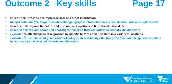
Outcome 2 Key skills Page 17 collect, sort, process and represent data and other information interpret and analyse maps, data and other geographic information to develop descriptions and explanations describe and explain the nature and purpose of responses to hazards and disasters describe and explain issues and challenges that arise from responses to hazards and disasters evaluate the effectiveness of responses to specific hazards and disasters in a variety of locations evaluate the usefulness of geospatial technologies in developing effective prevention and mitigation measures in response to the selected hazards and disasters.
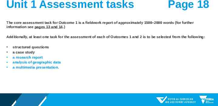
Unit 1 Assessment tasks Page 18 The core assessment task for Outcome 1 is a fieldwork report of approximately 1500–2000 words (for further information see pages 13 and 14.) Additionally, at least one task for the assessment of each of Outcomes 1 and 2 is to be selected from the following: structured questions a case study a research report analysis of geographic data a multimedia presentation.
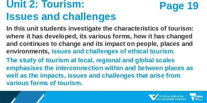
Unit 2: Tourism: Issues and challenges Page 19 In this unit students investigate the characteristics of tourism: where it has developed, its various forms, how it has changed and continues to change and its impact on people, places and environments, issues and challenges of ethical tourism. The study of tourism at local, regional and global scales emphasises the interconnection within and between places as well as the impacts, issues and challenges that arise from various forms of tourism.
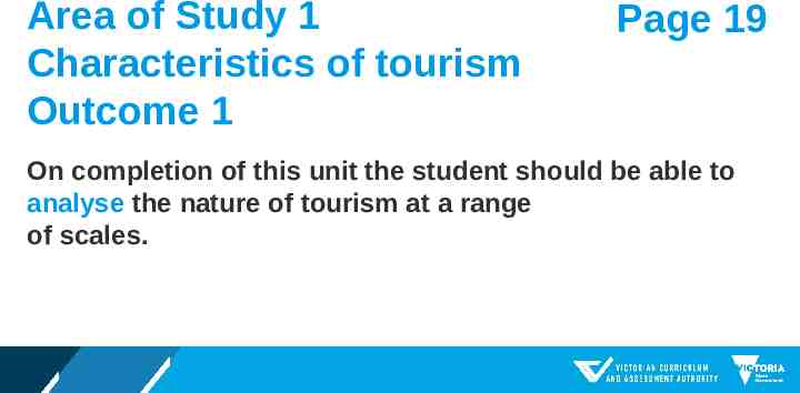
Area of Study 1 Characteristics of tourism Outcome 1 Page 19 On completion of this unit the student should be able to analyse the nature of tourism at a range of scales.
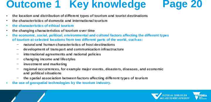
Outcome 1 Key knowledge Page 20 the location and distribution of different types of tourism and tourist destinations the characteristics of domestic and international tourism the characteristics of ethical tourism the changing characteristics of tourism over time the economic, social, political, environmental and cultural factors affecting the different types of tourism at selected locations from two different parts of the world, such as: ‒ natural and human characteristics of host destinations ‒ development of transport and communication infrastructure ‒ international agreements and national policies ‒ changing income and lifestyles ‒ investment and marketing ‒ regional occurrences, for example major events, disasters, diseases, and economic and political situations ‒ the spatial association between factors affecting different types of tourism the use of geospatial technologies by the tourism industry.
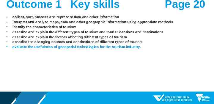
Outcome 1 Key skills Page 20 collect, sort, process and represent data and other information interpret and analyse maps, data and other geographic information using appropriate methods identify the characteristics of tourism describe and explain the different types of tourism and tourist locations and destinations describe and explain the factors affecting different types of tourism describe the changing sources and destinations of different types of tourism evaluate the usefulness of geospatial technologies for the tourism industry.
Area of Study 2 Impact of tourism: Issues and challenges Page 20 In this area of study students explore the environmental, economic, social and cultural impacts of different types of tourism, and the issues and challenges that these create for people and the environment. They investigate at least one tourism location using appropriate fieldwork techniques, and one location elsewhere in the world that requires an investigation of ethical tourism. Students evaluate the effectiveness of measures taken to enhance the positive impacts and/or to minimise the negative impacts at these locations. This fieldwork site could be the same fieldwork site explored in Area of Study 1. They investigate the interconnection of the two selected locations with their surrounding region and national context.
Outcome 2 Page 20 On completion of this unit the student should be able to analyse the impacts of tourism on people, places and environments, and evaluate the effectiveness of strategies for managing tourism.
Outcome 2 Key knowledge Page 21 the environmental, economic, social and cultural impacts of tourism at a range of locations and spatial and temporal scales the environmental, social, cultural and economic sustainability of tourism at a range of scales the issues and challenges for people and the environment that occur due to these impacts, including climate change the role of planning in managing sustainable outcomes in tourism the range of management strategies responding to environmental, economic, social and cultural impacts, including ethical tourism the effectiveness of management strategies in response to the impacts of tourism, including ethical tourism.
Outcome 2 Key skills Page 21 identify and explain the types of tourism impacts at a range of locations and scales describe the range of management strategies linked to tourism collect, sort and process primary and secondary data using appropriate methods from fieldwork, including the use of geospatial technologies interpret and analyse primary and secondary sources including maps, using appropriate methods such as Geographic Information Systems (GIS) and remote sensing evaluate the effectiveness of management strategies and consider their consequences, in relation to environmental, social, cultural and economic sustainability of tourism, including ethical tourism.
Unit 2 Assessment tasks Page 22 The core assessment task for Outcome 2 is a fieldwork report of approximately 1500–2000 words (for further information see pages 13 and 14.) Additionally, at least one task for the assessment of each of Outcomes 1 and 2 is to be selected from the following: structured questions a case study a research report analysis of geographic data a multimedia presentation.
Resources For more information visit the VCAA website for: VCE Geography Study Design VCE Geography Advice for Teachers 2022 -2026 Examination Specifications (not available as yet)
Thank you Contact Leonie Brown VCAA Humanities Curriculum Manager [email protected] Phone 03 9059 5143 Mobile 0407 279 470