Know the Earth…Show the Way eGEOINT – enabling GEOINT a SOA journey
11 Slides2.15 MB
Know the Earth Show the Way eGEOINT – enabling GEOINT a SOA journey Geospatial Line of Business Seminar US Department of Transportation Gregory Black Director, eGEOINT Management Office Approved for public release NGA # 07-102 NATIONAL GEOSPATIAL-INTELLIGENCE AGENCY
NATIONAL GEOSPATIAL-INTELLIGENCE AGENCY Agenda Purpose Vision Approach Service Oriented Architecture (SOA) & Governance Summary Opportunities for Partnership 2 Approved for public release NGA # 07-102 Know the Earth Show the Way
NATIONAL GEOSPATIAL-INTELLIGENCE AGENCY Purpose Demonstrate NGA’s commitment to: Improve NGA’s Warfighter support, information sharing, collaboration, and faster capability delivery Fulfilling evolving and expanding needs for GEOINT Maintaining NGA’s position as GEOINT provider of choice across DoD and the Intelligence Community Assuring implementations, and business practices are consistent with national and community strategies Mission enhancing GEOINT Visualization & Access services available Spring 2007 3 Approved for public release NGA # 07-102 Know the Earth Show the Way
NATIONAL GEOSPATIAL-INTELLIGENCE AGENCY Vision - eGEOINT - What To satisfy the mission needs of its partners, the vision for NGA includes being the premier online, on-demand geospatial data, information and knowledge service provider. – This service should provide global access to seamless content, related products and access to experts - whether from NGA or from its business counterparts around the world. – requires a new business perspective. – is more than a technology shift for NGA. Benefits: – – – – User focused - internally and externally Accelerates time to knowledge for all analysts and end users Geospatially enables data and decision-making Provides a GEOINT foundation for the NSG As a combat support agency, NGA’s aim should be to increase our partners’ capacity for independent action. Approved for public release NGA # 07-102 4 Know the Earth Show the Way
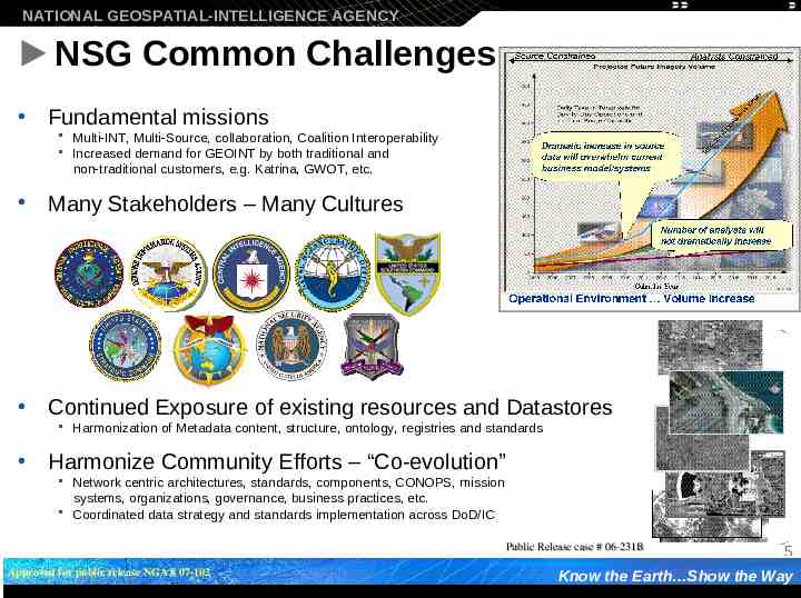
NATIONAL GEOSPATIAL-INTELLIGENCE AGENCY NSG Common Challenges Fundamental missions Multi-INT, Multi-Source, collaboration, Coalition Interoperability Increased demand for GEOINT by both traditional and non-traditional customers, e.g. Katrina, GWOT, etc. Many Stakeholders – Many Cultures Continued Exposure of existing resources and Datastores Harmonization of Metadata content, structure, ontology, registries and standards Harmonize Community Efforts – “Co-evolution” Network centric architectures, standards, components, CONOPS, mission systems, organizations, governance, business practices, etc. Coordinated data strategy and standards implementation across DoD/IC Public Release case # 06-231B Approved for public release NGA # 07-102 5 Know the Earth Show the Way
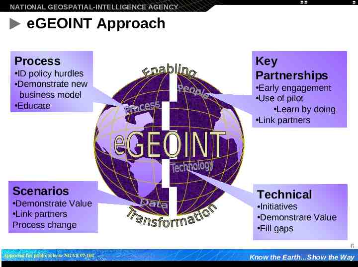
NATIONAL GEOSPATIAL-INTELLIGENCE AGENCY eGEOINT Approach Process ID policy hurdles Demonstrate new business model Educate Scenarios Demonstrate Value Link partners Process change Key Partnerships Early engagement Use of pilot Learn by doing Link partners Technical Initiatives Demonstrate Value Fill gaps 6 Approved for public release NGA # 07-102 Know the Earth Show the Way
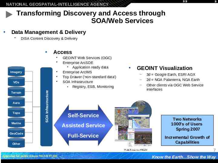
NATIONAL GEOSPATIAL-INTELLIGENCE AGENCY Transforming Discovery and Access through SOA/Web Services Data Management & Delivery DISA Content Discovery & Delivery Access Imagery Terrain Aero Topo Marine SOA Infrastructure VOs GeoCode Other GEOINT Web Services (OGC) Enterprise ArcSDE Application ready data Enterprise ArcIMS Top Drawer (‘non-standard data’) SOA Infrastructure Registry, ESB, Monitoring Self-Service Assisted Service Full-Service GEOINT Visualization – – – 3d Google Earth, ESRI AGX 2d NGA Palanterra, NGA Earth Other clients via OGC Web Service interfaces Two Networks 1000’s of Users Spring 2007 Incremental Growth of Capabilities 7 Approved for public release NGA # 07-102 Know the Earth Show the Way
NATIONAL GEOSPATIAL-INTELLIGENCE AGENCY Early Adaptors of Visualization Tools Users – EUCOM, TRANSCOM, STRATCOM, SOUTHCOM, PACOM, NORTHCOM, ONI, Homeland Security, Secret Service, FBI, Health & Human Services, CIFA, DHS, DTRA, NOAA, USCG, MAD, AFWA, NSA, DIA and NGA Uses – – – – – – Situational Awareness Information Sharing Data Aggregation Force Protection Mission Planning and Rehearsal Incident tracking 8 Approved for public release NGA # 07-102 Know the Earth Show the Way
NATIONAL GEOSPATIAL-INTELLIGENCE AGENCY Opportunities for Partnership Partner with NGA to identify benefits and implications to your operations Use the GEOINT Visualization Pilot Examine your local environment and policies Client loads, Firewall policies, Data enablement Apply a SOA model to your operations & plans provide and consume services in a net-centric environment Learn by doing 9 Approved for public release NGA # 07-102 Know the Earth Show the Way
NATIONAL GEOSPATIAL-INTELLIGENCE AGENCY Summary/ Discussion NSG SOA is a foundation for Mission Success – – – – Increased agility to connect Sensors, Decision-makers, Shooters through NetCentricity Net Centricity through Service Orientation Focus on data/information and services Standards are still critically important eGEOINT program and influence moving forward – – Significant near-term adjustments already affected Requires continued focus to affect culture change Must continue to push execution processes Must unify objectives and governance Approved for public release NGA # 07-102 10 Approved for public release NGA # 07-102 Know the Earth Show the Way
NATIONAL GEOSPATIAL-INTELLIGENCE AGENCY NATIONAL GEOSPATIAL-INTELLIGENCE AGENCY Know the Earth Show the Way 11 Approved for public release NGA # 07-102 Approved for public release NGA # 07-102 Know the Earth Show the Way