EO & SAR Technology Developments: Approaches to Processing and

15 Slides3.93 MB
EO & SAR Technology Developments: Approaches to Processing and Analytics October 2019 Jason Lohn, Orbital Insight [email protected]
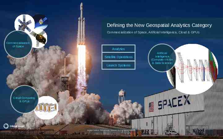
Defining the New Geospatial Analytics Category Commercialization of Space, Artificial Intelligence, Cloud & GPUs Commercialization of Space Analytics Satellite Operations Launch Systems Artificial Intelligence (Computer Vision & Data Science) Cloud Computing & GPUs 2017 Orbital Insight Image Source: PBS Image, SpaceX Falcon Heavy Launch 2
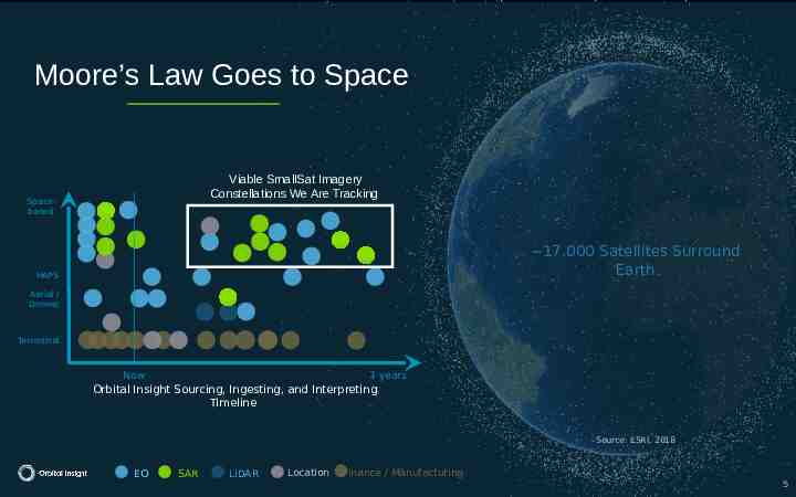
Moore’s Law Goes to Space Viable SmallSat Imagery Constellations We Are Tracking Spacebased 17,000 Satellites Surround Earth HAPS Aerial / Drones Terrestrial Now 3 years Orbital Insight Sourcing, Ingesting, and Interpreting Timeline Source: ESRI, 2018 EO SAR LiDAR Location Finance / Manufacturing 5
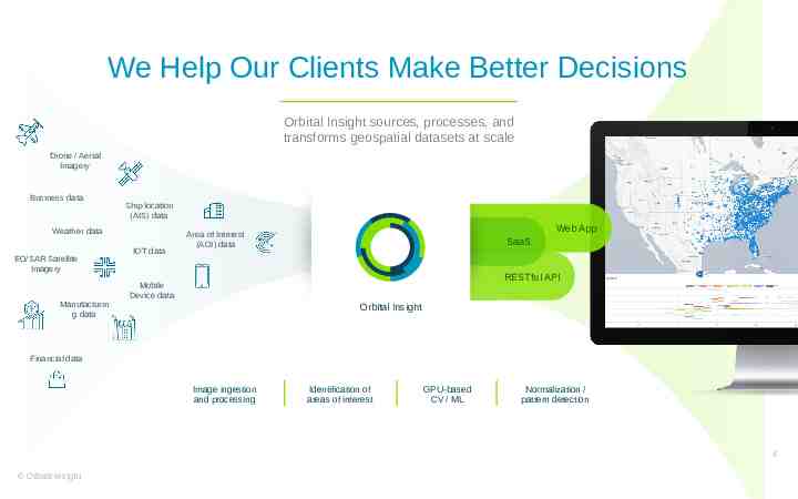
We Help Our Clients Make Better Decisions Orbital Insight sources, processes, and transforms geospatial datasets at scale Drone / Aerial Imagery Business data Ship location (AIS) data Weather data EO/SAR Satellite Imagery Manufacturin g data IOT data Web App Area of Interest (AOI) data SaaS RESTful API Mobile Device data Orbital Insight Financial data Image ingestion and processing Identification of areas of interest GPU-based CV / ML Normalization / pattern detection 4 Orbital Insight
Where are we: software & hardware Current generation of commercial EO satellites spans a wide range of capabilities: o GSD from 0.3 -- 15 m o a range of spectral bands with a focus on viz and SWIR o constellations of anywhere from one to 100 Commercial SAR landscape is quite robust, across TerraSAR, CosmoSkyMed, RADARSAT, and others (C, L, X band) Next generation, while moving more slowly than hoped, continues to progress, both from incumbents, e.g., DG Legion, and from "newspace" types such as Planet and Spaceflight/LeoStella. 5 2
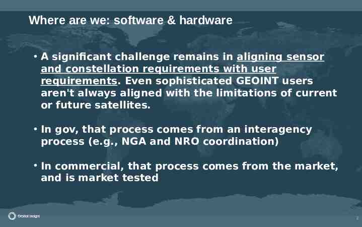
Where are we: software & hardware A significant challenge remains in aligning sensor and constellation requirements with user requirements. Even sophisticated GEOINT users aren't always aligned with the limitations of current or future satellites. In gov, that process comes from an interagency process (e.g., NGA and NRO coordination) In commercial, that process comes from the market, and is market tested 6 2
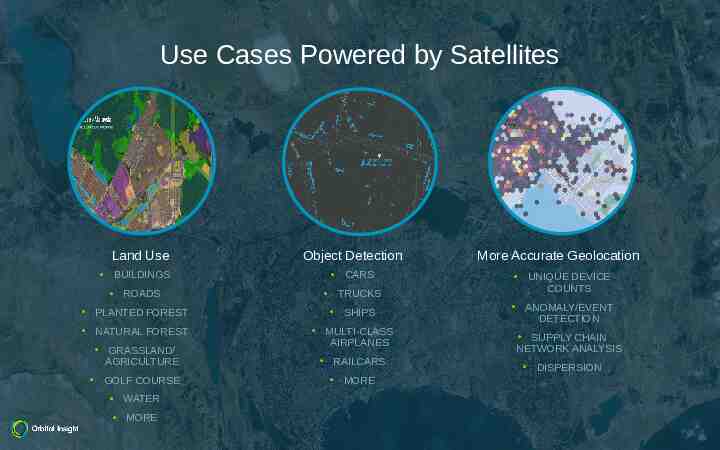
Use Cases Powered by Satellites Land Use Object Detection BUILDINGS CARS ROADS TRUCKS PLANTED FOREST SHIPS NATURAL FOREST MULTI-CLASS AIRPLANES GRASSLAND/ AGRICULTURE GOLF COURSE WATER MORE RAILCARS MORE More Accurate Geolocation UNIQUE DEVICE COUNTS ANOMALY/EVENT DETECTION SUPPLY CHAIN NETWORK ANALYSIS DISPERSION
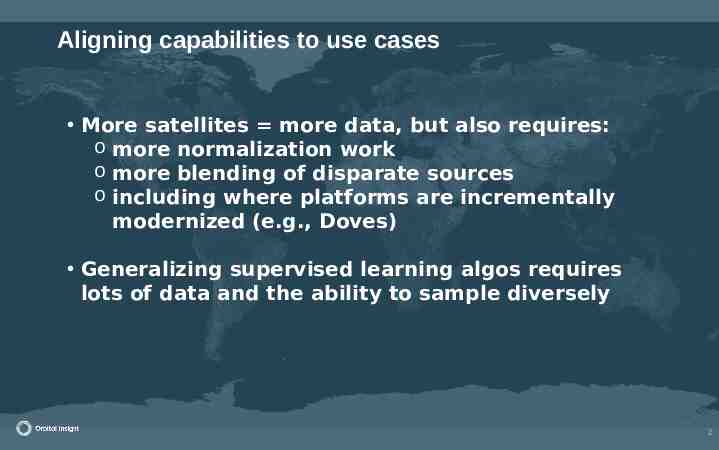
Aligning capabilities to use cases More satellites more data, but also requires: o more normalization work o more blending of disparate sources o including where platforms are incrementally modernized (e.g., Doves) Generalizing supervised learning algos requires lots of data and the ability to sample diversely 8 2
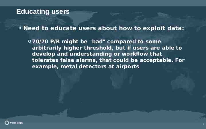
Educating users Need to educate users about how to exploit data: o 70/70 P/R might be "bad" compared to some arbitrarily higher threshold, but if users are able to develop and understanding or workflow that tolerates false alarms, that could be acceptable. For example, metal detectors at airports 9 2
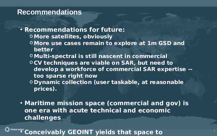
Recommendations Recommendations for future: o More satellites, obviously o More use cases remain to explore at 1m GSD and better o Multi-spectral is still nascent in commercial o CV techniques are viable on SAR, but need to develop a workforce of commercial SAR expertise -too sparse right now o Dynamic collection (user taskable, at reasonable prices). Maritime mission space (commercial and gov) is one era with acute technical and economic challenges Conceivably GEOINT yields that space to 10 2
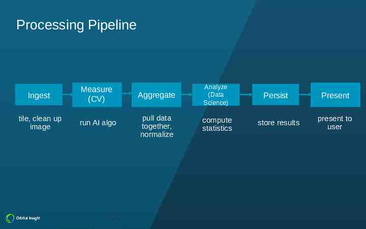
Processing Pipeline Common Pipeline Ingest Measure (CV) CV/Telem Aggregate Analyze Analyze (Data (Data Sc) Science) tile, clean up image run AI algo pull data together, normalize compute statistics Orbital Insight Persist store results Present present to user
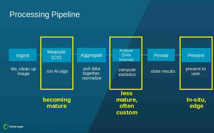
Processing Pipeline Common Pipeline Ingest Measure (CV) CV/Telem Aggregate Analyze Analyze (Data (Data Sc) Science) tile, clean up image run AI algo pull data together, normalize compute statistics becoming mature Orbital Insight less mature, often custom Persist store results Present present to user In-situ, edge
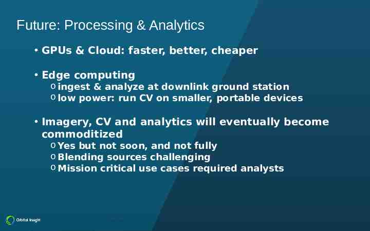
Future: Processing & Analytics GPUs & Cloud: faster, better, cheaper Edge computing o ingest & analyze at downlink ground station o low power: run CV on smaller, portable devices Imagery, CV and analytics will eventually become commoditized o Yes but not soon, and not fully o Blending sources challenging o Mission critical use cases required analysts Orbital Insight
14 2
EO & SAR With limitations imposed by the basic physics on hardware, what unique approaches to processing and analysis will lead this segment of the industry? What technology developments does OI see ahead in EO? Hyperspectral More data What tech developments does OI see in SAR? Significantly more commercial SAR data coming soon (ICEYE, Capella) Antennas want to have certain form factors, clever engineering helps, but eventually physics stops you 15 2